Posted on 09/08/2004 9:06:23 AM PDT by bd476
ZCZC MIATCPAT4 ALL
TTAA00 KNHC DDHHMM
BULLETIN
HURRICANE IVAN ADVISORY NUMBER 25
NWS TPC/NATIONAL HURRICANE CENTER MIAMI FL
11 AM AST WED SEP 08 2004
...Dangerous Hurricane Ivan heading for the central Caribbean Sea...
A hurricane warning remains in effect for Aruba...Bonaire...and Curacao.
A hurricane watch and a Tropical Storm Warning remain in effect for The Guarjira Peninsula of Columbia...and for the entire Northern Coast of Venezuela.
At 11 AM AST...1500z...the Government of Haiti has issued a Hurricane Watch for the entire Southwest peninsula of Haiti from the border of the Dominican Republic Westward...including Port Au Prince.
A Tropical Storm Watch remains in effect for the Southwestern coast of the Dominican Republic from Santo Domingo Westward to Pedernales.
Interests in Central and Western Caribbean Sea should closely monitor the progress of dangerous Hurricane Ivan.
At 11 AM AST...1500z...the eye of Hurricane Ivan was located near Latitude 12.7 North...Longitude 66.2 West or about 145 miles...235 Km...East-Northeast of Bonaire and about 795 miles...1280 km... EAST-Southeast of Kingston Jamaica.
Ivan is moving toward the West-Northwest near 16 mph...26 km/hr. This motion is expected to continue during the next 24 hours. On this track...the center of Ivan should move North of Aruba... Bonaire...and Curacao later today. However...any deviation to the left of the forecast track could bring the center close to those islands.
Ivan is an extremely dangerous category 4 hurricane on the Saffir-Simpson Hurricane Scale with maximum sustained winds near 140 MPH...220 KM/HR...with higher gusts. Some fluctuations in intensity are expected during the next 2 hours.
Hurricane force winds extend outward up to 70 miles...110 KM… from the center...and tropical storm force winds extend outward up to 160 miles...260 KM.
Estimated minimum central pressure is 955 MB...28.20 inches.
Storm surge flooding of 3 to 5 feet above normal tide levels... along with large and dangerous battering waves...can be expected near the center of ivan in the hurricane warning area.
Rainfall Amounts of 5 to 7 inches...possibly causing flash floods and mud slides...can be expected along the path of Ivan.
Repeating the 11 AM AST position...12.7 N... 66.2 W. Movement toward...West-Northwest near 16 mph. Maximum sustained winds...140 MPH. Minimum central pressure... 955 MB.
For storm information specific to your area...please monitor Products issued by your local weather office.
An intermediate advisory will be issued by the National Hurricane Center at 2 pm AST followed by the next complete advisory at 5 pm AST.
Forecaster Avila
$$
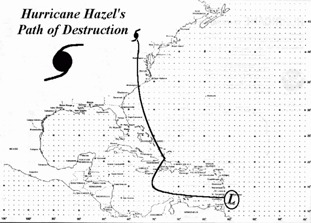
Weather babe on FNC was just talking about historic percentages regarding storms with similar tracks as Ivan's current one...........one name popped out at me.......Hazel.
The last I heard (about 10 minutes ago) said that 90% of the buildings on Grenada had been damaged, with many destroyed, and yes I also heard about the prison "break."
I'm just plain worried now........and I'm not even in any of the propbable paths of this monster.
Thought of that "crazy Ivan" reference too.
Wasn't the character's name, "Jonesy"?
If this thing were to hit Miami it would be like a nuclear blast or 9/11. I've heard Miami hotels and buildings weren't built to withstand major hurricanes.
They probably called her Howlin' Hazel

Hmmm, I wonder where that's direct-linked from? $;-)

That's why I pinged you!!!!
I'll stick it on my space if it's ovrloading your server.
What kind of business do you have to have offices in these places?
Cat 4/5 usually never stay that huge...you've got to have perfect conditions for that to happen.
THEY ALSO REPORTED A LOWER CENTRAL PRESSURE OF 920 MB...SUGGESTING THAT IVAN MAY CONTAIN SURFACE WINDS A LITTLE STRONGER THAN THE 160 MPH INDICATED IN THE 5 AM AST ADVISORY. DROPSONDE WIND REPORTS ALSO INDICATED WINDS OF NEAR 210 MPH AT AN ALTITUDE OF ABOUT 350 FEET ABOVE THE OCEAN SURFACE.Wow! This is getting Series ! Ivan the Terrible.
No problem at all. I have 10GB bandwidth per month. That's what it's there for! $:-)
I also have a ton of other pics and stuff there, if you rummage around.
Superb thread -- all kinds of important and useful information. Thanks for posting.
If you have a ping list, please put me on it.
IVAN IS A 5 - PING.
Good luck fishing. Destin is very beautiful...the sands and dunes look animated it's so clean looking.
The Florida Keys will be evacuated as a precaution, which may or may not be necessary. With a storm this powerful, that seems like a wise decision because they cannot be evacuated quickly.
I still think this is a northern Gulf storm, but if I were a resident of south Florida I sure wouldn't count on it.
I don't know...since 92, building codes are fairly tough in Miami, probably the some of the toughest there are anywhere.
However, pictures of the damage done by Andrew give a fair indication of what could occur.
Conditions Generate Conga Line Of Storms
By ROB SHAW rshaw@tampatrib.com
Published: Sep 9, 2004
TAMPA - The conveyor belt of tropical trouble has been alive and well this hurricane season, with seemingly one destination point for most of Mother Nature's wrath. Florida.
First, Tropical Storm Bonnie slid ashore Aug. 12 near Apalachicola. The next day, Hurricane Charley and its monstrous 145 mph winds slammed Charlotte County. Then Hurricane Frances pounded the east coast over Labor Day weekend before marching across the state and walloping the west coast.
Now hurricane-weary Floridians are keeping a close eye on Hurricane Ivan, whose 145 mph winds could be on a collision course for the state by early next week.
So why have so many systems taken aim at what is supposed to be the picture-perfect Sunshine State, transforming Florida from a tourist destination into a frenzied hotbed of resident evacuation?
Some weather experts will point to meteorological conditions such as above-normal water temperatures, winds aloft blowing from the east to guide storms, and myriad other factors.
Others, however, simply say it might be Florida's time.
``The thing about the Florida peninsula, you all have been extremely lucky,'' said William Gray, the Colorado State University professor who tries to predict how many hurricanes and tropical storms will form each season. ``There have been storms out there that just never came ashore.''
It hasn't always been that way. Between 1926 and 1965, the Florida peninsula was battered by 14 major hurricanes, colossal beasts with winds of 111 mph or higher.
Contrast that to the years between 1966 and 2003, when one major hurricane hit the state. Granted, that hurricane was the legendary Andrew, which slammed Miami-Dade County in 1992.
``As you go back historically, we seem to go in cycles,'' said Bob Sheets, former director of the National Hurricane Center, who is retired and living near Sebring.
``Every once in a while the atmosphere sets up where the Bermuda High and the trough seem to be in sync to steer them in a particular direction,'' Sheets said Wednesday while taking a break from putting new shingles on his house that had been ripped off by Frances. ``It's not a good thing.''
Taking Aim At The Record
This Atlantic hurricane season, which runs from June 1 to Nov. 30, already has been a busy one. Nine named storms have formed, with the peak of the season not coming until Friday. A typical season has 10 named storms, with six blooming into hurricanes.
Last year, there were 16 named storms, with seven becoming hurricanes. In 1995, when the current cycle of above-normal activity kicked off, there were a record 19 named storms.
``It looks like we're going to challenge that this year,'' Sheets said. ``It all goes back to a favorable environment. We seem to have all those things going for us right now.''
What has protected Florida for the most part since 1995 has been the presence of an upper-level trough off the East Coast of the United States. That trough has helped curve storms and hurricanes to the north before they get to Florida.
That was the case with 1999's Hurricane Floyd, which teased and terrorized the state's east coast before sliding north and slamming into North Carolina.
``The upper-level trough has been our guardian. Unfortunately, we switched to a pattern this year where the trough is farther to the west,'' said Frank Alsheimer, a meteorologist with the National Weather Service in Ruskin. ``Instead of being our guardian, it's steering systems right into Florida.
``Essentially, we have been pretty much ground zero this year for these Atlantic systems.''
Instead of the trough helping to steer storms away from Florida, a ridge of high pressure has been present and prevents most turns to the north. That high instead serves as kind of a steering wheel of air guiding tropical systems to the west toward the state.
``The door to turn north before they get to Florida has been closed,'' Alsheimer said.
`There Is A Chance It Could Hit'
What remains to be seen is whether Ivan will follow in the path of Charley or Frances and end up blasting Florida as well. If Ivan slides into the Gulf of Mexico, any trough of low pressure present could turn it to the right, directly into the state's west coast.
``The people in Florida have got to watch Ivan,'' Gray said. ``There is a chance it could hit.''
Alsheimer agrees.
``I think it's most likely going to affect somewhere in Florida,'' the local forecaster said. ``I wouldn't say Tampa necessarily, but I think Tampa has just as good a chance as Apalachicola or Key West.''
Disclaimer: Opinions posted on Free Republic are those of the individual posters and do not necessarily represent the opinion of Free Republic or its management. All materials posted herein are protected by copyright law and the exemption for fair use of copyrighted works.