Posted on 09/19/2004 12:21:10 PM PDT by SunkenCiv
Egg island is a flyspeck of land (0.2 square miles) at the end of a string of small islands extenting west from the northern end of Eleuthera Island in the Bahamas. Along with its near neighbor Royal Island, Egg was proposed as the landfall in 1981 by Arne B. Molander, a retired civil engineer. Molander has been a tireless advocate for his theory since, although his efforts so far have failed to convince anyone that the idea has merit.
(Excerpt) Read more at 1.minn.net ...
George W. Bush will be reelected by a margin of at least ten per cent
I thought Columbus landed in what is now Hispaniola in the Caribbean.
Please FREEPMAIL me if you want on, off, or alter the "Gods, Graves, Glyphs" PING list --
Archaeology/Anthropology/Ancient Cultures/Artifacts/Antiquities, etc.
The GGG Digest -- Gods, Graves, Glyphs (alpha order)
Pickering seems to be sensitive to these issues (without seeming to mention them) as he has an entire page in which he discusses the Earth's magnetic field, judging at the end of that discussion that the Plana Cays location has been scientifically proved. And yet, the island doesn't come close to matching Columbus' description. :')Columbus Was A Latitude SailorThe extreme accuracy difference between LS and DR derives entirely from the ways compass errors are monitored because these navigation methods are otherwise identical on an east-west course. Either system would simply have accumulated the distances made good on each westerly heading. The DR pilot, however, might have detected compass variations by noting azimuth-angle deviations from Polaris, a measurement most easily made in the full darkness of midnight. In contrast, the LS pilot would have detected the integrated effect of compass variation by noting elevation-angle deviations of Polaris and the circumpolar stars, a measurement made during the brief twilight interval when the star and horizon are both visible. (Note that each of Columbus's three recorded compass checks occurred during either evening or morning twilights, as required by LS, rather than at the midnight preference for DR.)
by Arne B. Molander
Summer 1990
Encounters: A Quincentenary Review
Molander may be deceased, I'm not sure. In any case, he's often cruised the Caribbean, and compared Columbus' log with the actual currently available possibilities. I note "currently" because of the volcanic activity in the Caribbean, which could alter the landscape directly (eruption) or indirectly (tsunami).Cruising Guide to the Abacos and the Northern BahamasAdvocates of the Northern Route -- based on the premise that Columbus used latitude sailing to maintain a due west Atlantic crossing -- have long been held that Columbus left his first footprints on the beaches of Egg Island at the northwest corner of Eleuthera... [S]ail east-northeast from Harbour Island about six nights after a full moon. When you reach a location six miles east of Man Island at 2 a.m., the moon should be high enough to reflect off Eleuthera's surf, just as it did for Columbus' lookout 500 years off... coast cautiously along northern Eleuthera's reef into the Northeast Providence Channel. On your way you'll note three important landfall features unique to Eleuthera are Harbour Island's entrance, the shallows behind it, and the equally spaced triple cusps on the north coast of Royal Island. At first light you should keep an eye out for the same benthic (bottom-growing) seaweed Columbus "found in the gulf when he arrived at his discovery". There is no gulf at either Watlings or Samana Cay. When you reach the end of Eleuthera's reef shortly after dawn you will see Columbus's first lee anchorage opportunity southwest of Egg Island. Now you can begin following 30 features uniquely matching descriptions Columbus himself recorded in his Journal of Discovery.
by Arne B. Molander
Pelican Power
Revised: February 22, 2002
George W. Bush will be reelected by a margin of at least ten per cent
just added this topic to GGG:
State Plays Orwellian with Columbus
FrontPage Magazine ^ | 8/26/04 | Robert Spencer
Posted on 08/28/2004 3:13:16 PM PDT by wagglebee
http://www.freerepublic.com/focus/f-news/1201919/posts
...more to come...Honoring historically hidden heroThere are even signs that the Icelanders' activities in the New World could have influenced Columbus' trip. Prior to his voyage, Columbus went to Bristol, England, a city that traded extensively with Iceland, and where stories of Ericson's journey could have circulated. Columbus also visited Iceland in 1477, and as Ambassador Hannibalsson says, "He couldn't have been there long, without being told the story of the discovery of America 477 years earlier (which he later claimed for himself)."
by Peter Brownfeld
Cavalier Daily Columnist
October 11, 1999
Please FREEPMAIL me if you want on, off, or alter the "Gods, Graves, Glyphs" PING list --
Archaeology/Anthropology/Ancient Cultures/Artifacts/Antiquities, etc.
The GGG Digest -- Gods, Graves, Glyphs (alpha order)
Years ago I read Columbus's diaries, I don't remember much, but I seem to remember him speaking of number of inhabitants where they first landed. An island that is .2 square miles is very small and I question that it could sustain more than a handful of people. It would seem that the natives would have migrated to the larger Bahamanian islands. An island this small would not even have been able to accomodate Columbus's crew for one night.
I've actually been to Egg Island, about 20 years ago. I had no idea that it had been considered as Colombus first landfall.
However, the way I remember, if he was coming from the east, which he was, he would have had to see Eleuthera and Spanish Wells (St. George's Cay) first, and sailed past them to get to Egg Island. I better check this on a chart to see if memory serves me correctly.
It is small, but they were maritime people, so a small island could have accommodated more than a handful on a permanent basis. The ships themselves would have drawn a crowd from other islands. :')
Yeah, that seems a little odd. :')
http://worldatlas.com/webimage/countrys/namerica/caribb/lgcolor/bscolor.htm
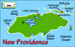
Another candidate?
http://worldatlas.com/webimage/countrys/namerica/caribb/smallmap/newprov.gif
Bahamas Attractions:
Eleuthera
http://www.lonelyplanet.com/destinations/caribbean/bahamas/attractions.htm#eleuthera
"This slender wisp of an island has traditionally been the destination of choice for hobnobbing socialites, drawn here by chic club resorts and sands the delicate hue of Cristal Rosé. The mainland has declined in recent years. The happening scene is now the offshore cay of Harbour Island, one of the choicest places in The Bahamas, boasting Dunmore Town, a Loyalist village with 200-year-old architecture; Pink Sands Beach; and great diving and snorkelling. Eleuthera also offers scenic headlands and seascapes and interesting towns. Harbour Island lies just a few kilometres east of the northwestern tip of the mainland."
The Watling Island/Samana Cay debate is an interesting one. Back in the 1980's, National Geographic suggested (IIRC)Samana Cay and the Smithsonian proposed Watling. Could the shorelines of the islands have changed so much in five centuries that the "bays" no longer exist but once did?
Landfall Clues: MapsThe la Cosa map is also significant because it is the only existing map of the landfall drawn by any member of the first voyage. The map shows Guanahani, the landfall island, apparently as a small group of islets, lying roughly east-west. Guanahani is also shown as lying at the longitude of the Windward Passage, between Cuba and Hispaniola.
by Keith A. Pickering
Pickering's map:
http://www1.minn.net/~keithp/pictures/lfmap.gif
Disclaimer: Opinions posted on Free Republic are those of the individual posters and do not necessarily represent the opinion of Free Republic or its management. All materials posted herein are protected by copyright law and the exemption for fair use of copyrighted works.

