
Posted on 03/20/2019 6:54:48 AM PDT by Enlightened1
It may be one of the most important Air Force installations in the continental United States, but Offutt Air Force Base has proven no match for the full fury of the Missouri River.
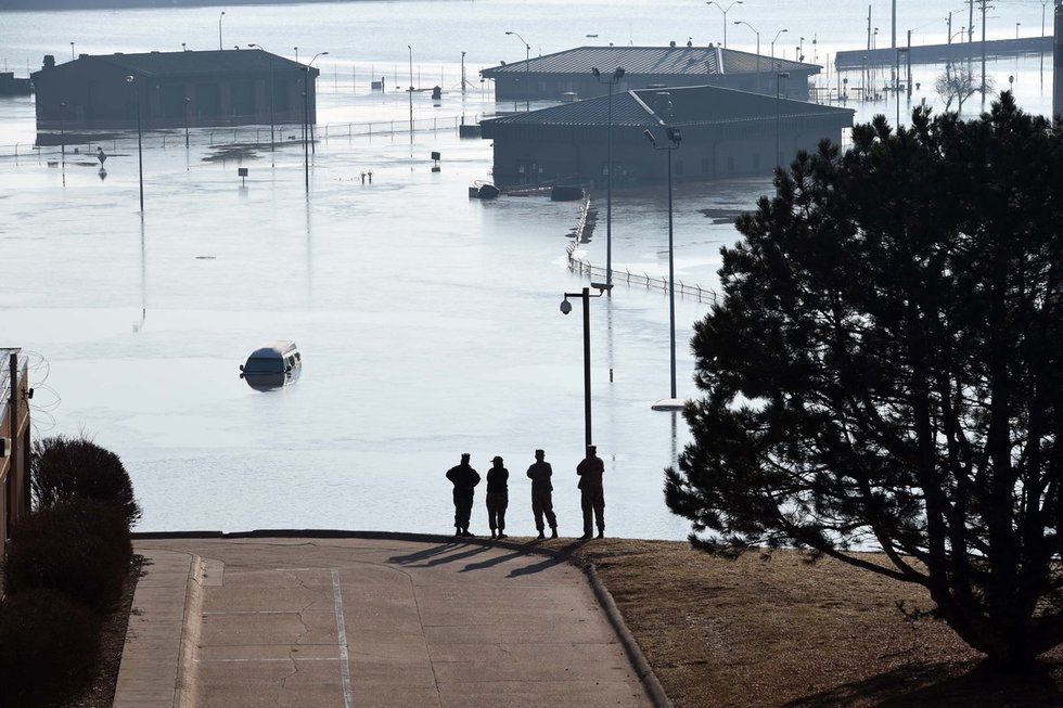
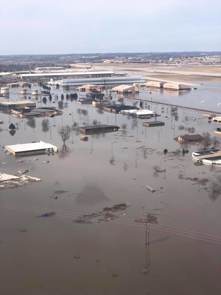
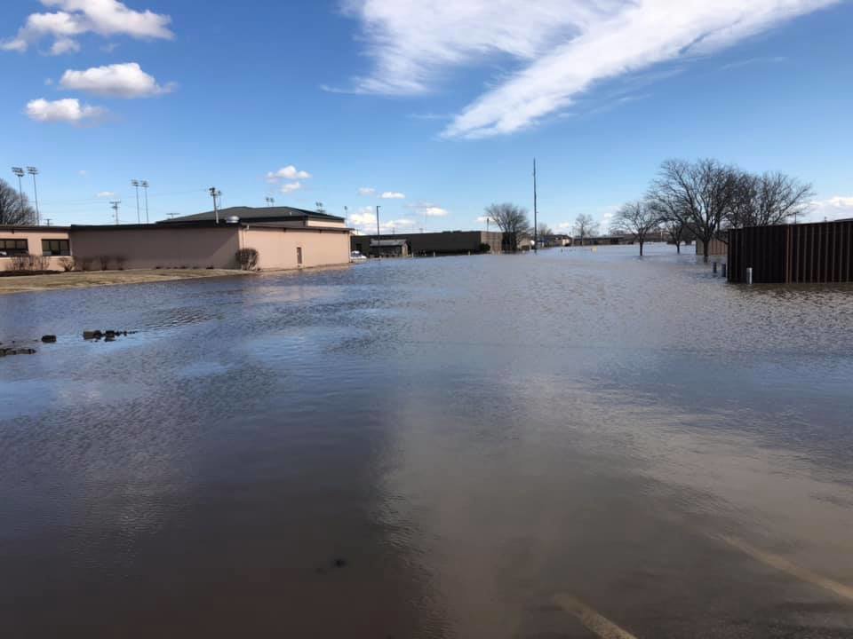
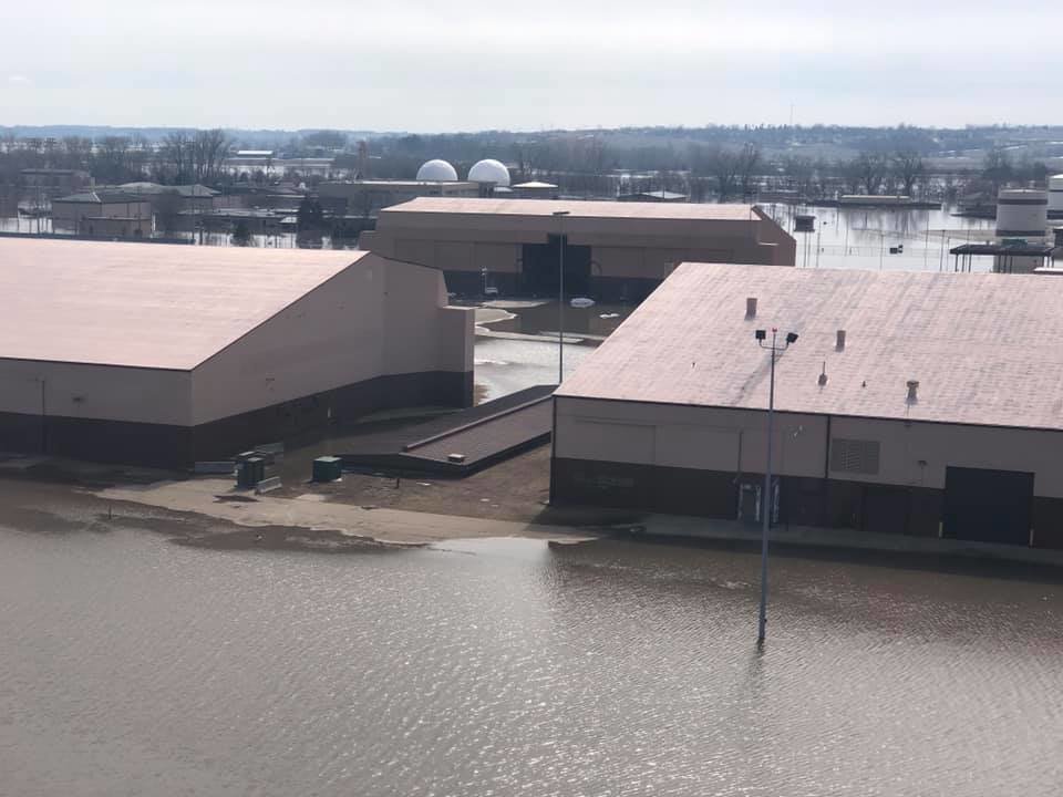
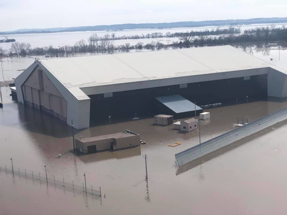
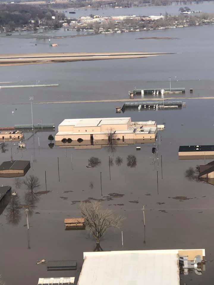
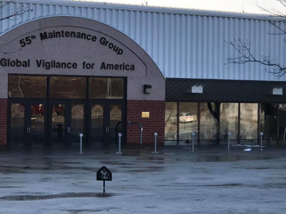
As record flooding swept through towns across the Midwest, floodwaters had swallowed at least thirty buildings at Offutt as of Sunday and damaged another 30, the 55th Wing announced, including the headquarters of the 55th Wing, 55th Security Forces Squadron, 97th Intelligence Squadron, and 343rd Reconnaissance Squadron
And while the 55th Wing said that Air Force personnel worked round-the-clock to shore up facilities with 235,000 sandbags and 460 flood barriers "to minimize damage as much as possible," floodwaters were so intense that they eventually abandoned a frantic sandbagging effort.
"It was a lost cause" 55th Wing spokeswoman Tech. Sgt. Rachelle Blake told the Omaha World-Herald. "We gave up."
The full extent of the damage is currently unknown, but it's worth noting that Offutt is home of U.S. Strategic Command, which oversees the Pentagon's nuclear strategic deterrence and global strike capabilities — and opened a brand-new $1.3 billion command and control facility at the air base in January.
Below, dramatic photos capture the flooding at Offutt:
(Excerpt) Read more at taskandpurpose.com ...
I am sure they moved the Dooms Day plane.
I saw Satellite pictures of before and after. They built it in a river bottom flood plain. What did they expect?
Horrible. And so close after Tyndall Air Force Base was devastated by Hurricane Michael.
I play bridge with an interesting group.
One was a West Point Army Corp of Engineer Grad and another is a Naval Academy Engineer grad with relatives, who are engineers.
Yesterday, we discussed this flooding and the probable flooding in California if and when the Oroville dam collapses.
They both said that we can manage and control big rivers only so long before they and gravity win, when we have big, heavy and prolonged rainfall.
People on the Plains try to avoid building their homesteads in areas called playa lakes that are dry most of the time, but become small lakes in a heavy rain.
Prime Beef’s gonna be busy...
can see it or it’s mirror... up the full pan photo in the article— which may, or may not be it. There is a nearly full runway with turnaround available other side of the flooding, so access.
Shouldn’t and doesnt stay there anyway. Loose lips.
If you look at the first photo, an E-4 is top center. Two KC-135s are to the left.
You can bet that the others are still operational.
SAC hq and ancillary facilities are up on a hill, discrete and secure.
Take a canoe to work? How’s the fishing? That’s where I got my physical when I entered the Air Force.
Exactly what I was thinking. USAF (meaning “us”) is gonna have a lot of repair costs in the next year or two.
I was stationed there in the late 70’s. It seem’s the whole flight area and Maintenance Depo are inundated. There’s also a lot of underground infrastructure do to the old SAC HQ.
They were planning to rebuild the whole runway this year or next. I don’t know if that was ever completed. If not it may not be as big of a loss.
Their main job was to run old 707’s loaded with RF sensors, and also a 24hr nonstop airborne command post.
My highlight there was watching an SR-71 takeoff.
True, but it seems like any military base so near a major river would have its own protective levee system, along with generators and drainage pumps. NASA's Michoud Assembly Facility in New Orleans is set up that way and suffered minimal damage despite Hurricane Katrina's flooding the area.
Getting to the top of the Hill might be tough for a few days, maybe the Air Force can do an air drop of row boats so the air man, officers, and civilians can row to work.
Downstream from a dam is also NOT a good idea.
Yup. Swan Lake in the North Valleys of Reno is suffering from that currently and there is a lot of snow in the mountains to melt come spring. No natural drainage for it either. And the city apparently had no problem permitting construction there with more planned. Lots of soggy homes. Gotta love them tax dollars.
The base and airfield long pre-dates the establishment of SAC in 1946. This is the first flooding that has affected this part of the base to this degree over all of those years, to include 2011.
In the 2011 flood, the Corps of Engineers was to work with the AF to further mitigate the problem by expanding the protections already in place. To date, they have spent their time getting the federal permits to start work and accomplished nothing.
This year is unique. We had a lot of snow and cold temps so that the snow accumulation and river ice was melted within a few days because of the bomb cyclone weather pattern that brought the temps above freezing and brought heavy rains across the entire area which has dozens of tributary rivers to the Missouri where ice broke up over about a day and jammed the river flows; resulting in flooding. Offutt is just a tiny part of the overall flooded areas across NE, IA, and MO.
The existence of the facility as well as the surrounding farms, and towns has little to do with any flood plain and are certainly not new structures that have been built there. I’ve been here and lived a couple of miles from the base for 30 years this time around and even the 2011 floods had a small effect on Offutt. The circumstances this year are unique.
LOL! Yup. That and some LM folks who rode it out and kept pumps going. Worked there for 12 years before going to KSC for 24 years. Lots of acquaintances lost everything. Of course had the storm NOT turned and gone in where it did and gone west about 20 miles there would be NO New Orleans.
I wonder how many underground bunkers are now subterranean swimming pools?
Disclaimer: Opinions posted on Free Republic are those of the individual posters and do not necessarily represent the opinion of Free Republic or its management. All materials posted herein are protected by copyright law and the exemption for fair use of copyrighted works.