The Lionel Pincus & Princess Firyal Map Division is very proud to announce the release of more than 20,000 cartographic works as high resolution downloads. We believe these maps have no known US copyright restrictions.* To the extent that some jurisdictions grant NYPL an additional copyright in the digital reproductions of these maps, NYPL is distributing these images under a Creative Commons CC0 1.0 Universal Public Domain Dedication. The maps can be viewed through the New York Public Library’s Digital Collections page, and downloaded (!), through the Map Warper. First, create an account, then click a map title and go. Here’s a primer and more extended blog post on the warper.
It means you can have the maps, all of them if you want, for free, in high resolution. We’ve scanned them to enable their use in the broadest possible ways by the largest number of people.
Though not required, if you’d like to credit the New York Public Library, please use the following text "From The Lionel Pincus & Princess Firyal Map Division, The New York Public Library.” Doing so helps us track what happens when we release collections like this to the public for free under really relaxed and open terms. We believe our collections inspire all kinds of creativity, innovation and discovery, things the NYPL holds very dear.
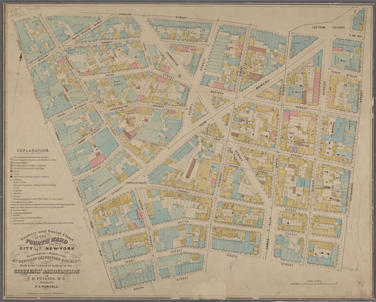
Sanitary and social chart of the Fourth Ward of the City of New York, to accompany a report of the 4th Sanitary Inspection District. 1864 A little background on how we got here… We’ve been scanning maps for about 15 years, both as part of the NYPL’s general work but mostly through grant funded projects like the 2001 National Endowment for the Humanities (NEH) funded American Shores: Maps of the MidAtlantic to 1850, the 2004 Institute of Museum and Library Services (IMLS) funded Building a Globally Distributed Historical Sheet Map Set and the 2010 NEH funded New York City Historical GIS.
Through these projects, we’ve built up a great collection of: 1,100 maps of the Mid-Atlantic United States and cities from the 16th to 19th centuries, mostly drawn from the Lawrence H. Slaughter Collection; a detailed collection of more than 700 topographic maps of the Austro-Hungarian empire created between 1877 and 1914; a collection of 2,800 maps from state, county and city atlases (mostly New York and New Jersey); a huge collection of more than 10,300 maps from property, zoning, topographic, but mostly fire insurance atlases of New York City dating from 1852 to 1922; and an incredibly diverse collection of more than 1,000 maps of New York City, its boroughs and neighborhoods, dating from 1660 to 1922, which detail transportation, vice, real estate development, urban renewal, industrial development and pollution, political geography among many, many other things.
We in the Map Division are all very excited about this release and look forward to seeing these maps in works of art, historical publications, movies, archaeological reports, novels, environmental remediation efforts, urban planning studies and more… Enjoy!
* The maps may be subject to rights of privacy, rights of publicity and other restrictions. It is your responsibility to make sure that you respect these rights.