Posted on 09/23/2022 2:32:24 AM PDT by NautiNurse
The late-blooming 2022 Atlantic Tropical Storm season is making up for lost time. A tropical system has developed in the Central Caribbean Sea. This storm system is forecast to threaten continental U.S. interests next week. While the tropical wave passed south of a key geographic area known as Hebert's Box #1, it will very likely pass through Hebert's Box #2. These boxes are useful as predictors of hurricanes that will strike South Florida. For more information about Hebert's Boxes, see Hebert Box. See graphic below which illustrated the Hebert's Boxes.
Mash the graphics below to enlarge. All links and images are self-updating.
Thank you for all you do!
Thank you for your kind sentiments! We are sheltered snug as a bug in a rug at our evac. hotel. Raining cats and dogs. Winds calm before the storm.
Great!
Be safe!
Not for my family in Naples. someones good news is someone else’s bad news. Where do you see worst of eye wall south of Naples? still looks like a direct hit on Port Charlotte to me
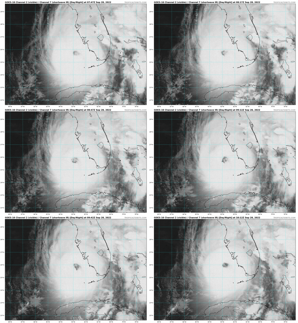
The eye is about 30 miles across. Punta Gorda is the latest guesstimate for official landfall. Always last minute wobbles.
My folks in Bonita Springs. 8 miles inland. They just got up and have power, having coffee and listening to wind and rain behind storm screens shutters.
Thanks. I did t think anything had changed
Thanks. I did t think anything had changed
My folks not up yet but watching and listening to tv coverage with hurricane shutters closed and locked. Prayers for all invoked. Going to be a long day.
Wind field estimate.
https://www.boatus.com/hurricanes/upload/9/windfield.gif
I actually couldn’t recall the name of the storm that hit us 5? years ago.
Was it Ivan?
We are north Hall.
BUMP
It’s strange how differently I learned about hurricanes when I had meteorology in college. We were told then that lightning was rare in hurricanes because of the horizontal layout of the storm. Not much elevation and reduced friction.
Lately though, they seem to have subtly changed that. Intense lightning in the eyewall is more common than assumed and usually signals a rapidly intensifying storm.
Ian is now a Cat 4. Yikes.
Irma was 5 years ago.
Was watching the Key West webcams last night just before midnight as Ian waa passing by outside of Sloppy Joe’s. You could see some minor flooding and blasts of wind but people were still boozing and carousing. Walking around, driving, walking their bikes etc.
My brother-in-law and his buddy were in Bradenton. They evacuated all the way to Biloxi, Mississippi.
One of the smartest things he’s ever done.
Sorry, but there's a better chance of Joe Biden riding a bicycle in the 2023 Tour de France and finishing first place than that happening.
It just occurred to me that there are alligators, snakes, and whatever that are going to be in places they shouldn’t be; that alone is reason enough to get outta there…
Let’s hope they’re not aiming for the prime GOP-voting panhandle before the election.

Disclaimer: Opinions posted on Free Republic are those of the individual posters and do not necessarily represent the opinion of Free Republic or its management. All materials posted herein are protected by copyright law and the exemption for fair use of copyrighted works.