
On balance, shrinking the apparent size of Greenland and Canada is probably a slight positive for Trump. Diminishes Canada’s only claim to relevance (lots of vacant land) and makes Greenland look a bit less formidable.
That’s cool.
Saved the image.
How come it’s impossible to find what this map looks like without it superimposed on the normal map?
The projection of a sphere onto a flat surface has been a problem for centuries.
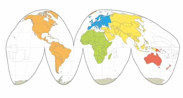
Goode is an interrupted, equal-area, composite projection composed of 12 regions that form six lobes, each the top section of a Mollweide projection, carefully grafted on to six interior regions along the equator. Provides an effective alternative to portraying global area relationships on the Mercator map. This projection was quite common in the 1960's, when it gained the nickname “the orange-peel map". (Source)
Honey, I shrunk the 51st State!
What is that?
Good map and a graphic illustration why the United States, with 4% of the world’s land area and 5% of the world’s population, cannot be the boarding house to the 70% or so of the world population who would like to move here.