Skip to comments.
Cahokia's Woodhenge: a supprising implication [sic]
Examiner.com ^
| Friday, November 26th, 2010
| Richard Thornton
Posted on 11/29/2010 8:19:23 PM PST by SunkenCiv
Today we travel to southern Illinois, where just across the Mississippi River is located the Cahokia Archaeological Zone. Cahokia was the largest known Native American city north of Mexico. At its peak population around 1250 AD, it was larger that London, England. Of course, Cahokia was not its real name. No one knows its real name. Unlike the ancient towns in the Southeast, where direct descendants of the original occupants still live, no one even knows yet what happened to the population of Cahokia, after it was abandoned.
There was an indigenous village in the vicinity of Cahokia as early as 600 AD. Around 800 AD, newcomers arrived and introduced large scale agriculture and different styles of artifacts. They built few mounds. The mounds they did build were relatively small. The village was also rather modest in size until around 1100 AD, when the population exploded. The original village was razed and a new grand plaza was constructed nearby that included the beginnings of many new, large mounds.
During the 1980s archaeologists working at Cahokia discovered a circle of postholes some distance away from the main acropolis. The postholes were far too spread apart to be a ruins of a building. The archaeologists eventually decided that the posts functioned as a solar observatory . . . a sun dial. Since the circle of posts seemed have the function as Stonehenge in England, it was labeled "Wood-henge."
(Excerpt) Read more at examiner.com ...
TOPICS: History; Science; Travel
KEYWORDS: archaeoastronomy; britain; cahokia; durringtonwalls; england; godsgravesglyphs; illinois; megaliths; missouri; monksmound; stonehenge; unitedkingdom; woodhenge
Navigation: use the links below to view more comments.
first 1-20, 21-33 next last
1
posted on
11/29/2010 8:19:26 PM PST
by
SunkenCiv
To: StayAt HomeMother; Ernest_at_the_Beach; 1010RD; 21twelve; 24Karet; 2ndDivisionVet; 31R1O; ...
2
posted on
11/29/2010 8:20:53 PM PST
by
SunkenCiv
(The 2nd Amendment follows right behind the 1st because some people are hard of hearing.)
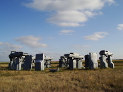
To: SunkenCiv
meanwhile, a more advanced civilization constructed Carhenge
3
posted on
11/29/2010 8:31:01 PM PST
by
bigbob
To: SunkenCiv
The Dipping Gourd is depicted in a series of mounds (of an observational type) in Indiana near Muncie/Marion/Anderson (where there are a lot of mounds).
A LARGER Dipping Gourd is depicted in a series of Council Circles OUTSIDE of the smaller one. it extends South to Seymour, Indiana, W/NW toward Terre Haute (still in business when DeSoto visited), then N/NE up to Michigan, then S/SE toward Richmond Indiana.
These sky pictures were laid out JUST BEFORE the rise of Cahokia.
4
posted on
11/29/2010 8:33:38 PM PST
by
muawiyah
(GIT OUT THE WAY ~ REPUBLICANS COMIN' THROUGH)
To: SunkenCiv
blah, blah ... that Native Americans had knowledge of astronomy for thousands of years before the arrival of European. They were not ignorant savages wandering through the woods ... blah, blah, blahPosh, ramblers with axes to grind can be so very dreary.
5
posted on
11/29/2010 8:35:40 PM PST
by
eclecticEel
(Life, Liberty, and the Pursuit of Happiness: 7/4/1776 - 3/21/2010)
To: SunkenCiv
"John White, the governor of the Roanoke Colony in 1585, and an accomplished artist, created many drawings of the Native Peoples near Fort Roanoke. One of his more famous drawings portrays men and women dancing around a large circle created by carved wooden totems with human faces..." Or, could it not be as this painting he did?

6
posted on
11/29/2010 8:39:26 PM PST
by
Beowulf9
To: Beowulf9
Did he draw that from a helicopter ?
7
posted on
11/29/2010 8:43:24 PM PST
by
fieldmarshaldj
(~"This is what happens when you find a stranger in the Amber Lamps !"~~)
To: SunkenCiv
From the link: "In 2010 archaeologists working in the vicinity of Stonehenge, England discovered a woodhenge there too." Absolute bull-poop. I visited Woodhenge on Salisbury Plain in 1994. It was discovered in 1925 by aerial photography. It's part of the Stonehenge-Durrington Walls complex and not a recent discovery at all; it's thought to possibly predate Stonehenge.
8
posted on
11/29/2010 8:45:25 PM PST
by
Bernard Marx
(I donÂ’t trust the reasoning of anyone who writes then when they mean than.)
To: SunkenCiv
Or was it indeed this?....

9
posted on
11/29/2010 8:46:02 PM PST
by
Beowulf9
To: SunkenCiv
10
posted on
11/29/2010 8:58:20 PM PST
by
BenLurkin
(This post is not a statement of fact. It is merely a personal opinion -- or humor -- or both)
To: fieldmarshaldj
“Did he draw that from a helicopter?”
No. The Indians shot him out of a tree and made a totem pole of him to dance around.
11
posted on
11/29/2010 8:59:22 PM PST
by
Beowulf9
To: Beowulf9
12
posted on
11/29/2010 9:04:50 PM PST
by
fieldmarshaldj
(~"This is what happens when you find a stranger in the Amber Lamps !"~~)
To: Beowulf9
Y’know, some of those Injuns look like “Close To Home” White people.
13
posted on
11/29/2010 9:07:10 PM PST
by
fieldmarshaldj
(~"This is what happens when you find a stranger in the Amber Lamps !"~~)
To: SunkenCiv
Cahokia...Ca-a-hoo-ki-a...Ca-na-oo-ki-a...Ca-noo-ki-a...Canookia...Canooka...Canada....?
Well, they seem to have disappeared into obscurity. What better explanation for the origins of Canada?
14
posted on
11/29/2010 9:44:04 PM PST
by
Tainan
(Cogito, ergo conservatus - Domari Nolo)
To: Southside_Chicago_Republican
15
posted on
11/29/2010 9:51:52 PM PST
by
Southside_Chicago_Republican
("During times of universal deceit, telling the truth becomes a revolutionary act." --Orwell)
To: SunkenCiv
Of course we don’t know the real name of Stonehenge either—at least not what the people who built it called it. That would have been before the Celtic invasion of Britain.
To: SunkenCiv
My, oh my! Cahokia sure has changed since our visit in 1982!
And that visit was an accident. We hit the SW entrance to the St Louis bridge at rush hour. 2 lanes had to merge left to stay on the freeway, while 4 lanes from the city proper were trying to merge right, to hit the East St Louis off ramps! We were more less trapped, then saw the sign for Cahokia, and said, “YES!”
A very pleasant, interesting, and educational breather, while the traffic cleared...and yet another place we had to kicked out of so they could close.
(Did I ever mention the time we got locked in, and had to break OUT of the Queen Mary?)
17
posted on
11/30/2010 12:21:59 AM PST
by
ApplegateRanch
(Made in America, by proud American citizens, in 1946.)
To: SunkenCiv
18
posted on
11/30/2010 2:47:29 AM PST
by
Does so
(Government is the only enterprise in the world which expands in size when its failures increase.)
To: Does so; SunkenCiv
Miami has a “Woodhenge”.Ayuh. Runnin' a bit slow. Specially on them cloudy days.
19
posted on
11/30/2010 3:09:21 AM PST
by
Kenny Bunk
(Obama. He's Ray Nagin in National Office)
To: Does so; Kenny Bunk
20
posted on
11/30/2010 3:57:15 AM PST
by
SunkenCiv
(The 2nd Amendment follows right behind the 1st because some people are hard of hearing.)
Navigation: use the links below to view more comments.
first 1-20, 21-33 next last
Disclaimer:
Opinions posted on Free Republic are those of the individual
posters and do not necessarily represent the opinion of Free Republic or its
management. All materials posted herein are protected by copyright law and the
exemption for fair use of copyrighted works.
FreeRepublic.com is powered by software copyright 2000-2008 John Robinson
