Skip to comments.
Very Detailed Update on the Undersea Discoveries off Cuba (Includes Photos!).
The Morien Institute ^
| May 28 2002
| Dr Paul Weinzweig
Posted on 08/19/2002 6:52:42 PM PDT by vannrox
Exclusive Morien Institute interview with
- Dr Paul Weinzweig -
Advanced Digital Communications
Havana, Cuba
On May 28 2002 National Geographic News reported on the many recent discoveries underwater on the coastal shelves around the world. The story focussed on the recent discovery of megalithic ruins some 2,200 ft below sea level off the coast of Cuba, interviewing geologist, Manuel Iturralde, the Director of Research at Cuba's Natural History Museum. He is the Consulting Geologist for the Canadian exploration company, Advanced Digital Communications (ADC), based in Havana, Cuba, which discovered the megalithic formations
It has been suggested that what they have discovered in the Yucatan Channel could be the buildings and monuments of an early, unknown American civilization, which sank beneath the waves during some ancient cataclysm. As Ocean Engineer, Paulina Zelitsky, and the ADC crew are currently back on expedition with their research vessel, 'Ulises', Dr Paul Weinzweig, a partner in ADC with his wife, Paulina Zelitsky, kindly agreed to answer some of our questions when the Morien Institute contacted ADC in Cuba, June 3rd - 12th 2002 ...
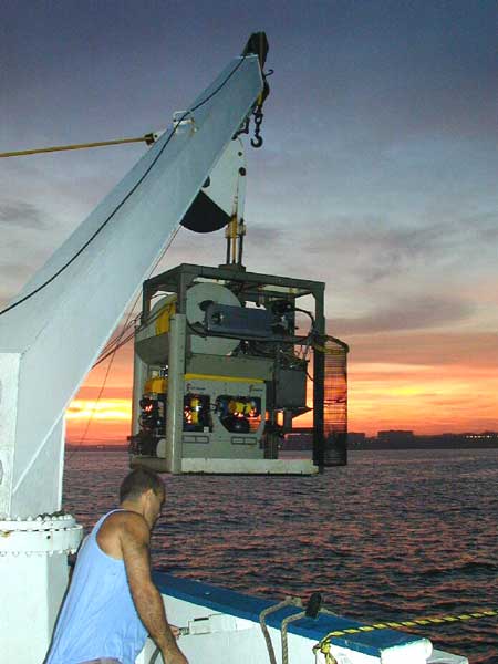
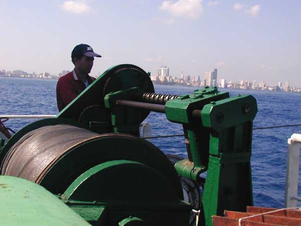
The ROV on the 'Ulises'research vessel
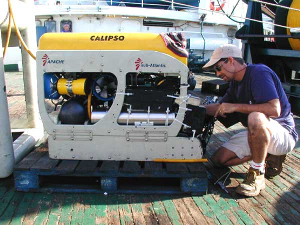
Advanced Digital Communications (ADC), based in Havana, Cuba, discovered the megalithic formations over the past two years using increasingly sophisticated equipment. The image directly below is of the winch that lowers and retrieves the Remotely-Operated-Vehicle (ROV) from the sea. It carries an array of lighting and video cameras. On this current expedition (June 2002) they have also taken a magnetometer to search for any metals which may be present amongst the megalithic ruins. Dr Paul Weinzweig told the Morien Institute on June 5th 2002 that:
"Presently (June 2002) the ship and team are conducting magnetometer, sidescan and ROV investigations of Cuban deep territorial waters in the Yucatan Channel"
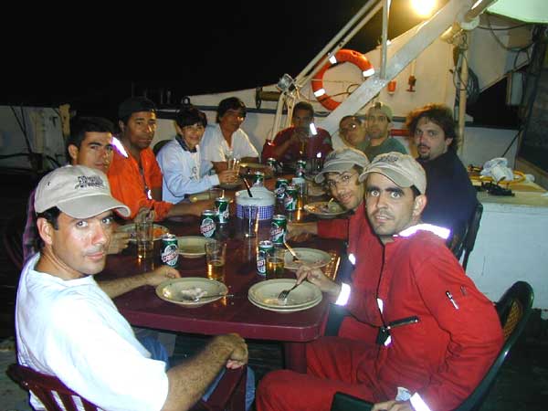
the ADC expedition crew eating their evening meal on board the 'Ulises' research ship. This is the time when they can relax, discuss the day's findings, and plan which part of the vast megalithic complex they should investigate next ...
The ADC expedition crew winch the ROV aboard the 'Ulises' around sunset after a long day of deep water exploration in the Yucatan Channel
Morien Institute:
What is the ADC expedition team doing at this present time?
Dr Paul Weinzweig:
"Presently the ship and team are conducting magnetometer, sidescan and ROV investigations of Cuban deep territorial waters in the Yucatan Channel."
Morien Institute:
Are you currently looking for anything specific based on earlier findings, such as the carved symbols and hieroglyphs that were widely reported in the media over the last six months or so?
Dr Paul Weinzweig:
"I would not over-emphasize the earlier reports of symbols in rocks. At the time, water clarity and ROV lighting was not optimal. The currents in this particular area are very strong and there is a lot of backscatter light effects from current-driven plankton. Our next expedition to the site will try to improve the video quality with better lighting, low light cameras and some improved perspective shots of megalithic structures evidenced in our sidescan sonar images."
Morien Institute:
Will you attempt to take samples during the current expedition from the structures you have found, and what about samples of the sediments from around the structures?
Dr Paul Weinzweig:
"We have already taken a few samples this Spring which are presently being analyzed by our Consulting Geologist and Geophysicist, Dr. Manuel Iturralde, Director of Research for the Cuban Museum of Natural History. The samples include both mineral and biological."
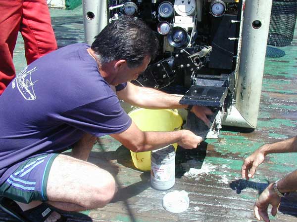
a crew member taking samples whilst fixing the ROV on the deck of the 'Ulises' research vesse
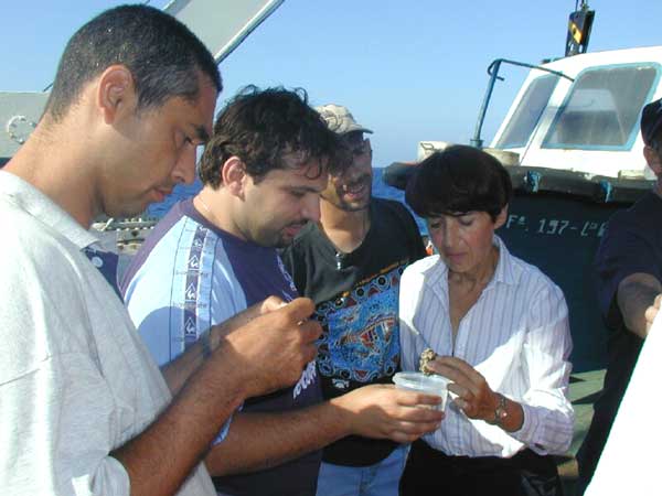
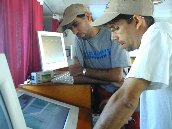
Ocean Engineer, Paulina Zeltisky, and other ADC crew members, examining some of the samples gathered by the ROV during one of it's expeditions in July 2001. The research ship 'Ulises' is equipped with sophisticated computers to help the ROV operators direct it to the most likely places to video the ruins ...
"To drill samples from these structures is not easy because they look like granite. And to drill granite at a depth of 600 metres is very difficult ... "
"We are discovering the influence of currents on global climate, volcanoes, the history of formation of Caribbean islands, numerous historic wrecks and even possibly a sunken city built in the pre-classic period and populated by an advanced civilization similar to the early Teotihuacan culture of Yucatan." Paulina Zelitsky, Whitley Streiber's Unknown Country", May 19 2001
Morien Institute:
What special equipment will you be using during the current expedition that you have not used before, and what extra data do you expect to be able to gather as a result?
Dr Paul Weinzweig:
"See the answer to question number 2 above. We may also try to re-do the sidescan sonar along with a powerful magnetometer to register any metals on the site."
Morien Institute:
I gather that there is another complex of apparent urban ruins, which has been discovered underwater in the Bay of Batabané, and that they stretch south towards the Isle of Youth. Has ADC explored these ruins, or if not, do you have any plans to explore them in the future?
Dr Paul Weinzweig:
"We have not explored these other areas yet but intend to in the future."
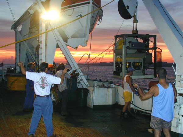
The ADC expedition crew with GeoPulse and winch aboard the 'Ulises' research vessel...
On December 7 2001 , Michael Posner of the Canadian Globe & Mail reported that in January 2002, the ADC expedition team would be returning to the site of the megalithic complex they discovered in July 2000, though this time with the first deep-water mobile excavator equipped with functions needed for on-site archæological evaluation, including the ability to blow sand off stone. In an interview with Dr Paul Weinzweig of ADC, Posner quoted Dr Weinzweig as saying:
"Some structures within the complex may be as long as 400 metres wide and as high as 40 metres ... Some are sitting on top of each other. They show very distinct shapes and symmetrical designs of a non-natural kind. We've shown them to scientists in Cuba, the U.S. and elsewhere, and nobody has suggested they are natural."
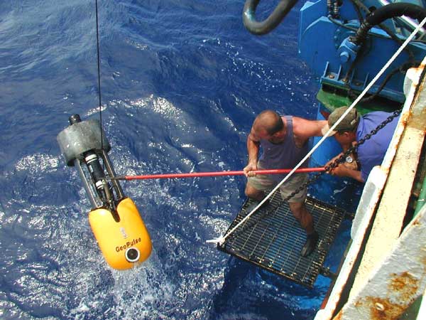
an ADC crew member helps to retrieve the GeoPulse Sidescan Sonar from the sea after an expedition in July 2001, when they returned with a 1.3 tonne, unmanned Remotely Operated Vehicle (ROV) controlled by fibre-optic cable from computers in the research ship 'Ulises'
The cameras on board the ROV confirmed the earlier findings, showing large granite-like blocks between 6 and 15 feet in length, that were cut in circular and perpendicular designs. But because of some technical problems encountered, Dr Weinzweig told the "Globe & Mail":
" ... we were only able to survey the perimeter of the site. Based on initial explorations, we think it's much larger than even our sonar projections show. It may extend for several kilometres."
Morien Institute:
There have been reports since the 1950's by light aircraft pilots of submerged buildings, evident from the air, to the north of Cuba and in the Old Bahaman Channel. Has ADC explored those ruins, and if not, do you have any plans to explore them in the future?
Dr Paul Weinzweig:
"Probably not. Since our work is currently confined to Cuba's deep territorial ocean waters. Ocean images recorded by aircraft would be in shallow waters accessible by human divers. Our expertise is in Deep Ocean Technology and investigation."
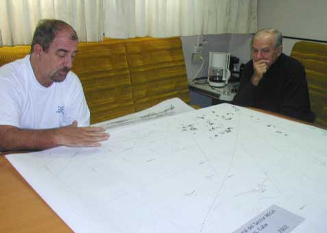
geologist Dr Manuel Iturralde of Cuba's Natural History Museum and archæologist Dr Gabino La Rosa of the Cuban Museum of Natural Sciences discuss ocean charts of the underwater megalith discovery area...
On May 28 2002 National Geographic News reported on the many recent discoveries underwater on the coastal shelves around the world. The story focussed on the recent discovery of megalithic ruins some 2,200 ft below sea level off the coast of Cuba, and made some interesting comments about ancient 'flood myths':
"Ancient stories of massive floods pass from generation to generation and in many places in the world are integral to a people's spoken history. The tales differ by locale, but commonly feature either torrential rains or a hugely destructive wall of water bursting into a valley, destroying everything in its path. In many cases, the flooding is an act of retribution by displeased gods. Scientists, historians, and archaeologists view many of these enduring tales as myth, legend, or allegoric tales meant to illustrate moral principles. Recent findings indicate that at least a few of them could be based on real floods that caused destruction on an enormous scale."
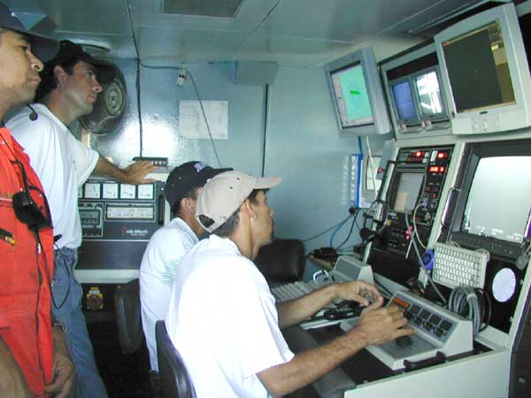
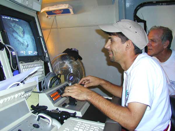
an ADC crew member operates the Sidescan Sonar while a colleague looks on. The images it sends back to the 'Ulises' are compared with the ocean charts of the area, and it seems that the plateau 2,200 ft down where the megalithic complex was discovered is right on the edge of a geological fault-line.
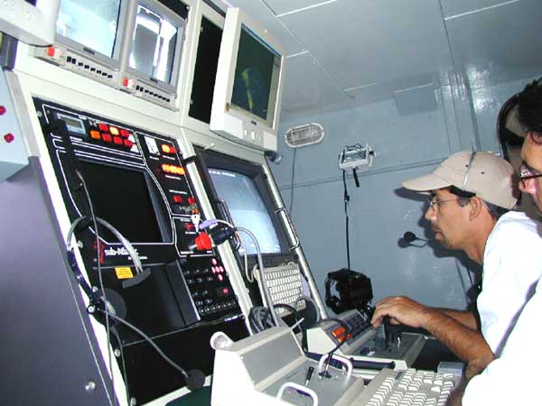
an ADC crew member 'flying' the ROV from the controls aboard the 'Ulises'. The remotely-operated-vehicle is attached to the ship by a fibre-optic cable, which allows the operator to navigate the Cuban deep territorial waters in the Yucatan Channel, where the megaliths were discovered in July 2000
Morien Institute:
Do you have any thoughts about the recent discoveries of underwater megalithic structures in northwest India, at the Gulf of Cambay, and also in southeast India at Mahabalipuram?
Dr Paul Weinzweig:
"We follow these findings with interest. We believe that much of the significant archaeology of the future will be discovered in the little-explored world's oceans and will greatly expand our understanding of the enourmous antiquity of human civilization."
Morien Institute:
Similarly, do you have any thoughts about the underwater megalithic structures found off several of the Japanese islands, particularly the discovery at Yonaguni-Jima?"
Dr Paul Weinzweig:
"The marine structures at Yonaguni, as I understand them, bear close resemblance to the terraced terrestrial geology. Perhaps human settlements were carved out of local geology. In our Cuban site the granite monolithic stones are foriegn to the local marine and terrestrial geology."
On May 15 2001, ocean engineer, Paulina Zelitsky, of ADC was quoted in a Reuters despatch from Havana, Cuba:
"We don't know what it is and we don't have the videotaped evidence of this yet, but we do not believe that nature is capable of producing planned symmetrical architecture, unless it is a miracle, ... It is stunning. What we see in our high-resolution sonar images are limitless, rolling, white sand plains and, in the middle of this beautiful white sand, there are clear manmade large-size architectural designs. It looks like when you fly over an urban development in a plane and you see highways, tunnels and buildings ... "
Below, an ADC crew member is fixing the ROV on the deck of the 'Ulises' research vessel
Below, the ADC expedition team are lowering the ROV back into the water after repairs. The ship is well-equipped for the task, and the crew have many years of experience between them in deep-water exploration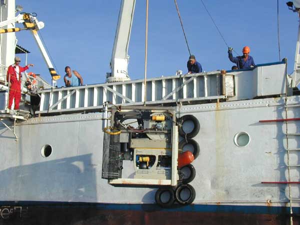
an ADC crew member at the controls of the ROV. Manoeuvring it precisely is a delicate operation, requiring intense concentration and a steady hand, but the GeoPulse equipment is just right for the job.
"It's a really wonderful structure which really looks like it could have been a large urban centre ... "
Paulina Zelitsky, BBC News, June 7 2001
Morien Institute:
Are the structures ADC has found off the Guanahacabibes Peninsula in western Cuba identical to ruins of the Mesoamerican 'Pre-Classic Period', or have you detected any unique features from the video footage ADC has acquired so far?
Dr Paul Weinzweig:
"At this stage in the investigations, we can only speculate that some features (such as temple foundations layouts) seem to be reproduced at our site. Since the ancients built their new structures on old structural sites, we really don't know their true antiquity. Garcilaso in "Royal Commentaries of the Incas" reports similar enormous geometrically shaped granite building stones in Cuzco (Peru) and Lake Titicaca.
These megalithic granite stones are located miles from the nearest quarries. There is nothing in our understanding of ancient engineering and construction or in our present rational imagination to explain the logistics of such megalithic construction. There is much mystery here."
Morien Institute:
We believe that similar symbols and hieroglyphs to what you have found carved on the underwater structures have also been discovered in various caves on the island of Cuba itself. Can you tell us anything about these discoveries on dry land?
Dr Paul Weinzweig:
"Yes, there are caves in the Isle of Youth and elsewhere that show ancient symbols. Andrew Collins, in "Gateway to Atlantis", examines some of these land sites and symbols."
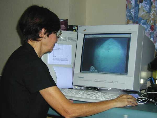
Paulina Zelitsky of ADC looking at video from the ROV and the 'Sidescan Sonar' computer screen
On December 12 2001 the Cuban newspaper, "Granma" reported that during the previous summer, ADC had filmed ruins of a possible 'Lost City' submerged off the coast of the Guanahacabibes Peninsula, on the western tip of Cuba in the Yucatan Channel. It quoted ocean engineer, Paulina Zelitsky, of ADC as cautioning that the nature of their discovery is not yet fully understood, and that they would return in January 2002 to conduct further investigations:
"It's a marvelous structure which could possibly have been a great urban center ... However, it would be completely irresponsible to to say what it is, before having all the evidence."
An ADC crew member 'flying' the ROV from the controls on the 'Ulises' research vessel, with archæologist, Dr Gabino La Rosa, scrutinising the 'live' seabed video images sent back to the computer screen
Below, Paulina Zelitsky of ADC looks at the video image of a 'pyramid-shaped structure' that the ROV had sent back to one of the dedicated computers on board the 'Ulises'. "Granma" reported that researchers have pointed out the mysterious structures could have been at least 6,000 years ago, 1,500 years before the first pyramids on the Giza plateau in Egypt. Paulina Zelitsky told them that the structures, presumably built on dry land before being covered by the sea, could have been sunk by volcanic activity in the area. It also told that, in July 2000, ADC researchers had identified an area 650 metres deep, where symmetrically organised stone structures that resembled an urban layout, were clearly visible:
,i>
"That footage confirms the presence of large blocks of granite in circular and perpendicular formations. Most of the blocks, between two and five meters long, were not covered. Others were covered with sediment and the area’s fine white sand."
The computer screen below shows one of the original 'sidescan sonar' images from the July 2000 ADC expedition. On December 28 2001, a report by Reuters featured on Linda Moulton Howe's "Earthfiles" website, where Paulina Zelitsky was quoted as saying that ADC has high resolution sidescan sonar images of:
" ... a huge land plateau with clear images of what appears to be manmade large-size architechural designs partly covered by sand. From above, the shapes resemble pyramids, roads and buildings."
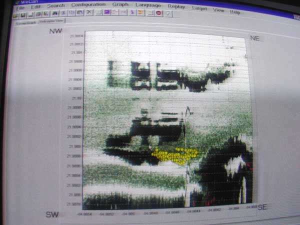
One of the many 'sidescan sonar' images of part of the megalithic complex discovered by ADC. Using a growing array of sophisticated underwater equipment, which includes the ROV, such images are facinating archæologists and geologists around the world. As ADC's investigations progress, it will be interesting to see if any of the roadways, or the axis orientation of any of the major structures, points in the direction of the 'Old North Pole', which during the last Ice Age was at 60° North, 73° West, in the Hudson's Bay area ...
"We believe that much of the significant archaeology of the future will be discovered in the little-explored world's oceans and will greatly expand our understanding of the enormous antiquity of human civilization."
Dr Paul Weinzweig, June 12 2002, Havana, Cuba
Morien Institute:
Is there any geological evidence to suggest that the Caribbean Islands, as we see them today, might be just the mountain-tops and high ground of a much larger landmass which partially sank as a result of cataclysms in ancient times?
Dr Paul Weinzweig:
"Yes, geologists tell us that Yucatan, Cuba, Domincan Republic and Puerto Rico were connected at one time. There is still much to learn about the geological history of the Gulf of Mexico and the Caribbean. Our Consulting Geologist, Dr. Iturralde, is a world authority on the subject. You can find many references to his scientific work on the internet."
Dr. Weinzweig told us that Paulina Zelitsky and her crew aboard their research vessel 'Ulises' will be back on Cuban dry land at around the end of June 2002. We hope to have more images at that time, and to be able to provide an update on anything new that has been discovered during the current expedition
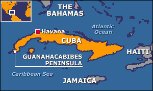
the location of the discoveries - an image link to the BBC story
TOPICS: Business/Economy; Canada; Cuba; Culture/Society; Extended News; Foreign Affairs; Government; News/Current Events; Russia
KEYWORDS: atlantis; blocks; canada; catastrophism; cuba; explore; godsgravesglyphs; history; mystery; past; paulinazelitsky; paulinazelitzky; ruins; russia; science; stone; undersea; underwater; yonaguni
Navigation: use the links below to view more comments.
first 1-20, 21-24 next last
| |
'LOST CITY' FOUND OFF CUBA - IS IT PROOF OF ATLANTIS?
|
|
| |
|
|
| |
A Special Report by Andrew Collins A 'lost city', that could turn out to be the fabled city of Atlantis, has been located by a Canadian scientific research team. In a press release dated Havana, 14 May 2001 Reuters of London informed the world that Soviet-born ocean engineer Paulina Zelitsky, the president of Canadian-based company Advanced Digital Communications, had detected 'a sunken city' in deep waters off the west coast of Cuba, the largest island of the Caribbean. Satellite-integrated ocean bottom positioning systems, echo sounders and high precision side-scan double-frequency sonar have detected the presence of what are being described as 'shapes' that 'resemble pyramids, roads and buildings'. Their regularity seems consistent with the idea that they represent an 'urban development' composed of 'symmetrical architecture'. Reuters reported that the deep-sea city is located on a huge land plateau lying in around 2,200 feet (700 metres) of water. Furthermore, that in Paulina's opinion the complex belongs to 'the pre-classic period' of Central American history, and was populated by 'an advanced civilization similar to the early Teotihuacán culture of Yucatán'. 'It is stunning,' she said during an interview with the Reuters representative at her office at Tarara, on the coast east of Havana. 'What we see in our high-resolution sonar images are limitless, rolling, white sand plains and, in the middle of this beautiful white sand, there are clear man-made large-size architectural designs. It looks like when you fly over an urban development in a plane and you see highways, tunnels and buildings. 'We don't know what it is, and we don't have the videotaped evidence of this yet, but we do not believe that nature is capable of producing planned symmetrical architecture, unless it is a miracle,' she added. Paulina is cautious about what lies beneath the glistening blue waters of the Yucatán Channel, admitting only that she is 'excited but reluctant to speculate until a joint investigation with the Cuban Academy of Sciences and the National Geographic Society takes place early this summer.' The discoveries were made last summer during deep-sea surveys made by Paulina and a trained scientific research team aboard the Cuban research vessel Ulises. Sonar images revealed 'an extensive series of structures' over a several-mile area in darker and lighter shades. The site is close to the edge of the underwater geological feature known as the Cuban shelf, which falls off sharply in a series of shelves which drop down to several thousand metres, and it is on one of these shelves, in around 600-700 metres of water, that the structures are to be found. The mass of rectilinear features are said to be located in the proximity of an 'extinct volcano, geological faults and a river bed'. This last fact alone shows that the land shelf, which rises to a height of around 40 metres, was once above water. 'Whenever you find a volcano, there is often a settlement associated with it,' Paul Weinzweig, Paulina's husband and a director of ADC, observed. 'I don't know the exact relationship, but it is in the same vicinity as the volcano, the fault lines and the river. They're quite close to one another.' On the matter of whether the sonar imagery really does show 'pyramids, roads and buildings', Paul stated: 'We had been looking at the images for some months, and keep a picture on the wall showing pyramids in the Yucatán, and let's just say they kept reminding us of these structures. They really do look like an urban development.' As to whether the light and dark areas of the sonar imagery appear to be three-dimensional features or not, he answered: 'There's a lot of symmetry, apart from actual shapes, and some suggestion of structure. Some American geologists have looked at them and said that the darker shadings are suggestive of metal roofing.' In order to explore the site more closely, ADC are currently planning to send down remote robot video cameras and a one-man submersible. We therefore look forward to further news of these discoveries in the coming months. The Search for Sunken Vessels ADC's intentions had never been to search for sunken cities. Their scientific operation to survey the deep waters off the Cuban coastline forms part of a joint venture set up between the Canadian company and the Cuban government, in particular its state partner Geomar. One of their principal aims is the location of the billions of dollars of bullion and lost treasure disgorged from sunken ships since the time of the Conquest. As Paul said: 'Cuba has the richest galleon cemetery in the world.' Over the past 500 years it is estimated that hundreds, if not thousands, of vessels must have been lost in Cuban waters due poor navigation, piracy on the high seas and the violent Caribbean storms that plague the region on a frighteningly regular basis. Visa Gold, a Toronto-based low-tech company which operates out of Havana's Marina Hemingway, claims already to have found some 7,000 objects from sunken vessels. They include jewellery, diamonds and pistols, said to have come from a brigantine called Palemon, lost off Cuba's northern coast in 1839. Visa Gold's next target is the Atocha y San Jose, a Spanish vessel. It sank in Havana Bay in January 1642 after fleeing storms at sea. The renewed interest in treasure salving in Cuban coastal waters comes in the wake of Fidel Castro's government recognising the fact that it does not have the ocean expertise or the inclination to conduct scientific operations of this nature. Its divers, who are considered to be among the best in the world, have been diving off Cuba's coast treasure hunting for decades. Yet Cuba lacks expertise and technology for deep-ocean search and science, which is why they have invited ADC to take up the challenge. Their 80-metre oceanographic reseach vessel, the Ulises, uses high-tech equipment and a highly trained scientific team to survey the ocean bottom up to a depth of several thousand metres. It was their high-skilled sonar software analysts who detected the reported underwater remains in the Yucatán Channel. 'These projects are very important in helping us rescue things from history, which contribute to our national patrimony,' said Eddy Fernandez, vice president of Geomar. 'As you know, we have financing problems. This is a very expensive activity. They give us technology and financing. We provide historical and ocean expertise'. THE CUBA-ATLANTIS ARGUMENT The implications of ADC's discoveries off Cuba's western coastline are far reaching and quite extraordinary. In an on-line pole, conducted by the NBC home news service MSNBC, of the 1827 people who had voted by the end of 26 May 2001, no less than 73 percent believed that the find 'could be something big: Next stop, Atlantis'. It means that already NBC are considering the possibility that the sunken city could be linked with Plato's account of the lost city of Atlantis. This is good news for me, as my book GATEWAY TO ATLANTIS, published in 2000, concluded that the most likely location of Plato's sunken empire was Cuba, the first time that this country had ever been proposed in this respect. I pointed out that the evidence contained in Plato's works the TIMAEUS and CRITIAS hinted strongly that his view of Atlantis was based on stories and rumours reaching the ancient world via Phoenician and Carthaginian who were crossing the Atlantic prior to his age. Moreover, Plato's description of Atlantis' great plain, said to have been 3000 by 2000 stadia (552 by 368 kilometres) in size, matches very well Cuba's great western plain. Before the rapid rise in sea-level following the end of the last Ice Age this stretched southwards across the Bay of Batabanó to the mysterious Isle of Youth and was originally 540 by 160 kilometres in size. Although I speculated in the book - which has now been published in the USA, Italy, Holland, Germany and Portugal - that the Atlantean city might await discovery beneath the shallow waters of the Bay of Batabanó, news that a sunken city may now have been detected in the Yucatán Channel, between Cuba and the Yucatán peninsular, is exciting news. Incidentally, ADC have plans to explore the Bay of Batabanó during the next year, so it should be interesting to see what if anything they find here. The Search for the Mother Lode In September 1972 American oceanic explorer J. Manson Valentine, flying over the Bahamas in a light aircraft with and his associate Jim Richardson, noticed a mass of rectilinear and curvilinear features in shallow waters on the south-western edge of the former Bahaman landmass (now the Great Bahama Bank). Valentine referred to this mass of possible archaeological features as 'the mother lode'. They faced out across the Old Bahama Channel, like some kind of ancient port serving the Cuban mainland. As early as the 1950s light-aircraft pilots reported seeing what they described as underwater 'stonework' which was 'well within Cuban waters'. Similar sightings 'north of Cuba' of an alleged 'submerged building complex covering over ten acres' might even have convinced the Cuban government that a veritable city awaited discovery in its vigorously defended waters. There are, for instance, unconfirmed reports that this 'building complex' was explored with the assistance of Soviet submarines based in Cuba during the 1960s. Strange then that these recent discoveries of a sunken city in Cuban waters are being conducted by a Russian-born Canadian oceanographer. Among those who felt they had glimpsed the remains of a lost citadel in Cuban waters was Leicester Hemingway, brother of the writer Ernest Hemingway. During a flight into the country, Leicester noticed, beyond its northern coast, 'an expanse of stone ruins, several acres in area and apparently white, as if they were marble'. The exact location of these underwater features remains unclear. Only time will tell whether the discoveries made by Paulina Zelitsky and ADC do constitute firm evidence of Plato's Atlantis, for if they do then it will fix, once and for all, its geographical location in the Bahamas and Caribbean, and not anywhere else in the world. However, the location of a lost city on a huge land plateau lying at a depth of around 600-700 metres poses new problems for the Atlantis debate. Plato wrote that his Atlantic island empire was destroyed by 'earthquakes and floods' in 'one terrible day and night', post-8570 BC in the TIMAEUS and around 9421 BC in the CRITIAS. This time-frame corresponds with the cessation of the last Ice Age, when we know that the sea-levels began to rise fairly rapidly as the ice fields which had covered vast areas of North America and Europe for tens of thousands of years began to disappear. In GATEWAY TO ATLANTIS I proposed that the mechanism behind Atlantis' destruction was a comet impact which devastated the eastern Atlantic coast of America, causing literally 500,000 elliptical craters, known today as the Carolina Bays, sometime around 8500 BC (+/- 500 years). Fragments of the comet falling in the Western Atlantic basin, north of the Bahamas, would have created tsunami tidal-waves perhaps hundreds of metres high. These would have drowned, temporarily at least, large parts of the Bahamas and Caribbean, as well as many low-lying regions of the eastern United States. Myths and legends told by the indigenous peoples of the Bahaman and Caribbean archipelagos, when the Spanish first reached the New World, spoke of just such a cataclysm. They said that the waters suddenly rushed in and drowned the great landmass, breaking it up into the individual islands seen today. Although a fragmentation of the former landmasses of the Bahamas and Caribbean in the manner indicated could not have been caused by tsunamis alone, the gradual rise in the sea-level which followed this cataclysmic event would have drowned, more permanently this time, all low-lying regions, creating the archipelagos we see today. Yet in the thousands of years which it took for the ice fields to melt in full, the sea-level rose only 300 metres (some estimates place it as much as 400 metres). If the 'city' does lie in 600-700 metres of water, we will need to propose a suitable geological mechanism in order to justify its submergence to this depth post 9000 BC. Either that, or we will have to define a geological time-frame in which the land plateau, with its volcano, fault lines and river was above sea-level. Paulina's statement that the 'city' might belong to 'the pre-classic period' of Mesoamerican history, and was populated 'by an advanced civilisation similar to the early Teotihuacán culture of Yucatán', is very difficult to equate with the discovery. The Teotihuacán culture, which thrived in Central Mexico from around 400 BC through until around AD 500, remains an enigma to archaeologists. Its origin is unclear. What we do know is that legends once told by the Totonac peoples of eastern Mexico spoke of the founders of its sacred city of Teotihuacán, with its mighty Pyramids of the Sun and Moon, as having arrived on the Gulf coast from an island homeland which lay beyond the sea. Here was to be found Chicomoztoc, the Seven Caves, where the first humans emerged out of the darkness at the beginning of time. For many reasons, not least of all the appearance of sea-shells of a purely Caribbean nature carved on the walls of the Temple of Quetzalcoatl at Teotihuacán, the Teotihuacán culture saw their ancestral homeland as connected in some way with the Caribbean. Moreover, in GATEWAY TO ATLANTIS I identified the original Seven Caves complex as the Punta del Esté caves on Cuba's Isle of Youth, one of which, Ceuva # 1, has been described as a veritable Sistine Chapel of the prehistoric world. Many thousands of years ago unknown artists adorned its walls and ceilings with abstract petroglyphs of a blatantly celestial nature. Yet even so, any sunken city lying off the northern coast of Cuba, in 600-700 metres of water, must antedate the Teotihuacán culture by many thousands of years. Curiously, Pauline Zelitsky visited Ceuva # 1 at the Punta del Esté complex during the summer of 2000, shortly before she made her dramatic discovery of the underwater 'city'. There is something magical about this place. It assaults the senses and inspires thoughts regarding the origins of Cuba's indigenous peoples and their apparent knowledge of the cataclysm which devastated the region so many thousands of years ago. If Paulina Zelitsky and her oceanographic colleagues are right in their belief that 'pyramids, roads and buildings' do lie off Cuba's western coastline, then it is clear that the prehistory of the Caribbean, and its influence on the rise of Mesoamerican civilisation, will have to be revised dramatically. Moreover, it could well be that at long last the mystery of Atlantis, mankind's greatest historical enigma, is about to unfold in a most spectacular fashion. Sources: 'Looking for lost riches in Cuba's seas: Underwater surveyors say they may have found sunken city', Reuters report dated Havana, 14 May, 2001, MSNBC Home News to be found at http://www.msnbc.com/news/573489.asp Collins, Andrew, GATEWAY TO ATLANTIS, Headline, London, 2000; Carroll & Graf, USA, 2000. All references comes from either of these sources, or personal communications between Paul Weinzweig and the author between 17 and 29 May 2001. |
|
| |
|
|
| |
|
|
| |
|
|
| |
|
|
1
posted on
08/19/2002 6:52:42 PM PDT
by
vannrox
To: vannrox
'As above, so below'. . .the ever-expanding metaphor.
2
posted on
08/19/2002 7:04:26 PM PDT
by
cricket
To: cricket
There were a lot of pics of the boat, the people and the operation, but no pics of the findings. Why not?
3
posted on
08/19/2002 7:18:09 PM PDT
by
Kermit
To: cricket
I waited forever with my kids for this to download at 28,800 BPS. And low and behold what do we get for our trouble but great pics of the crew, the equiptment, a few shots of a side scan sonar that looks like an LA earthquake. But not a single picture of the structures, . . If you actually get some pictures please mail them to me. thanks sharkdiver sends with over 3,000 dives logged.
To: sharkdiver
"But not a single picture of the structures, . ." Another disappointing report from these folks. (I keep reminding myself that they are working for the communist Cubans)
5
posted on
08/19/2002 7:27:55 PM PDT
by
blam
To: sharkdiver
"If you actually get some pictures please mail them to me. thanks sharkdiver sends with over 3,000 dives logged."
Did not post this. . .but share your disappointment that there were not picts. . .but then, think they only have 'graphed out' charts or maybe I missed actual pict references; in which case, maybe they are not available. . .copyrights et al. Don't know. . .
6
posted on
08/19/2002 7:40:49 PM PDT
by
cricket
To: Kermit
"There were a lot of pics of the boat, the people and the operation, but no pics of the findings. Why not?"
Don't know!
7
posted on
08/19/2002 7:50:29 PM PDT
by
cricket
To: Kermit
I think Johnny Rotten from the Sex Pistols summed up things like this rather well:
"You ever get the feeling you've been cheated?"
8
posted on
08/19/2002 7:54:07 PM PDT
by
Orangedog
To: vannrox
I DID NOT SEE ONE UNDER-SEA PHOTO!
In that group picture, I did spot their tin-foiled life vests.
9
posted on
08/19/2002 7:56:15 PM PDT
by
A CA Guy
To: vannrox
Sonar says it's a GIRL! Congrats...
10
posted on
08/19/2002 7:57:30 PM PDT
by
A CA Guy
To: vannrox
So where are the actual photographs of the undersea objects? Very disappointing post.
11
posted on
08/19/2002 7:59:58 PM PDT
by
StormEye
To: StormEye
My thoughts exactly!! Where is the undersea city? Even with all those pictures of the boat, I remained unconvinced that Atlantis is under Cuba.
12
posted on
08/19/2002 8:09:25 PM PDT
by
BRK
To: sharkdiver
The first picture showed what I thought was an artifact at first, but upon reflection I had to agree with our learned establishmentarians that steel ballast tanks and welded cubic assemblies could have been naturally formed by intense magnetic fields interacting with volcanic forces.
For more information on these phenomena, please reference the many crop circle explanations, as maintained by the Royal Society for Conventionality at all Costs.
To: Kermit
A Lovecraftian horror lays sleeping in the megalithic ruins. The photographer went insane after taking the pictures. Wouldn't want the same fate happening to us if we saw the pictures, I suppose. ;-)
14
posted on
08/19/2002 9:20:30 PM PDT
by
BradyLS
To: sharkdiver
FYI: With my DSL it took about 3 seconds to load.
To: wallcrawlr
I thought they found the 100 million africans that fell off the slave boats... oh well I guess that'll come later.
16
posted on
08/19/2002 9:53:25 PM PDT
by
Naspino
To: Admin Moderator
Please change the title of this to delete the "Includes Photos!" reference. It is misleading, since there are no photos of the discoveries as implied.
17
posted on
08/19/2002 10:13:20 PM PDT
by
SkyPilot
To: vannrox
The implications of ADC's discoveries off Cuba's western coastline are far reaching and quite extraordinary. In an on-line pole, conducted by the NBC home news service MSNBC, of the 1827 people who had voted by the end of 26 May 2001, no less than 73 percent believed that the find 'could be something big: Next stop, Atlantis'.Well, this pretty much proves something. . .
To: blam; Ernest_at_the_Beach; FairOpinion; StayAt HomeMother
Just adding this to the GGG catalog, not sending a general distribution. I thought I'd previously found 'em all, but here's one last one about the freakin' Cuban Atlantis.
To all -- please ping me to other topics which are appropriate for the GGG list. Thanks. Please FREEPMAIL me if you want on or off the
Gods, Graves, Glyphs PING list or GGG weekly digest
-- Archaeology/Anthropology/Ancient Cultures/Artifacts/Antiquities, etc.
Gods, Graves, Glyphs (alpha order)
19
posted on
09/03/2005 9:06:28 PM PDT
by
SunkenCiv
(Down with Dhimmicrats! I last updated by FR profile on Sunday, August 14, 2005.)
To: StormEye
So where are the actual photographs of the undersea objects? Very disappointing post. There must be some way we can blame Bush.
Navigation: use the links below to view more comments.
first 1-20, 21-24 next last
Disclaimer:
Opinions posted on Free Republic are those of the individual
posters and do not necessarily represent the opinion of Free Republic or its
management. All materials posted herein are protected by copyright law and the
exemption for fair use of copyrighted works.
FreeRepublic.com is powered by software copyright 2000-2008 John Robinson