Posted on 09/04/2017 2:02:19 PM PDT by NautiNurse
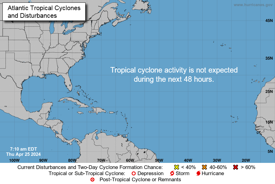
While thoughts and prayers are with our Texas FRiends and neighbors, we are at the peak of the Atlantic Tropical Storm season. Hurricane Irma continues its trek from Cape Verde across the pond and toward the Hebert Box (see below). People with interests in the Southeastern U.S. and Gulf of Mexico should be alert to the forecast path updates for this powerful storm. It is important to note that the average NHC track errors are about 175 and 225 statute miles at days 4 and 5, respectively.
Hurricane Irma originally had a small wind field. In the past 24 hours, however, the wind field has expanded with hurriance force winds up to 40 miles from the center, and tropical storm force winds up to 140 miles from the storm center.
FL Governor Rick Scott reminds Floridians: Families should take time today to make sure you have a disaster plan and fully-stocked Disaster Supply Kit. Florida residents from West Palm Beach to Tampa Bay are heeding the alert. Store shelves are emptying of bottled water.


Mash image to find lots of satellite imagery links
Public Advisories
NHC Discussions
NOAA Local Weather Statements/Radar San Juan, Puerto Rico
NHC Local Weather Statements/Radar Miami, FL
NHC Local Weather Statements/Radar Key West, FL
Buoy Data Caribbean
Buoy Data SE US & GOM

Hebert Box - Mash Pic for Tutorial
Credit: By J Cricket - Modification of map from Wiki
00z GFS still has the sharp turn into south FL...a little more west then 18z
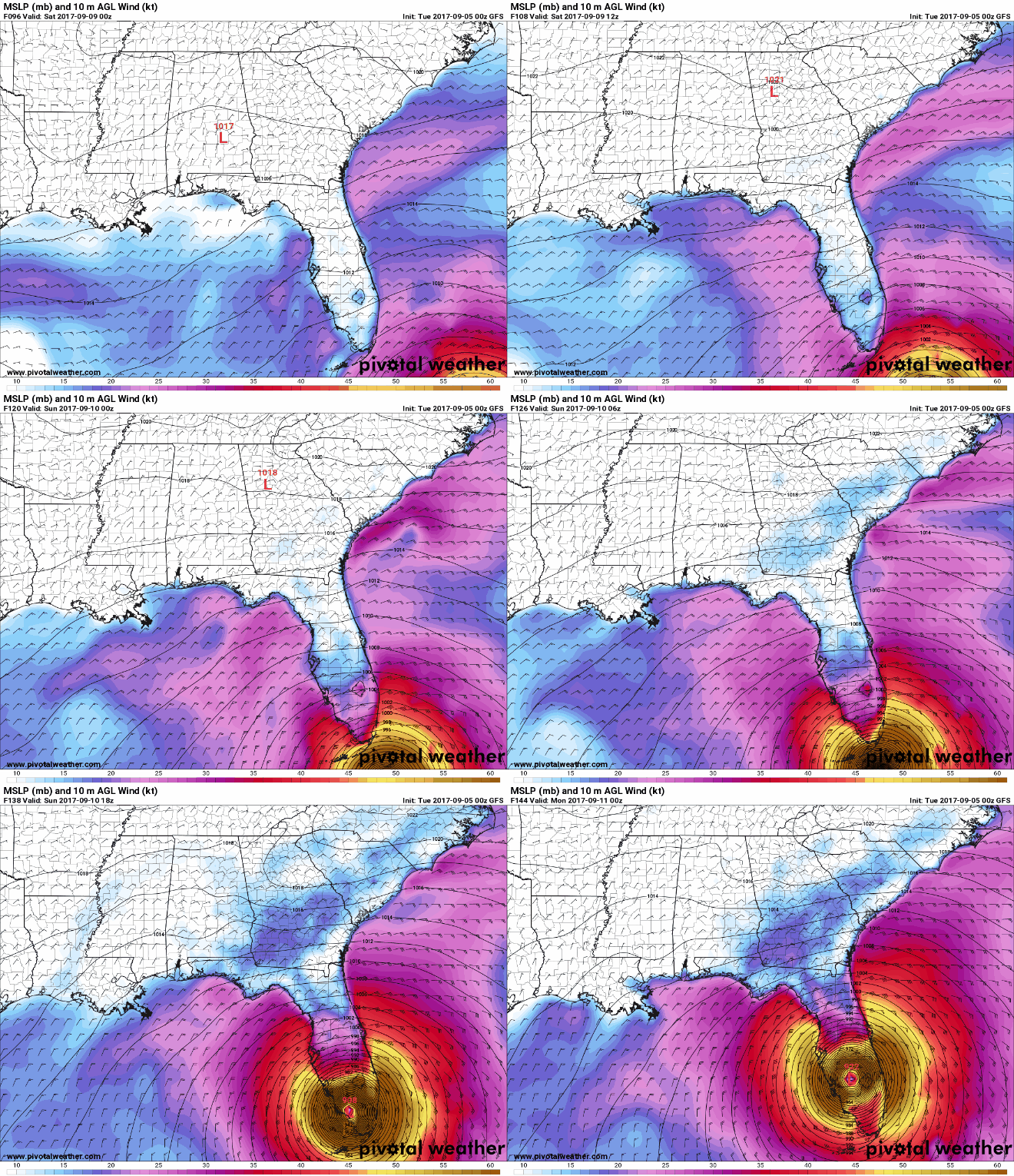
If Irma doesn’t attain Cat 5, I will be astonished.
Prayers for all who might end up in harm’s way! Here is a list from a FL friend on Facebook. Very practical and timely:
1. Start running your ice makers now and bagging the ice in freezer bags. Fill as much space in between your freezer items as you can.
2. Freeze regular tap water for pets, cleaning or drinking in tupperware-type containers. REMEMBER to leave a small bit of space between the top of the water & the lids so the ice expands but doesn’t crack the container.
3. Start using up your perishables to make more room for ice in the freezer.
4. Fill up all vehicles & check tires & oil.
5. Cash from ATM, at least enough to get you through tolls and gas out of town. Call your bank if you plan on leaving the state so they don’t freeze your card for out-of-area “suspicious” transactions.
6. All important docs screenshot & send to your email. Take originals in sealed bags or plastic bins.
7. Pet & livestock food & supplies. Vet records in case you need to shelter then at a storm-safe facility.
8. Evacuation plans and share with family members so they know where you’re headed.
9. Consider putting heirlooms & photos in plastic bins in a high place, second floor, or safe room if you don’t plan on taking them with you.
10. SECURE ALL FIREARMS & AMMUNITION PROPERLY.
11. Old rags & beach towels on your windowsills. Even with the best windows & shutters, water seeping from the wind pressure happens. A few damp towels is better than soaked drywall or floors!
12. Shutter windows and doors and bring everything outside into your garage or house NOW. Do not wait until the day before. Better to get done early and relax than wait until its too late, ESPECIALLY IF YOU ARE MANDATORY PERSONNEL (hospital employee or first responder).
13. If you don’t already have your hurricane supplies, you might want to get them now before shelves start emptying.
14. Have plastic bins filled with clothing and toiletries you can take with you quickly if you must be evacuated. Luggage leaks.
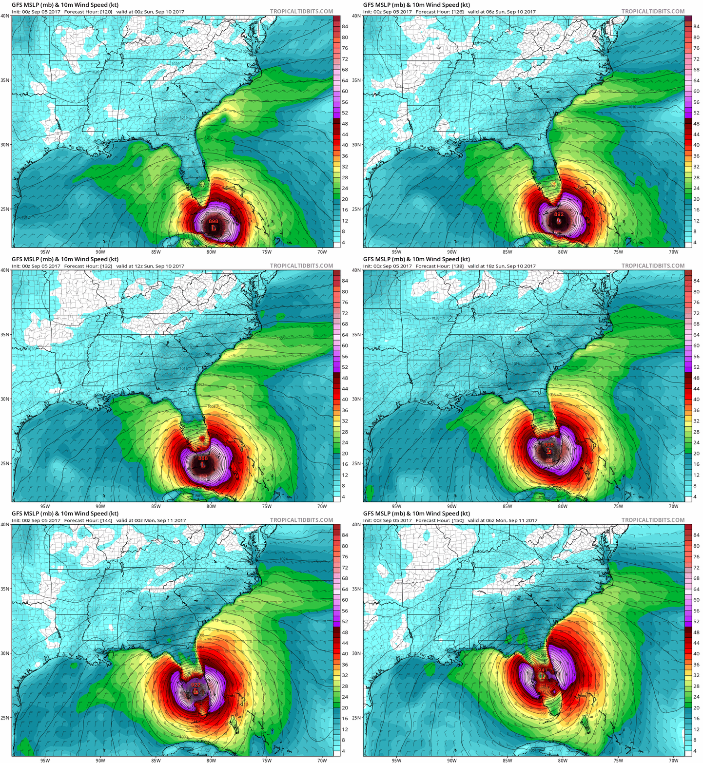

Buzz saw right up through the peninsula. Worst possible case. Very, very bad for Okeechobee.
Not looking too good. Aiming to thread the eye of the needle between Florida and Cuba. Then, all hell is going to break loose.
Oh man. That tells a lot.
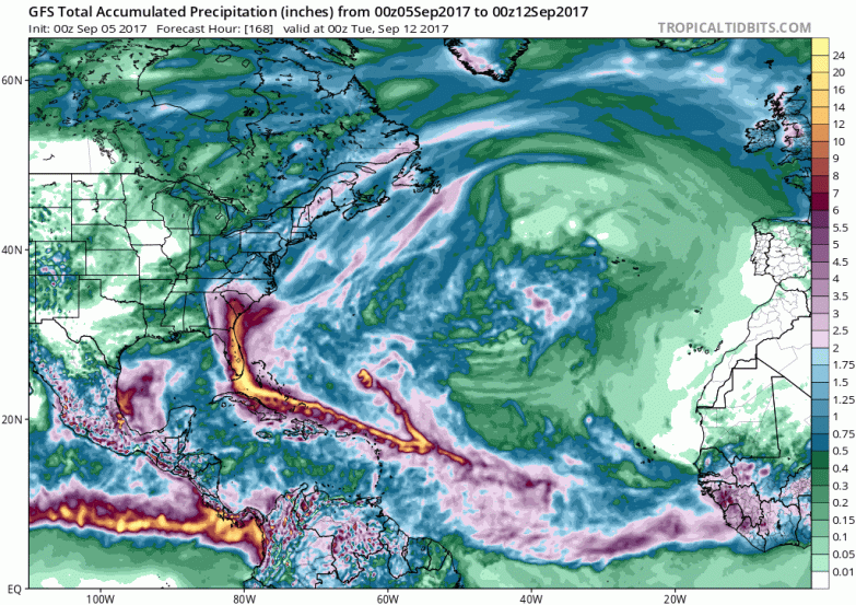
If that holds, Okeechobee is in trouble.
CMC model takes it over Cuba(was way too far west with Harvey though) and we did have a slight shift west on the gfs
00z is “slightly” less devasating since the big cities on the SE coast may barely miss the strongest eyewall winds
a continue nudge west will the the best of the worst options
The track of the 1928 hurricane through Florida is....eerie.
CMC initialized at 988 mb. Garbage run.
yep
recon seems to be finding sub 940mb pressure now
Yep, Recon finding pressures close to 938 mb.
Dvorak has it close to 150 mph
http://www.storm2k.org/phpbb2/viewtopic.php?f=59&t=119059&start=6560
Scrolling down a bit one can see maps showing if this trend actually holds the state will have sustained hurricane winds. The whole state.
I don’t see it as possible. Except for Lake O and the swamps feeding it.
12 volt charger, maybe even a 12 volt inverter.
Obviously bon-bons and palm frond fans.
1926 Cat 5. Easy to find.
Disclaimer: Opinions posted on Free Republic are those of the individual posters and do not necessarily represent the opinion of Free Republic or its management. All materials posted herein are protected by copyright law and the exemption for fair use of copyrighted works.