| This thread has been locked, it will not receive new replies. |
| Locked on 08/29/2005 2:09:55 PM PDT by Admin Moderator, reason: |
Posted on 08/29/2005 2:47:45 AM PDT by NautiNurse
Category 4 Hurricane Katrina is approaching landfall in Eastern Louisiana. At 4:00AM EDT the storm's center was about 90 miles south of New Orleans.
The following links are self-updating:
Public Advisory Currently published every 3 hours 5A, 8A, 11A, 2P, etc. ET
NHC Discussion Published every six hours 6A, 11A, 6P, 11P
Three Day Forecast Track
Five Day Forecast Track
Navy Storm Track
Katrina Track Forecast Archive Nice loop of each NHC forecast track for both three and five day
Forecast Models
Alternate Hurricane Models via Skeetobite
Bouy Data Louisiana/Mississippi
Buoy Data Florida
Lake Ponchartrain Real Time Water Level
Images:
New Orleans/Baton Rouge Experimental Radar Subject to delays and outages - and well worth the wait
Ft. Polk, LA Long Range Radar Loop
Northwest Florida Long Range Radar
Storm Floater IR Loop
Storm Floater Still & Loop Options
Color Enhanced IR Loop
Other Resources:
Hurricane Wind Risk Very informative tables showing inland wind potential by hurricane strength and forward motion
Central Florida Hurricane Center
New Orleans Web Cams Loads of web cam sites here. The sites have been very slow due to high traffic
New Orleans Music Online Couldn't resist--love that jazz
Golden Triangle Weather Page Nice Beaumont weather site with lots of tracks and graphics
Hurricane City
Crown Weather Tropical Website Offers a variety of storm info, with some nice track graphics
Live streaming:
Cut and Paste:
http://www.wwltv.com/perl/common/video/wmPlayer.pl?title=beloint_khou&props=livenoad
Fully-linked version of the live feeds (just in case a few people don't want to first open up WMP to cut-and-paste) -
WWL-TV/DT New Orleans (WMP) - mms://beloint.wm.llnwd.net/beloint_wwltv
WVTM-TV/DT Birmingham (WMP) - mms://a1256.l1289835255.c12898.g.lm.akamaistream.net/D/
1256/12898/v0001/reflector:35255
WDSU-TV/DT New Orleans (WMP) - http://mfile.akamai.com/12912/live/reflector:38202.asx
Hurricane City (Real Player) - http://hurricanecity.com/live.ram
ABCNews Now (Real Player) - http://reallive.stream.aol.com/ramgen/redundant/abc/now_hi.rm
WKRG-TV/DT
Mobile (WMP) - mms://wmbcast.mgeneral.speedera.net/wmbcast
.mgeneral/wmbcast_mgeneral_aug262005_1435_95518 WDSU-TV/DT New Orleans via WESH-TV/DT Orlando - http://mfile.akamai.com/12912/live/reflector:38843.asx
Hurricane Katrina Live Thread, Part VII
Hurricane Katrina Live Thread, Part VI
Hurricane Katrina Live Thread, Part V
Hurricane Katrina, Live Thread, Part IV
Hurricane Katrina Live Thread, Part III
Katrina Live Thread, Part II
Hurricane Katrina Live Thread, Part I
Tropical Storm 12
| Category | Wind Speed | Barometric Pressure | Storm Surge | Damage Potential |
|---|---|---|---|---|
| Tropical Depression |
< 39 mph < 34 kts |
Minimal | ||
| Tropical Storm |
39 - 73 mph 34 - 63 kts |
Minimal | ||
| Hurricane 1 (Weak) |
74 - 95 mph 64 - 82 kts |
28.94" or more 980.02 mb or more |
4.0' - 5.0' 1.2 m - 1.5 m |
Minimal damage to vegetation |
| Hurricane 2 (Moderate) |
96 - 110 mph 83 - 95 kts |
28.50" - 28.93" 965.12 mb - 979.68 mb |
6.0' - 8.0' 1.8 m - 2.4 m |
Moderate damage to houses |
| Hurricane 3 (Strong) |
111 - 130 mph 96 - 112 kts |
27.91" - 28.49" 945.14 mb - 964.78 mb |
9.0' - 12.0' 2.7 m - 3.7 m |
Extensive damage to small buildings |
| Hurricane 4 (Very strong) |
131 - 155 mph 113 - 135 kts |
27.17" - 27.90" 920.08 mb - 944.80 mb |
13.0' - 18.0' 3.9 m - 5.5 m |
Extreme structural damage |
| Hurricane 5 (Devastating) |
Greater than 155 mph Greater than 135 kts |
Less than 27.17" Less than 920.08 mb |
Greater than 18.0' Greater than 5.5m |
Catastrophic building failures possible |
Tell that to the people floating in the street. Mandatory evacuations is what saved N'Awlins from unprecedented disaster.
I thought everyone in LA had a BBQ......
Onyx just called me and wanted me to tell you all that she's ok, but she's NEVER in her life seen anything like this storm. She's out like a tourist on her patio watching the storm and hearing noises she's never heard before! She doesn't think it will come any closer to her home, but she was a bit frazzled. She just asked me to tell you all that she's ok. I'm going to call her later and I'll fill you all in again.
Perhaps you should ask Jesus of Nazareth, who could have saved His life but felt it would have been wrong. Some things are more precious than life, including ideals. Is violating the Commandment "Thou Shalt Not Steal" lesser in precendence than saving a life? After all, there's Thou Shalt Not Murder, but not "Thou Shalt Not Let Someone Die"...else we'd expect Jerry Falwell to be stopping the executions of murderers, right?
Possibly so, but it's not morally wrong. Human lives take precedence over property. Especially in an emergency situation.
Just for hoots...what would you say if two people in the pharmacist's family died because those medicines used to save the other person were not available? Was it wrong then?
Don't get me wrong...I see your point...but just don't like the way "God's law" is thrown around so carelessly. :-)
Rights are more important than life, or we'd not have so many people give their lives for this country.
Thank God!!!
Thanks for the Houma report. Give some idea of Thibodaux.
I thought I saw a report out of Slidell...but I've been out of pocket for awhile. I'll see if I can find it. May take a bit of time.
Well, I've been paying attention for two reasons: A) I take a healthy interest in meteorology and B) The last time we got the leftovers of a nice size hurricane it was Floyd in 1999 and half the roads around here were close to t 2-3 days because of flooding and the creek 250 yards across the street from my in-laws house, was in their front lawn.
As of right now, the models show the "precip" of this system to be missing the Philly area to the west.
301 PM CDT MON AUG 29 2005
THE NATIONAL WEATHER SERVICE IN BIRMINGHAM HAS ISSUED A
* TORNADO WARNING FOR...
EASTERN LEE COUNTY IN EAST CENTRAL ALABAMA
* UNTIL 330 PM CDT
* AT 259 PM CDT...NATIONAL WEATHER SERVICE DOPPLER RADAR INDICATED A SEVERE THUNDERSTORM CAPABLE OF PRODUCING A TORNADO 7 MILES SOUTHEAST OF SMITHS STATION...OR NEAR PHENIX CITY...MOVING NORTH AT 40 MPH.
* THE TORNADO IS EXPECTED TO BE NEAR... SMITHS STATION BY 310 PM CDT 7 MILES EAST OF SALEM BY 320 PM CDT
AND
302 PM CDT MON AUG 29 2005
THE NATIONAL WEATHER SERVICE IN BIRMINGHAM HAS ISSUED A
* TORNADO WARNING FOR...
FAYETTE COUNTY IN WEST CENTRAL ALABAMA
* UNTIL 330 PM CDT
* AT 259 PM CDT...NATIONAL WEATHER SERVICE DOPPLER RADAR INDICATED A SEVERE THUNDERSTORM CAPABLE OF PRODUCING A TORNADO 7 MILES SOUTHEAST OF BERRY...OR ABOUT 20 MILES SOUTHWEST OF CORDOVA...
MOVING NORTHWEST AT 35 MPH.
* THE TORNADO IS EXPECTED TO BE NEAR... BERRY BY 310 PM CDT 8 MILES SOUTH OF BAZEMORE BY 330 PM CDT
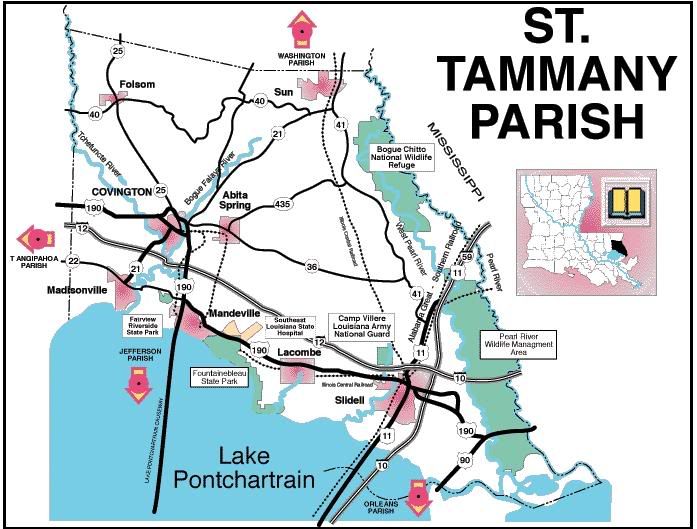
"I've been trying all day to get a report from Slidell....it seems since the French Quarter didn't get flooded, nothing else matters."
I share your concern and frustration. However, I'm fearing the reason we're not hearing anything coming out of Slidell is more than just an apathetic media. Brace yourself and be strong. That's what I'm trying to do.
Saw a report from Houma, no major damage there......no mention of Thibodeaux.
I too cannot believe anyone would ride it out in Grand Isle......
I10 closed in Alabama...power tranmission lines fell on the roadway...most of the offramps are under water too.
look at the map here:
http://www.freerepublic.com/focus/news/1472657/posts?page=3848#3848
There's a dot above the word end to represent the heart of New Orleans. That's where the French Quarter is.
I told her NOT to go out there.........she's never seen a hurricane before though......go figure!
see post #3924
Your statement that 'they don't' is counter to both my education and experience. It won't necessarily drive them long term, but it can have significant impact on short term direction especially when differential water/temperature profiles exist.
Thanks for your work, NN.
You think anybody has radar for Columbus, MS? NHC doesn't have it available right now. I have a friend at Columbus AFB.
Disclaimer: Opinions posted on Free Republic are those of the individual posters and do not necessarily represent the opinion of Free Republic or its management. All materials posted herein are protected by copyright law and the exemption for fair use of copyrighted works.