
An interesting map in which geography is weighted by population density.
Posted on 11/06/2004 7:46:55 AM PST by liberallarry
Map day has become Map Weekend!
Here they are in all their cartographic glory: All the election map post-mortems. (They were just lying around the internet gathering dust anyway).
These graphic representations of the election's outcome are thought provoking.
(Did I miss any? Send 'em to thebigpicture -at- optonline -dot- net)
Be sure to checkout:
Proportional Electoral Map
(this one is my favorite -- because land doesn't vote, people do)
Popular Vote, Population Density
similar ideaRed & Blue World
You know how the States voted; Here's how the World didPurple America
a sentimental favoriteThe Kids Are Alright
How the Youth of America voted . . .County-by-County vote, with Population
Self explanatory
2000 vs 2004 County by County Election ResultsWhere did their votes come from?
an interesting 3D comparisonElectoral College Over Represents Rural Areas
no kidding?which leads to the very sad
Voting: Free versus Slave States
Look how far we’ve come as a countryNew America redistricted
DeLay loves redistricting, so . . .and just for laughs, Jesusland
guaranteed to offend someone
Cartographic political analytics -- fun for the whole family! Now, with more colors! Collect them all! Trade 'em with your friends (batteries not included)
No matter how they cut it, the Dems still lost! Nyah, nyah!
I SAVOR THIS like I savor a FINE STEAK and a glass of FINE NON-FRENCH CAB. Liberals apparently are so SHELTERED that they've never heard the axiom "WHEN IN A HOLE...." (The rest of that one is OUR SECRET. SHHHHH!!!)
Dems/Libs WILL NEVER "GET IT" because, at the very LEAST, they don't LIVE IT, and they don't WANT to live it. They don't LIVE the values and deeply held BELIEFS that most in this country DO LIVE.
They are on the outside of a fun bar's glass window, like BOB EUKER, looking in through the window on a VERY fun bar party saying, "Gee, they're SURE having fun in there."
Yes we are.
That map is incorrect because San Diego votes 54% Bush to Kerry 42%. THis map shows San Diego blue. WRONG!
Thank you! I've been wanting to see the purple map. < :)
***I just watched the season finale of "Politically Incorrect". Andrew Sullivan was trying to tell Bill Maher that the condescension and anti-Chritian attitude of people like him was alienating huge swaths of the public and costing the Democrats elections. But Bill thinks they need to trash religion even more. I think we could be looking at Republican domination for the next 20 years...
Posted by: Ethan at November 7, 2004 02:18 PM***
I've been watching the miniseries "North and South", a 20-hour Civil War drama. Methinks history is repeating.
People, now as then, are increasingly pressed to choose sides. A key point in such ideological division leading to conflict is the need for a clear geographic division, whereby people can physically position themselves as "us vs. them" and overcome psychological barriers preventing a physical manifestation of ideological self-defense.
Visualizations such as the by-county and by-population-density maps are critical to quickly convincing people that we are one nation with variances in political preference. Without it, ideologically stressed people may be swayed quickly toward civil strife by "ha-ha only serious" dark humor such as the Jesusland map. Once people convince themselves of geographic us-vs-them divisions of ideology, strife follows.
Take them seriously. The only thing they lack is a leader he11-bent on power by any means necessary, one who needs followers and has swaying us-vs-them rhetoric. (Can you say ... Hillary?)
What I'm hoping for is success in Iraq followed by a run by Giuliani. That would end most of the divisiveness.
Failure in Iraq and/or a collapse of the economy might result in chaos.
An interesting map in which geography is weighted by population density.
Thanks for the info.
Oh and I hate your name.
BUMP!
Nifty!
Surprising that NY City isn't reaching out to the Moon on that map...
Yeah, obviously, leftist.
Looks like a drunk butterfly...
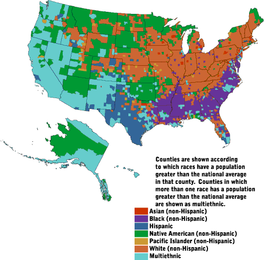
I'd be interested in seeing a black population density map. Since this demographic goes democratic 95% to 5% and is pretty sizable, I would imagine that it would almost mirror the Bush-Kerry county map 100%.

The maps clearly show that George Bush was elected by white Mormons and white Protestant Evangelicals living in the rural and suburban areas of what was formerly the Confederacy and associated slave-tolerating territories.
The maps clearly show that George Bush was elected by white Mormons and white Protestant Evangelicals living in the rural and suburban areas of what was formerly the Confederacy and associated slave-tolerating territories.
Here is a map of air pollution by state
and here is a graph of crime by state (I couldn't find a map)
As you can see the truth is exactly the opposite of what you said it was. Both crime and pollution are highest in Bush country.
Disclaimer: Opinions posted on Free Republic are those of the individual posters and do not necessarily represent the opinion of Free Republic or its management. All materials posted herein are protected by copyright law and the exemption for fair use of copyrighted works.