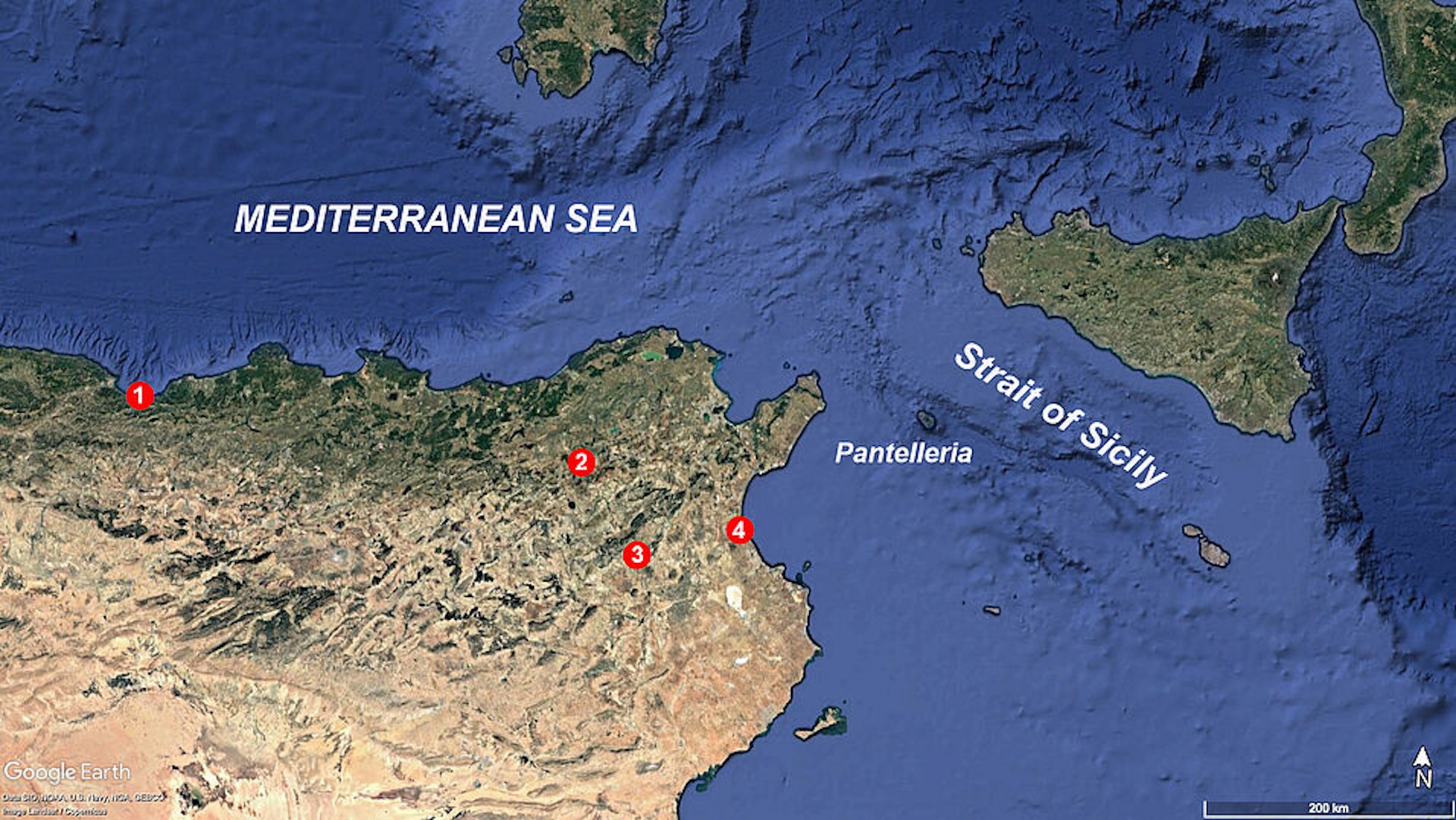
A map of the eastern Maghreb in North Africa, including (1) Afalou Bou Rhummel; (2) Djebba; (3) Doukanet el Khoutifa; and (4) Hergla.Image credit: Google Earth
A map of the eastern Maghreb in North Africa, including (1) Afalou Bou Rhummel; (2) Djebba; (3) Doukanet el Khoutifa; and (4) Hergla.Image credit: Google Earth
Waiting for a Federal District Judge to order them all back..................
The Strait of Gibraltar is about 8 miles wide. I could see Neolithic people wandering down Spain, seeing land from on top of the Rock of Gibraltar, and deciding to paddle over, then going east across the North African coast.
Setting out from Sicily with no idea of whether you would find land before dying, seems a bit ambitious. I could see it happening after it became common knowledge that land was there.
One can see Africa from southern European coast.
...and returned for our women!
Ahem...they were state-of-the-art boats....
I am always amazed at how dense the archaeologists are about human sea travel. Humans have been sailing the seas for at least a 100,000 years.
Sailed—or floated on an adrift fishing boat?
I would be shocked to learn that there wasn’t considerable back and forth between Sicily and North Africa. Humans had populated the world by then and managed to canoe to the Pacific islands, a much more rigorous trip than Sicily to North Africa.
Wasn’t N. Africa mostly desert then and Sicily/S. Italy pretty fertile then? If so, why would anyone want to go there? Enlighten me.
Probably, several small islands emerged, too.
However, I have no idea how to calculate that.