Skip to comments.
Hurricane Milton - map of predicted storm surge [likely to make landfall along the west-central coast of FL Wed. night, and move east-northeastward across central Florida through Thurs.
NOAA.gov ^
| 10/8/24
| National Oceanic and Atmospheric Administration
Posted on 10/08/2024 9:44:32 AM PDT by ransomnote

Hurricane Milton
Advisory Number 14
10 AM CDT Tuesday October 08, 2024
STORM SURGE: The combination of storm surge and tide will cause
normally dry areas near the coast to be flooded by rising waters
moving inland from the shoreline. The water could reach the
following heights above ground somewhere in the indicated areas if
the peak surge occurs at the time of high tide...
Anclote River, FL to Englewood, FL...10-15 ft
Tampa Bay...10-15 ft
Englewood, FL to Bonita Beach, FL...6-10 ft
Charlotte Harbor...6-10 ft
Yankeetown, FL to Anclote River, FL...5-10 ft
Bonita Beach, FL to Chokoloskee, FL...4-7 ft
Suwannee River, FL to Yankeetown, FL...3-5 ft
Chokoloskee, FL to Flamingo, FL...3-5 ft
Port Canaveral, FL to Altamaha Sound, GA...3-5 ft
Altamaha Sound, GA to Edisto Beach, SC...2-4 ft
Sebastian Inlet, FL to Port Canaveral, FL...2-4 ft
Dry Tortugas...2-4 ft
St. Johns River...2-4 ft
Flamingo, FL to Card Sound Bridge, FL...1-3 ft
Indian Pass, FL to Suwannee River, FL...1-3 ft
Edisto Beach, SC to South Santee River, SC...1-3 ft
Florida Keys...1-3 ft
For information specific to your area, please see products issued by your local National Weather Service forecast office.
TOPICS: Miscellaneous
KEYWORDS: florida; hurricanemilton
Navigation: use the links below to view more comments.
first 1-20, 21-27 next last
To: ransomnote
I GOOFED. HEre's the right image:

2
posted on
10/08/2024 9:45:49 AM PDT
by
ransomnote
(IN GOD WE TRUST)
To: ransomnote
3
posted on
10/08/2024 9:46:42 AM PDT
by
ransomnote
(IN GOD WE TRUST)
To: ransomnote
I’ve asked admin to delete so I can correct the image
4
posted on
10/08/2024 9:48:08 AM PDT
by
ransomnote
(IN GOD WE TRUST)
To: ransomnote
I already had one cousin flooded out by Helene at the north end of Tampa Bay. Some others might be flooded out now.
5
posted on
10/08/2024 9:48:37 AM PDT
by
pierrem15
("Massacrez-les, car le seigneur connait les siens" )
To: ransomnote
From that map I’m wondering if Milton and Leslie combine and turn north-northwest right into DC....
6
posted on
10/08/2024 9:49:58 AM PDT
by
reed13k
To: ransomnote
Let US all pray somehow it swerves south and hits Cuba and not Florida!
7
posted on
10/08/2024 9:50:06 AM PDT
by
Harpotoo
(Being a socialist is a lot easier than having to WORK like the rest of US:-))
To: pierrem15
Prayers up for Floridians in general and Florida man in particular!

8
posted on
10/08/2024 9:52:40 AM PDT
by
Magnum44
(...against all enemies, foreign and domestic... )
To: ransomnote
I would add that the storm surge can be engineered out: I’ve seen the dykes near Leyden: the land is so far below sea level that the dyke must be 10 stories tall on the landward side. Absolutely massive, built over the past couple of hundred years. The windmills are there to pump rainwater out.
9
posted on
10/08/2024 9:56:36 AM PDT
by
pierrem15
("Massacrez-les, car le seigneur connait les siens" )
To: ransomnote
Now there's a confirmed tornado, actually a 'water spout,' moving on shore in Collier county, Floriday. Prayers UP!

From live coverage of milton on YOUTUBE channel Bryan Hall Y'all
https://www.youtube.com/watch?v=GQCOr1zJoFo
10
posted on
10/08/2024 10:01:04 AM PDT
by
ransomnote
(IN GOD WE TRUST)
To: Magnum44
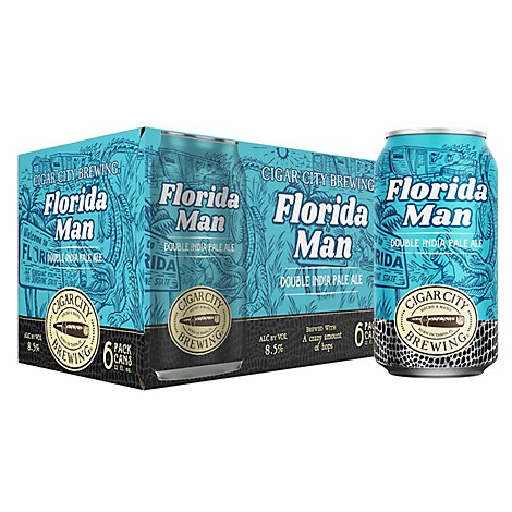
I am about 50 miles east of Tampa and am right in the current path for the eye. I regret that I don't have "Florida Man Beer" to ride out the storm. The can design has an alligator, trailer that is on fire and though there is no hurricane, when your trailer is destroyed by Hurricane Milton, you will see the alligators.
11
posted on
10/08/2024 10:05:20 AM PDT
by
MtnClimber
(For photos of scenery and wildlife, click on my screen name for my FR home page. More photos added.)
To: Magnum44
LOL That actually looks like me and my cousins during a tropical storm back in the 70s when the water in the streets was only knee deep.
12
posted on
10/08/2024 10:06:56 AM PDT
by
pierrem15
("Massacrez-les, car le seigneur connait les siens" )
To: ransomnote
10 to 15 ft storm surge in Tampa would be absolutely catastrophic and would put Katrina to shame
To: ransomnote
We live near the Anclote River but outside the evac zone. Hoping Milton will stay south.
14
posted on
10/08/2024 10:08:04 AM PDT
by
TexasGator
(l . . l / l / . l l . l).1 1 l l l l l " / . l l ( . 1 l l l . . l// l l l l . l)
To: ransomnote
“It’s not THAT the wind blows,
It’s WHAT the wind blows!”
Ron White
15
posted on
10/08/2024 10:08:18 AM PDT
by
shotgun
To: shotgun
A hurricane is like a divorce. There is incredible noise and screeching and then you lose your trailer.
16
posted on
10/08/2024 10:14:03 AM PDT
by
MtnClimber
(For photos of scenery and wildlife, click on my screen name for my FR home page. More photos added.)
To: MtnClimber
You have a future as a country song writer. lol
17
posted on
10/08/2024 10:16:35 AM PDT
by
Magnum44
(...against all enemies, foreign and domestic... )
To: ransomnote
18
posted on
10/08/2024 10:22:49 AM PDT
by
gundog
(It was a bright cold day in April, and the clocks were striking thirteen. )
To: ransomnote
You can watch it Live on Zoom.Earth .
To: gundog
This one is good too. You can select viewing options on the left. When Wind Speed is selected, you can place your cursor on the eye wall of Milton in various locations to see the windspeed. 10 meters above the ground, the windspeed isn't that fast right now - so you can vary altitude and other factors.
https://www.ventusky.com/?p=25.0;-83.2;5&l=wind-100m

20
posted on
10/08/2024 10:46:54 AM PDT
by
ransomnote
(IN GOD WE TRUST)
Navigation: use the links below to view more comments.
first 1-20, 21-27 next last
Disclaimer:
Opinions posted on Free Republic are those of the individual
posters and do not necessarily represent the opinion of Free Republic or its
management. All materials posted herein are protected by copyright law and the
exemption for fair use of copyrighted works.
FreeRepublic.com is powered by software copyright 2000-2008 John Robinson