Posted on 08/20/2023 11:13:55 AM PDT by MtnClimber
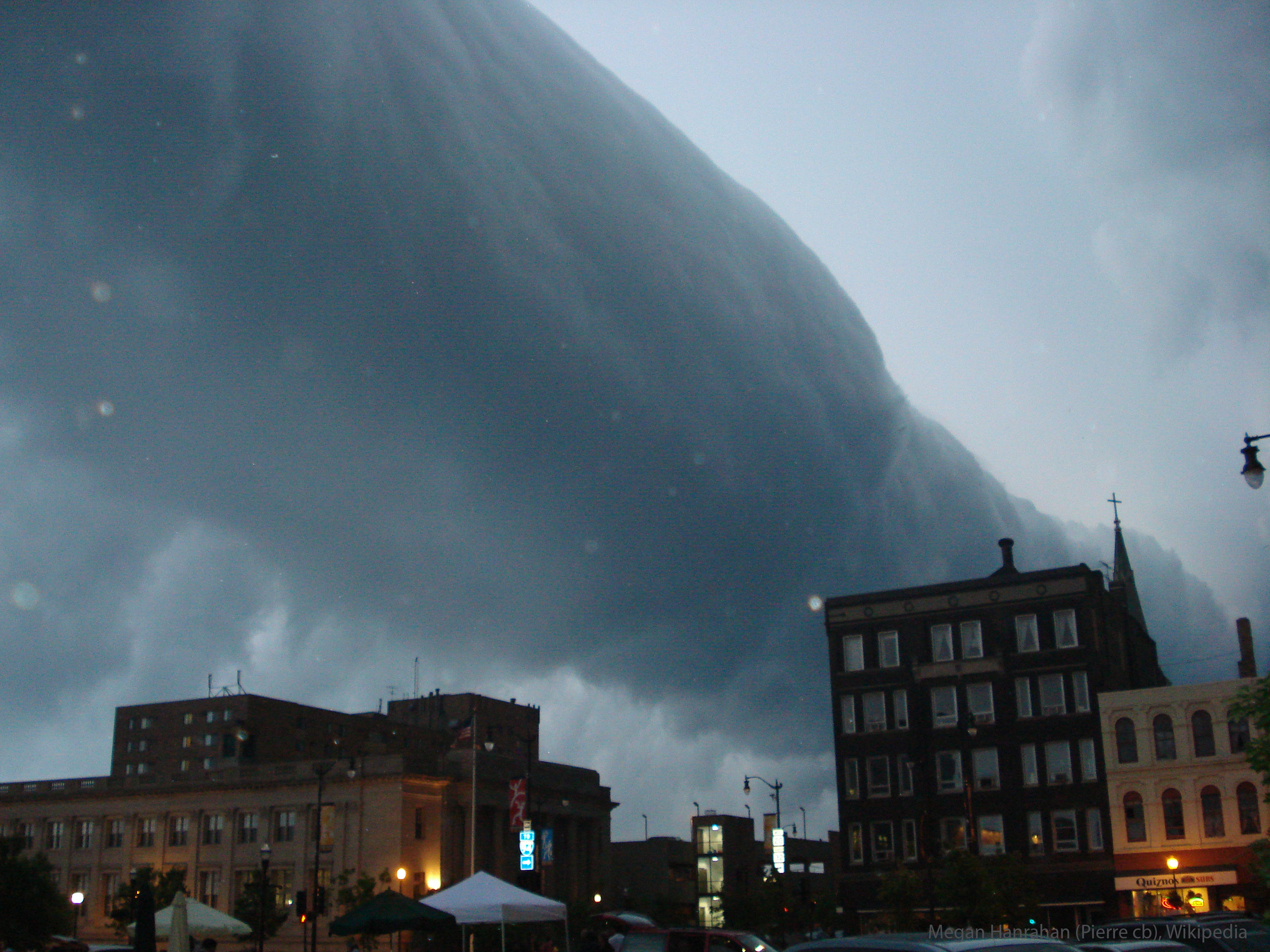
Explanation: What kind of cloud is this? A type of arcus cloud called a roll cloud. These rare long clouds may form near advancing cold fronts. In particular, a downdraft from an advancing storm front can cause moist warm air to rise, cool below its dew point, and so form a cloud. When this happens uniformly along an extended front, a roll cloud may form. Roll clouds may actually have air circulating along the long horizontal axis of the cloud. A roll cloud is not thought to be able to morph into a tornado. Unlike a similar shelf cloud, a roll cloud is completely detached from their parent cumulonimbus cloud. Pictured here, a roll cloud extends far into the distance as a storm approaches in 2007 in Racine, Wisconsin, USA.
For more detail go to the link and click on the image for a high definition image. You can then move the magnifying glass cursor then click to zoom in and click again to zoom out. When zoomed in you can scan by moving the side bars on the bottom and right side of the image.
bttt
I’ve seen those in person and they are rather unnerving in a ‘War of the Worlds’ kind of way!
We always called them ‘Shelf Clouds’ but that could be something else...
“Unlike a similar shelf cloud, a roll cloud is completely detached from their parent cumulonimbus cloud.”
Duh. Missed the print - was too busy looking at the picture!
Did I hear that Willie Nelson, Snoop Dog and Paul McCartney were having a ‘Jam Session” in the backwoods of Wisconsin?
Maybe somebody’s trying to take their ‘prescription Nerve Tonic’ right about now.
The clouds of DOOM!!
I saw one of those some years ago on the way to work. I went right over our area.
Disclaimer: Opinions posted on Free Republic are those of the individual posters and do not necessarily represent the opinion of Free Republic or its management. All materials posted herein are protected by copyright law and the exemption for fair use of copyrighted works.