Posted on 06/14/2022 2:26:03 PM PDT by MtnClimber
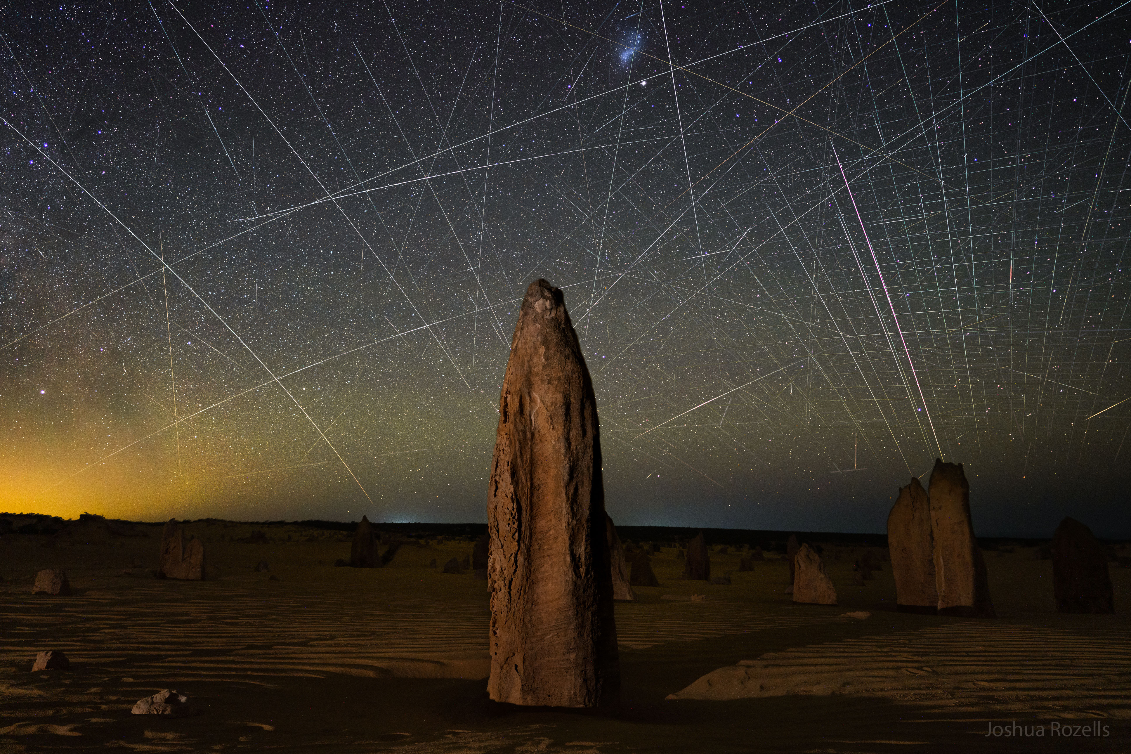
Explanation: What are all those streaks across the background? Satellite trails. First, the foreground features picturesque rock mounds known as Pinnacles. Found in the Nambung National Park in Western Australia, these human-sized spires are made by unknown processes from ancient sea shells (limestone). Perhaps more eye-catching, though, is the sky behind. Created by low-Earth orbit satellites reflecting sunlight, all of these streaks were captured in less than two hours and digitally combined onto the single featured image, with the foreground taken consecutively by the same camera and from the same location. Most of the streaks were made by the developing Starlink constellation of communication satellites, but some are not. In general, the streaks are indicative of an increasing number of satellites nearly continuously visible above the Earth after dusk and before dawn. Understanding and removing the effects of satellite trails on images from Earth's ground-based cameras and telescopes is now important not only for elegant astrophotography, but for humanity's scientific understanding of the distant universe.
For more detail go to the link and click on the image for a high definition image. You can then move the magnifying glass cursor then click to zoom in and click again to zoom out. When zoomed in you can scan by moving the side bars on the bottom and right side of the image.
Two of those were UFO’s.
I expected most of the satellite trails to be parallel to each, or only slightly angled from an equatorial orbit. Those are much more spread with large angles than I expected!
Yes, satellites get launched into different orbital inclinations depending upon the purpose of the satellite (some go over the north and south poles for example).
But to a different point, this photo and the complaint behind it is such a fraud. If the photographer waited an hour, guess what, most if not all of these satellite tracks would not be visible because the satellites would be inside earth's shadow and hence invisible. Why astronomers whine and complain about this is beyond me; they shouldn't be making serious observations so close to dawn or dusk anyway.
The majority of satellites in an equatorial orbit are geostationary satellites about 22,000 miles altitude. That altitude in a circular orbit has a 24 hour orbital period and, if in a W to E orbit appear to be over nearly the same point on earth. Low Earth satellites don’t have as much horizon-to-horizon coverage so an equatorial orbit would only cover several hundred miles to either side. That is why Low Earth Orbit (LEO) constellations are usually in an inclined polar orbit.
Example of the future problem: WALL-E
https://youtu.be/RmG5tUCrrsA?t=60
Disclaimer: Opinions posted on Free Republic are those of the individual posters and do not necessarily represent the opinion of Free Republic or its management. All materials posted herein are protected by copyright law and the exemption for fair use of copyrighted works.