Posted on 09/20/2021 7:59:38 AM PDT by BenLurkin
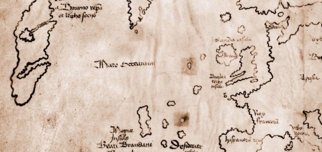
1957, was donated to Yale in the 1960s where it immediately came under a great deal of suspicion and intrigue.
Alleged to date back to the 15th-Century, the map depicts 'Vinlanda Insula' - a section of North America's coastline. It also claims that the region was visited by Europeans in the 11th Century.
Despite appearing outwardly genuine, the map has been mired in controversy ever since it first appeared. Previous studies have indicated the presence of modern ink on its parchment, however it wasn't until Yale researchers were able to apply modern tools and techniques that it was possible to determine once and for all that the entire thing was a complete forgery.

(Excerpt) Read more at unexplained-mysteries.com ...
“There is also strong evidence to suggest that the map was a deliberate hoax, rather than a modern recreation that had simply been misinterpreted as genuine, as evidenced by the fact that its creators used part of an authentic medieval volume and overwrote it to make the map appear more legitimate.”
And that it was written on an authentic medieval volume is proof that it was a hoax? This researcher makes a leap of faith. The exact opposite conclusion could be reached.
With “Made in China” stamped on the back.
I often use a base map provided by my client and then add my own results on top. It would make sense that they would use an existing map as a reference.
I’m guessing though that the makers of the N.A. map weren’t involved in slicing the two together. “Ikke na! It is MUCH farther away than THAT!!”
Disclaimer: Opinions posted on Free Republic are those of the individual posters and do not necessarily represent the opinion of Free Republic or its management. All materials posted herein are protected by copyright law and the exemption for fair use of copyrighted works.