Posted on 04/01/2020 3:15:20 AM PDT by loucon
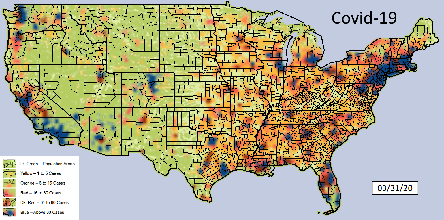
Covid Map Dated: 03/31/20
The data for this map was pulled from:
https://github.com/CSSEGISandData/COVID-19/tree/master/csse_covid_19_data/csse_covid_19_daily_reports
I am validating data by comparing it with other sources:
https://covidtracking.com/data/
https://infection2020.com/
https://coronavirus.1point3acres.com/en
as well as various state .gov websites
Thanks to all who pointed out missing data. I re-writen and re-structued stuff. May not be perfect yet (and will never be), but if you see something wrong, please point it out.
No claims of the use or accuracy of these maps is implied.
Other parties may use these maps as their own.
Thanks...I’m in one of the blue areas...which I knew. I wish they would give us names of the ill persons as we may have had contact.
Wyoming is the only state with zero deaths.
Later
So this is the number of deaths?
No cumulative cases.
>> I wish they would give us names of the ill persons as we may have had contact.
aids activists made sure that won’t happen. They have even changed laws that required them to notify potential sex partners that they have it. Informed consent? “But why?”
Disclaimer: Opinions posted on Free Republic are those of the individual posters and do not necessarily represent the opinion of Free Republic or its management. All materials posted herein are protected by copyright law and the exemption for fair use of copyrighted works.