Skip to comments.
The 'Lost' Island That Maps Made Up
ABC News via Yahoo ^
| 11/23/12
| DRAGANA JOVANOVIC
Posted on 11/24/2012 5:53:37 AM PST by Kartographer
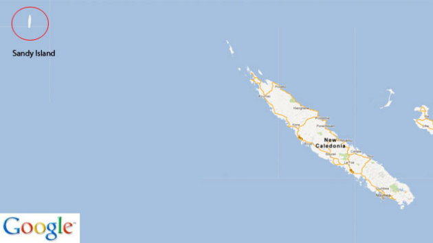
Sandy Island was nowhere to be found when Australian scientists reached the South Pacific location where it appeared on Google Earth, nautical charts and world maps. "It raises all kinds of conspiracy theories," expedition member Steven Micklethwaite said, adding that the CIA is among the sources of the world coastline database. "It reminded me of the hypernatural island in the "Lost" TV series." The phantom Manhattan-size island in the Coral Sea was shown as Sandy Island on Google Earth, sized about 15 miles by three miles on Google Maps, and halfway between Australia and the French New Caledonia.
(Excerpt) Read more at news.yahoo.com ...
TOPICS: TV/Movies; Weird Stuff
KEYWORDS:
Navigation: use the links below to view more comments.
first 1-20, 21-40, 41-42 next last

ABC News - The 'Lost' Island That Maps Made Up (ABC News)
To: Kartographer
How could this be? I mean Oceanic Airways Advertises flights to there all the time.

2
posted on
11/24/2012 5:55:40 AM PST
by
Kartographer
("We mutually pledge to each other our lives, our fortunes and our sacred honor.")
Comment #3 Removed by Moderator
To: Kartographer
Maybe that island was added by map-makers as copy-protection.
You add a fake island, and if anyone else has that island on their map then you sue them.
4
posted on
11/24/2012 6:06:21 AM PST
by
agere_contra
("An unjust law ceases to be a law: it becomes an act of violence". Thomas Aquinas)
To: agere_contra
"You add a fake island, and if anyone else has that island on their map then you sue them." And if anyone lost at sea seeks safe harbor at the island and dies because it's not there, their estate can sue the mapmakers :-)
5
posted on
11/24/2012 6:10:47 AM PST
by
Joe 6-pack
(Que me amat, amet et canem meum)
To: Kartographer
Amelia Earhart must have been using Google maps.
6
posted on
11/24/2012 6:12:02 AM PST
by
Joe 6-pack
(Que me amat, amet et canem meum)
To: Kartographer
Maybe?

7
posted on
11/24/2012 6:16:33 AM PST
by
Kartographer
("We mutually pledge to each other our lives, our fortunes and our sacred honor.")
To: Kartographer
Currently, Google Earth shows Sandy Island just where it’s indicated on the pictures in this post. There are even pictures attributed to being taken from people with a camera on Sandy Island.
To: willgolfforfood
Did any of the pictures look like this?

9
posted on
11/24/2012 6:21:13 AM PST
by
Kartographer
("We mutually pledge to each other our lives, our fortunes and our sacred honor.")
To: agere_contra
I was told many years ago that cartographers would add a town or two to their road maps as a way to check if other cartographers were just copying their maps. Maybe Google did the same thang*.
* a little Ebonics for the CBC.
10
posted on
11/24/2012 6:30:40 AM PST
by
Tupelo
(Hunkered down & loading up)
To: agere_contra
11
posted on
11/24/2012 6:31:34 AM PST
by
muir_redwoods
(Don't fire until you see the blue of their helmets)
To: Joe 6-pack
>>And if anyone lost at sea seeks safe harbor at the island and dies because it’s not there, their estate can sue the mapmakers :-)
If you are lost at sea with access to Google Earth, can’t you just text for help?
12
posted on
11/24/2012 6:35:05 AM PST
by
Bryanw92
(Sic semper tyrannis)
To: Bryanw92
Maybe they just printed out hardcopy before the voyage....

13
posted on
11/24/2012 6:37:16 AM PST
by
Joe 6-pack
(Que me amat, amet et canem meum)
To: Kartographer
Google Earth app now looks like someone took a black sharpie to the island.
14
posted on
11/24/2012 6:37:32 AM PST
by
Chipper
(You can't kill an Obamazombie by destroying the brain...they didn't have one to begin with.)
To: Kartographer
The explanation:
Ben Linus: Did he tell you what we're supposed to do?
John Locke: He did. He wants us to move the island.
15
posted on
11/24/2012 6:40:37 AM PST
by
GreenLanternCorps
("Barack Obama" is Swahili for "Jimmy Carter")
To: Kartographer
It’s still there in Google Maps.
16
posted on
11/24/2012 6:41:48 AM PST
by
Yo-Yo
(Is the /sarc tag really necessary?)
To: Kartographer
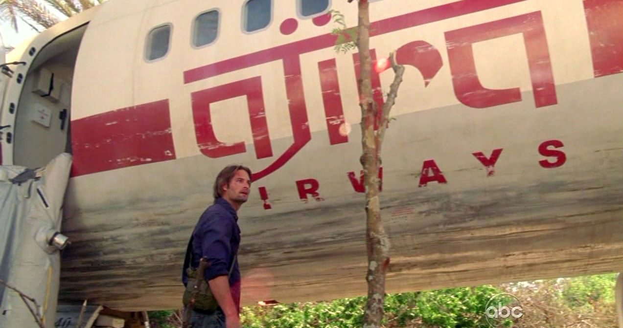
I always fly Ajira Airways myself.

I never did get the final check from Charles Widmore though.
17
posted on
11/24/2012 6:43:03 AM PST
by
KC_Lion
(Build the America you want to live in at your address, and keep looking up.-Sarah Palin)
To: Kartographer
-19.22299,159.918938
Plug these coordinates into a Google search. Then select maps and then the satellite view, zoom in and you will notice that the “island” appears to be covered in black pixels as if it is redacted.
18
posted on
11/24/2012 6:44:18 AM PST
by
Calamari
(Pass enough laws and everyone is guilty of something.)
To: Kartographer; GreenLanternCorps
19
posted on
11/24/2012 6:47:12 AM PST
by
KC_Lion
(Build the America you want to live in at your address, and keep looking up.-Sarah Palin)
To: Calamari; Kartographer
Actually, your coordinates are incorrect.The Right ones are 4 8 15 16 23 42

20
posted on
11/24/2012 6:50:06 AM PST
by
KC_Lion
(Build the America you want to live in at your address, and keep looking up.-Sarah Palin)
Navigation: use the links below to view more comments.
first 1-20, 21-40, 41-42 next last
Disclaimer:
Opinions posted on Free Republic are those of the individual
posters and do not necessarily represent the opinion of Free Republic or its
management. All materials posted herein are protected by copyright law and the
exemption for fair use of copyrighted works.
FreeRepublic.com is powered by software copyright 2000-2008 John Robinson


