Posted on 09/23/2004 4:37:41 AM PDT by Chairman_December_19th_Society
We will not tire, we will not falter, and we will not fail!
Good morning!!
Do not let the victims of the attacks on New York and Washington, nor the brave members of our Nation's military who have given their lives to protect our freedom, die in vain!!
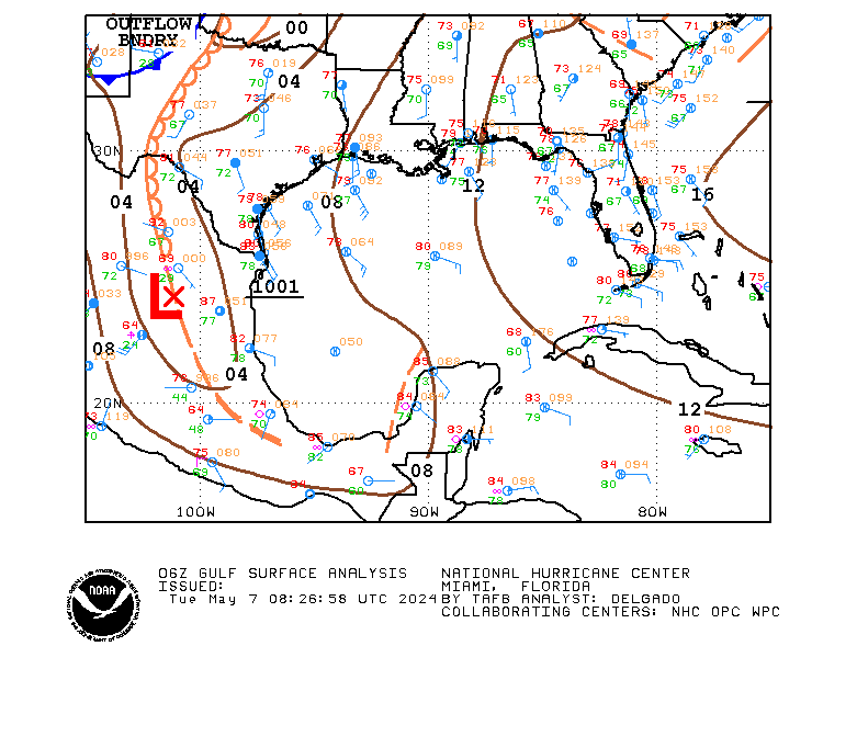
TROPICAL DEPRESSION IVAN ADVISORY #69
[Used in lieu of normal NHC graphic, which was not available.]
DISCUSSION
...IVAN POORLY ORGANIZED...MIGHT STRENGTHEN A LITTLE BEFORE REACHING TEXAS...
IVAN shows little sign of the normal organization associated with a tropical system (maybe because it is really a cut off LP system trying to behave as a tropical system?). There might be some strengthening before it reaches the coast, but the window for that to occur is closing.
IVAN is being steered by the strong mid-level HP center to its north. That center is forecast to weaken over the next 24 hours, and IVAN will slow after it makes landfall.
Rainfall amounts of 5 to 10 inches are possible along and to the right of the track of IVAN, which may result in life-threatening flash floods.
WATCHES/WARNINGS
A TROPICAL STORM WARNING IS IN EFFECT FROM THE MOUTH OF THE MISSISSIPPI TO SARGENT, TX.
STORM DATA
Fix Time: 5 AM ET / 4 AM CT (0900Z)
Location: 28.2N by 91.6W, or near Chattanooga, TN.
Vector: WNW at 15. This motion is expected to continue for the next 24 hours.
Winds: 40 MPH with some higher gusts.
Pressure: 1007 MB or 29.74"
Diameter of Hurricane Force Winds: N/A.
Diameter of Tropical Storm Force Winds: 170 miles.
Anticipated landfall time: 3 AM, Friday, September 24, 2004.
Anticipated landfall location: High Island, TX (about 20 miles NE of Galveston)
HURRICANE LOCAL STATEMENTS
NEXRAD IMAGERY

SLOSH DATA
Surge heights of 2 to 4 feet above normal are expected to the right of the center when IVAN makes landfall.
TOD DATA
Not applicable for a tropical storm.
STATE-ISSUED OFFICIAL EVACUATION INSTRUCTIONS AND OTHER INFORMATION
[None at this time.]
INTEREST WATCH AREA
Interests along the Louisiana and Texas Gulf coasts should monitor the progress of IVAN.
In the news...
Senator John Effin says that the draft would return if Bush is re-elected.
The Washington Pravda is accusing the Bush campaign of flip-flops since it targets one thing about Kerry, then something else, only to return to the first item.
For AMERICA - The Right Way, I remain yours in the Cause, the Chairman.
We'll prayer for you ong. At this time, after what you've just gone through, concentrate on doing what you enjoy most. If you want to cook, fine, if you want to read, fine, if you want to stand on your head, do it. Just take care of YOU. The debris will be there, waiting, when you are fit to handle it.
Ah Oh, another mind in neutral, finger in gear moment, sorry.
My grandmothers sister's daughter is now 96 years old and quite frail. Her youngest daughter who is much younger than I, did a google search on her great aunt and discovered my post about her here on FR.
She contacted me. We have been corresponding. She has filled in many blanks in our family history.
One of my many regrets is that I did not interview and record a much more detailed history of my family when I was young and those knowing the history were still alive.
I would urge you all to talk to your older relatives record your family history for the benefit of current and future generations. Nothing helps explain who, what, and why you are as your are, as does a detailed family history.
Mine like most families has had its share of both saints and villains. Recording your family history is something you and future generations will treasure.
It is never to late to start.
Don't let that fool of a doctor get to you! You won't, will you??
You did the right thing under difficult circumstances!
Get her REAL Dr. in on this...the other guy doesn't know squat about her history.
If you missed this morning's Allawi speech, and Kamikazikerry's response....
C-SPAN I will replay ABOUT:
Iraqi P.M. Allawi Address to Joint Meeting of Congress (10pm) · Sen. Kerry (D-MA) Reaction to Allawi Speech (10:40pm)
Thaks toots~~~
How are you doing sweetie???
I have a meeting tonite, and need husband's help to hang a tricky piece of wallpaper when I get home...Is this pushing it???? Should I wait til tomorrow night??
Not getting it done will hold me up....
ARe you about recovered from that surgery?
The depression thing is fairly common after bypass surgery. I don't have any experience with stents in my family so I cannot comment on that. But it stands to reason it would be the same.
You're just going to have to fight it off. Pity Partys aren't much fun after the first half hour.

DISCUSSION
...IVAN NEARING THE COAST...COULD RE-ENTER GOMEX FROM MEXICO ON SATURDAY
IVAN had a brief burst of convection, but that has diminished. Indeed, IVAN looks quite unremarkable on NEXRAD, as you can see below from the Lake Charles NWSFO facility.
IVAN is forecast to make landfall in a few hours, probably by 9 PM ET / 8 PM ET, at a point just a few miles E of the LA/TX border. After landfall, the low-level circulation, the remnant low, will separate from the upper level circulation, the anticyclone cap, and move to the SW in advance of a HP ridge building into the southern plains.
And, guess what?
In the "storm that will never die scenario," some models take the remnant LP center back over GOMEX on Saturday, moving it in a NE direction! [NO--This is NOT a joke!]
If so--upper level winds of 40 MPH, IOW very strong shear, will likely prevent regeneration.
Rainfall amounts of 5 to 10 inches may be expected in association with IVAN which can cause life-threatening flash floods.
WATCHES/WARNINGS
A TROPICAL STORM WARNING IS IN EFFECT FOR THE UNITED STATES GULF COAST FROM MORGAN CITY, LA, TO SARGENT, TX.
STORM DATA
Fix Time: 5 PM ET (2100Z)
Location: 29.4N by 93.0W, or 30 miles SSE of Cameron, LA, and 65 miles ESE of Port Arthur, TX.
Vector: NW at 8 MPH. A motion between NW and WNW is expected to continue for the next 24 hours.
Winds: 45 MPH. Some fluctuation is likley during the next 24 hours.
Pressure: 1003 MB or 29.62"
Diameter of Hurricane Force Winds: N/A.
Diameter of Tropical Storm Force Winds: 120 miles.
Anticipated landfall time: 9 PM ET / 8 PM CT, Thursday, September 24, 2004.
Anticipated landfall location: Johnson's Bayou, LA (about 10 miles E of the LA/TX border).
HURRICANE LOCAL STATEMENTS
NEXRAD IMAGERY

SLOSH DATA
IVAN will generate surge heights of 2 to 4 feet above normal tide levels near and to the right of where the center makes landfall.
TOD DATA
[Not applicable as IVAN is not a hurricane.]
STATE-ISSUED OFFICIAL EVACUATION INSTRUCTIONS AND OTHER INFORMATION
[None at this time.]
INTEREST WATCH AREA
Interests along the United States Gulf Coast in Louisiana and Texas should monitor the progress of IVAN.
Wow! I could use you in this household.
Wow, that's quite a recipe, I'll have to try it along with Guennie's. They have the right ingredients for me.
Thanks.
Grits would be faster.
Wow Whee, ole 'BoTox' is taking a couple days off, wonder whey, could it be that the joint session today with the head man from Iraq (can't spell his name so it will 'head man'), his appearance with OUR President W in the Rose garden had anything to do with it? Folks, I am seing panic time with this jerk.

DISCUSSION
...JEANNE FORECAST TO STRIKE FLORIDA...COULD BE STRONG CATEGORY III AT LANDFALL...
JEANNE will likely begin moving rather quickly to the west, and this motion should start tonight. This motion will be around the edge of a HP center to the storm's north. The ridge will weaken over the weekend, but not before JEANNE strikes Florida.
This is a recasting of the track guidance based on a stronger than expected building of the HP center into western NORLANT. That will keep the cyclone further south and moving faster than was believed in the 11 AM package.
JEANNE will likely intensify rapidly as it approaches the Florida coast because of the warm (29 degree) water of the Gulf Stream.
WATCHES/WARNINGS
A HURRICANE WATCH IS IN EFFECT FOR THE NORTHWEST BAHAMAS.
A TROPICAL STORM WATCH REMAINS IN EFFECT FOR THE CENTRAL BAHAMAS, INCLUDING CAT ISLAND, THE EXUMAS, LONG ISLAND, RUM CAY, AND SAN SALVADOR.
STORM DATA
Fix Time: 5 PM ET/AT (2100Z)
Location: 25.9N by 70.3W, or 425 miles E of Great Abaco Island.
Vector: WNW at 8 MPH. A turn toward the W and an increase in speed are expected during the next 24 hours.
Winds: 105 MPH 1-minute sustained. Some slight strengthening is expected over the next 24 hours.
Pressure: 966 MB or 28.53"
Diameter of Hurricane Force Winds: 90 miles.
Diameter of Tropical Storm Force Winds: 280 miles.
Anticipated Landfall Time: 10 PM ET, Saturday, September 25, 2004.
Anticipated Landfall Location: Ft. Pierce, FL.
HURRICANE LOCAL STATEMENTS
[None at this time.]
NEXRAD IMAGERY
[No part of JEANNE is within 124 nautical miles of any CONUS or Puerto Rico NEXRAD location.]
SLOSH DATA
[SLOSH data have not yet been calculated for JEANNE.]
TOD DATA
[None at this time. TOD data will be calculated if and when hurricane warnings are posted for CONUS and apply only to CONUS territories.]
STATE-ISSUED OFFICIAL EVACUATION INSTRUCTIONS AND OTHER INFORMATION
[There are no such documents for this system at this time.]
INTEREST WATCH AREA
Interests in the Bahamas, and along the United States Atlantic littoral from Maryland to Florida should monitor the progress of JEANNE.

DISCUSSION
...KARL KEEPS MOVING NORTH...WEAKENING...
KARL continues along. The cyclone is moving over colder waters and should be extratropical in 24 hours.
WATCHES/WARNINGS
[None at this time.]
STORM DATA
Fix Time: 5 PM ET/AT (2100Z)
Location: 35.7N by 43.3W, or 915 miles W of the Azores.
Vector: N at 30 MPH. A increase in forward speed is likely in the next 24 hours.
Winds: 105 MPH 1-minute sustained. Little change in strength is likely over the next 24 hours.
Pressure: 965 MB or 28.50"
Diameter of Hurricane Force Winds: 170 miles.
Diameter of Tropical Storm Force Winds: 860 miles.
Anticipated Landfall Time: N/A
Anticipated Landfall Location: N/A
HURRICANE LOCAL STATEMENTS
[None at this time.]
NEXRAD IMAGERY
[No portion of KARL is within 124 nautical miles of CONUS or Puerto Rico NEXRAD stations.]
SLOSH DATA
[None at this time.]
TOD DATA
[None at this time. TOD data will be calculated if and when hurricane warnings are posted for CONUS and apply only to CONUS territories.]
STATE-ISSUED OFFICIAL EVACUATION INSTRUCTIONS AND OTHER INFORMATION
[There are no such documents for this system at this time.]
INTEREST WATCH AREA
Interests in the Faroe Islands should monitor the progress of IVAN.
Reading you're getting a crockpot ong, it's a good investment. There should be a little book of recipes that comes with the machine, so check that out too for various foods you can cook in them. The best thing I think is that you can put dinner together early in the day and it's done.
Crockpots actually come with attachments if you want to order them. I don't have them but I've read about them. There's a meat rack thing that keeps the meat out of the broth if that's important to you and there is also a baking insert so you can bake things like banana bread in it. Again, I haven't tried these attachments.
I do know that you can make baked potatoes, apples and squash in a crock pot too. I've done that, wrap the potatoes and squash in foil and put it in for 8-9 hours. And baked apples with raisings, cinnamon, brown sugar etc work great too being baked in a crockpot.
Good evening everybody. We are at yet another music festival about an hour and a half from home this time. Will see some friends and be here until Sunday. Have the Sprint internet card for internet connection. Hope to freep some in the meantimes.
Prairie
I cannot BELIEVE Jeanne is headed for Fort Pierce! Friends from that area just got electricity back a week and a half ago from Frances, and home repairs haven't even commenced there, yet. They called today to ask if they could go back to our house in the Sarasota area.
Thanks for the info, Chair, even though I DON'T LIKE IT!!!

DISCUSSION
...LISA NOW A DEPRESSION...
LISA has suffered from the northerly shear being blown down on it by KARL. All of the deep convection has been blown away and a low-level cloud center to the NE of where the center should be has been exposed.
LISA has, accordingly, been relocated as the wrong center of the two centers mentioned in the 11 AM package was being tracked.
The question, as it has been for several days, is whether LISA will survive. Presuming it does so, it will be a moderate tropical storm at VT forecast plus five days, but not a threat to any land area.
WATCHES/WARNINGS
[None at this time.]
STORM DATA
Fix Time: 5 PM ET/AT (2100Z)
Location: 14.3N by 40.7W, or 1120 miles W of the Cape Verde Islands. [RELOCATED]
Vector: WNW at 6 MPH. A turn to the NW is expected during the next 24 hours.
Winds: 35 MPH 1-minute sustained. Little change in strength is likely over the next 24 hours.
Pressure: 1003 MB or 29.62"
Diameter of Hurricane Force Winds: N/A.
Diameter of Tropical Storm Force Winds: N/A.
Anticipated Landfall Time: N/A
Anticipated Landfall Location: N/A
HURRICANE LOCAL STATEMENTS
[None at this time.]
NEXRAD IMAGERY
[No portion of LISA is within 124 nautical miles of CONUS or Puerto Rico NEXRAD stations.]
SLOSH DATA
[None at this time.]
TOD DATA
[None at this time. TOD data will be calculated if and when hurricane warnings are posted for CONUS and apply only to CONUS territories.]
STATE-ISSUED OFFICIAL EVACUATION INSTRUCTIONS AND OTHER INFORMATION
[There are no such documents for this system at this time.]
INTEREST WATCH AREA
LISA is only a threat to shipping at this time.
The map was produced by my new software toy. The bright red straight line is the NHC forecast track.

So.....South of Ft. Pierce and then where? Sarasota???
Disclaimer: Opinions posted on Free Republic are those of the individual posters and do not necessarily represent the opinion of Free Republic or its management. All materials posted herein are protected by copyright law and the exemption for fair use of copyrighted works.