Posted on 09/23/2004 4:37:41 AM PDT by Chairman_December_19th_Society
We will not tire, we will not falter, and we will not fail!
Good morning!!
Do not let the victims of the attacks on New York and Washington, nor the brave members of our Nation's military who have given their lives to protect our freedom, die in vain!!
TROPICAL DEPRESSION IVAN ADVISORY #69
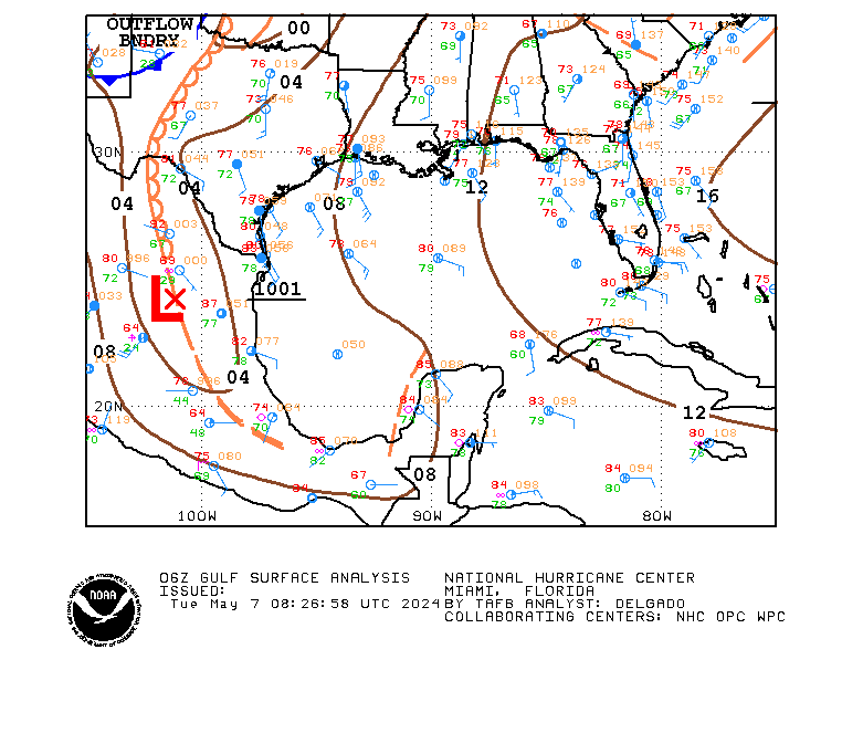
[Used in lieu of normal NHC graphic, which was not available.]
DISCUSSION
...IVAN POORLY ORGANIZED...MIGHT STRENGTHEN A LITTLE BEFORE REACHING TEXAS...
IVAN shows little sign of the normal organization associated with a tropical system (maybe because it is really a cut off LP system trying to behave as a tropical system?). There might be some strengthening before it reaches the coast, but the window for that to occur is closing.
IVAN is being steered by the strong mid-level HP center to its north. That center is forecast to weaken over the next 24 hours, and IVAN will slow after it makes landfall.
Rainfall amounts of 5 to 10 inches are possible along and to the right of the track of IVAN, which may result in life-threatening flash floods.
WATCHES/WARNINGS
A TROPICAL STORM WARNING IS IN EFFECT FROM THE MOUTH OF THE MISSISSIPPI TO SARGENT, TX.
STORM DATA
Fix Time: 5 AM ET / 4 AM CT (0900Z)
Location: 28.2N by 91.6W, or near Chattanooga, TN.
Vector: WNW at 15. This motion is expected to continue for the next 24 hours.
Winds: 40 MPH with some higher gusts.
Pressure: 1007 MB or 29.74"
Diameter of Hurricane Force Winds: N/A.
Diameter of Tropical Storm Force Winds: 170 miles.
Anticipated landfall time: 3 AM, Friday, September 24, 2004.
Anticipated landfall location: High Island, TX (about 20 miles NE of Galveston)
HURRICANE LOCAL STATEMENTS
NEXRAD IMAGERY

SLOSH DATA
Surge heights of 2 to 4 feet above normal are expected to the right of the center when IVAN makes landfall.
TOD DATA
Not applicable for a tropical storm.
STATE-ISSUED OFFICIAL EVACUATION INSTRUCTIONS AND OTHER INFORMATION
[None at this time.]
INTEREST WATCH AREA
Interests along the Louisiana and Texas Gulf coasts should monitor the progress of IVAN.
In the news...
Senator John Effin says that the draft would return if Bush is re-elected.
The Washington Pravda is accusing the Bush campaign of flip-flops since it targets one thing about Kerry, then something else, only to return to the first item.
For AMERICA - The Right Way, I remain yours in the Cause, the Chairman.
ong, could I suggest that you go outside with a notepad and wander around a little bit.
Break your cleanup detail into a dozen different spaces. (2 wks, with rest on the Sabbath).
When the job isn't so overwhelming, it's a little easier to face.
As for the crockpot left overs: Go to Wally World and get some plastic containers made especially for freezer storage and freeze your leftovers in meal sized containers.
If you have lots of meat left over and not as many vegetables, you might consider tearing some of the meat apart and let it swim in BBQ sauce for a bit on low on top of the stove. That makes a really yummy sandwich and it certainly isn't complicated to do.

DISCUSSION
...IVAN CONTINUES TO SLOWLY STRENGTHEN OVER THE GULF...LANDFALL LATER TODAY...
IVAN has a new wrinkle to its track.
It will still strike land, but a little further east--at the LA/TX border. Then it will retrogress into Mexico (!!). One of two things can happen--either it will dissipate fully against the Mexican mountains, or return back through CONUS as an extratropical LP center.
Rainfall amounts of 5 to 10 inches are possible along and to the right of the track of IVAN, which may result in life-threatening flash floods.
WATCHES/WARNINGS
AT 11 AM ET / 10 AM ET THE TROPICAL STORM WARNING PREVIOUSLY IN EFFECT FROM MORGAN CITY, LA, TO THE MOUTH OF THE MISSISSIPPI RIVER HAS BEEN DISCONTINUED.
A TROPICAL STORM WARNING IS IN EFFECT FROM MORGAN CITY, LA, TO SARGENT, TX.
STORM DATA
Fix Time: 11 AM ET / 10 AM CT (1500Z)
Location: 29.2N by 92.7W, or 85 miles SE of Port Arthur, TX.
Vector: NW at 15. This motion is expected to continue for the next 24 hours.
Winds: 60 MPH with some higher gusts.
Pressure: 999 MB or 29.50"
Diameter of Hurricane Force Winds: N/A.
Diameter of Tropical Storm Force Winds: 140 miles.
Anticipated landfall time: 9 PM, Thursday, September 23, 2004.
Anticipated landfall location: LA/TX border.
HURRICANE LOCAL STATEMENTS
NEXRAD IMAGERY
SLOSH DATA
Surge heights of 2 to 4 feet above normal are expected to the right of the center when IVAN makes landfall.
TOD DATA
Not applicable for a tropical storm.
STATE-ISSUED OFFICIAL EVACUATION INSTRUCTIONS AND OTHER INFORMATION
[None at this time.]
INTEREST WATCH AREA
Interests along the Louisiana and Texas Gulf coasts should monitor the progress of IVAN.
ABG, glad your mom is doing so much better.
lysie, have y'all thought about getting a complete & through work up of your MIL done?? You need help for sure as you say...to separate the real from the other stuff.
My mother continues to make out okay....living dangerously alone - at almost 90! - away from my sister and me...determined to be independent and keep us at arm's length. I don't know of anyone who has this kind of situation!!
My sister and I can only do so much, and have to help each other not to worry about what we can't control or influence..
No. Chairman, we know you wouldn't kid about a hurricane forecast. This situation is unreal, tho!

DISCUSSION
...JEANNE STILL MEANDERING...EXPECTED TO MOVE WEST...COULD RAKE COASTLINE...
JEANNE moving slowly westward, but the motion vector is still somewhat uncertain and tentative.
Track guidance, however, is something to be concerned about. Please note the landfall location. It DOES NOT give an adequate representation of what's going on. JEANNE is expected to move westward and then make a sharp turn to the NNW as a ridge to its north weakens. That turn is literally just miles off the Florida coastline and the cyclone is expected to stay just offshore.
Estimating in unit miles at VT forecast plus three days is a lot like trying to hit an erratic golf ball at three miles with a bullet. In other words, landfall could really be anywhere from Ft. Lauderdale to the stated point. Or even possibly several points in between.
Residents of central Florida, Georgia, and South Carolina should begin now to prepare for the arrival of a major hurricane this weekend.
WATCHES/WARNINGS
A TROPICAL STORM WATCH IS IN EFFECT FOR THE CENTRAL BAHAMAS, INCLUDING CAT ISLAND, THE EXUMAS, LONG ISLAND, RUM CAY, AND SAN SALVADOR.
A HURRICANE WATCH MAY BE REQUIRED FOR THE NORTHWESTERN BAHAMAS LATER TODAY.
STORM DATA
Fix Time: 11 AM AT/ET (1500Z)
Location: 25.6N by 69.7W, or 465 miles E of Great Abaco Island.
Vector: W at 5 MPH. This motion is expected to continue for the next 24 hours..
Winds: 105 MPH 1-minute sustained. A slow increase in strength is likely during the next 24 hours.
Pressure: 966 MB or 28.53"
Diameter of Hurricane Force Winds: 90 miles.
Diameter of Tropical Storm Force Winds: 280 miles.
Anticipated Landfall Time: 6 PM, Monday, September 27, 2004.
Anticipated Landfall Location: Charleston, SC. [NOTE: WHILE NOT FORECAST AS LANDFALLING TO THAT POINT, JEANNE WILL BRING HURRICANE FORCE WINDS ON THIS FORECAST TRACK TO ALL SHORE POINTS FROM FT. LAUDERDALE TO MYRTLE BEACH, SC!!]
HURRICANE LOCAL STATEMENTS
[None at this time.]
NEXRAD IMAGERY
[No part of JEANNE is within 124 nautical miles of any CONUS or Puerto Rico NEXRAD site.]
SLOSH DATA
[None at this time.]
TOD DATA
[None at this time. TOD data will be calculated if and when hurricane warnings are posted for CONUS and apply only to CONUS territories.]
STATE-ISSUED OFFICIAL EVACUATION INSTRUCTIONS AND OTHER INFORMATION
[There are no such documents for this system at this time.]
INTEREST WATCH AREA
Interests in the Bahamas, along with the United States Atlantic littoral from Florida to North Carolina should monitor the progress of JEANNE.

DISCUSSION
...KARL STILL HEADING NORTH...WEAKENING...
KARL just keeps going north.
WATCHES/WARNINGS
[None at this time.]
STORM DATA
Fix Time: 11 AM ET/AT (1500Z)
Location: 33.8N by 43.8W, or 980 miles WSW of the Azores.
Vector: N at 28 MPH. Acceleration is expected during the next 24 hours.
Winds: 120 MPH 1-minute sustained. Strengthening is likely over the next 24 hours.
Pressure: 955 MB or 28.20"
Diameter of Hurricane Force Winds: 170 miles.
Diameter of Tropical Storm Force Winds: 690 miles.
Anticipated Landfall Time: N/A
Anticipated Landfall Location: N/A
HURRICANE LOCAL STATEMENTS
[None at this time.]
NEXRAD IMAGERY
[No portion of KARL is within 124 nautical miles of CONUS or Puerto Rico NEXRAD stations.]
SLOSH DATA
[None at this time.]
TOD DATA
[None at this time. TOD data will be calculated if and when hurricane warnings are posted for CONUS and apply only to CONUS territories.]
STATE-ISSUED OFFICIAL EVACUATION INSTRUCTIONS AND OTHER INFORMATION
[There are no such documents for this system at this time.]
INTEREST WATCH AREA
Interests in Iceland, Northern Ireland, Scotland, and Norway should monitor the progress of KARL.
We were getting a steady rain all morning, but it seems to have slacked off. The sun is out right now, and no real wind to speak of.
On another note, Rush just had an interesting theory on why Ketchup Boy pulled ads out of those 4 battleground states: "Is he running out of money?" I can see that as plausible, since he has so many consultants who get a cut from those ads. I'd dismiss it, but Missouri was among those 4.

DISCUSSION
...LISA HAS TWO CENTERS...STILL WEAK...
LISA has, apparently, two centers of circulation. This may be due to the absorption of the disturbance previously to its SE.
NHC guidance is following what they believe to be the dominant center, which is currently the one to the SW. Position information in this dispatch reflects the NHC location information.
LISA will move into an area of low shear in about 72 hours, and if it can get the whole convective center thing worked out, it will become a hurricane.
WATCHES/WARNINGS
[None at this time.]
STORM DATA
Fix Time: 11 AM ET/AT (1500Z)
Location: 12.1N by 41.7W, or 1215 miles W of the Cape Verde Islands.
Vector: WSW at 3 MPH. This motion is expected to continue for the next 24 hours.
Winds: 45 MPH 1-minute sustained. Little change in strength is likely during the next 24 hours.
Pressure: 1000 MB or 29.53"
Diameter of Hurricane Force Winds: N/A.
Diameter of Tropical Storm Force Winds: 120 miles.
Anticipated Landfall Time: N/A
Anticipated Landfall Location: N/A
HURRICANE LOCAL STATEMENTS
[None at this time.]
NEXRAD IMAGERY
[No portion of LISA is within 124 nautical miles of CONUS or Puerto Rico NEXRAD stations.]
SLOSH DATA
[None at this time.]
TOD DATA
[None at this time. TOD data will be calculated if and when hurricane warnings are posted for CONUS and apply only to CONUS territories.]
STATE-ISSUED OFFICIAL EVACUATION INSTRUCTIONS AND OTHER INFORMATION
[There are no such documents for this system at this time.]
INTEREST WATCH AREA
LISA is a threat only to shipping.
Thanks IG for the suggestions... I had actually started to split up the work but even got depressed about that. Was talking with daughter this morning. Having worked for a cardiologist for a few years she said my feelings are not unusual.
My wonderful neighbor cut my lawn again today. I went out to speak with him and he assured me he would be encouraging me to do it myself in the future. He has been really great.
Thanks also for the ideas about freezing leftovers.
DISCUSSION
...IVAN WEAKENS AND SLOWS...
IVAN has slowed down, and is also showing some signs of weakening as it approaches the coast.
Rainfall amounts of 5 to 10 inches are possible along and to the right of the track of IVAN, which may result in life-threatening flash floods.
WATCHES/WARNINGS
A TROPICAL STORM WARNING IS IN EFFECT FROM MORGAN CITY, LA, TO SARGENT, TX.
STORM DATA
Fix Time: 2 PM ET / 1 PM CT (1800Z)
Location: 29.3N by 92.8W, or 50 miles S of Cameron, LS and 80 miles SE of Port Arthur, TX.
Vector: NW at 8. This motion is expected to continue for the next 24 hours.
Winds: 50 MPH with some higher gusts.
Pressure: 1003 MB or 29.62"
Diameter of Hurricane Force Winds: N/A.
Diameter of Tropical Storm Force Winds: 140 miles.
Anticipated landfall time: 9 PM, Thursday, September 23, 2004.
Anticipated landfall location: LA/TX border.
HURRICANE LOCAL STATEMENTS
NEXRAD IMAGERY
SLOSH DATA
Surge heights of 2 to 4 feet above normal are expected to the right of the center when IVAN makes landfall.
TOD DATA
Not applicable for a tropical storm.
STATE-ISSUED OFFICIAL EVACUATION INSTRUCTIONS AND OTHER INFORMATION
[None at this time.]
INTEREST WATCH AREA
Interests along the Louisiana and Texas Gulf coasts should monitor the progress of IVAN.
DISCUSSION
...JEANNE MOVING WEST SLOWLY...
JEANNE continues as before, slowly west toward Florida.
Residents of central Florida, Georgia, and South Carolina should begin now to prepare for the arrival of a major hurricane this weekend.
WATCHES/WARNINGS
A TROPICAL STORM WATCH IS IN EFFECT FOR THE CENTRAL BAHAMAS, INCLUDING CAT ISLAND, THE EXUMAS, LONG ISLAND, RUM CAY, AND SAN SALVADOR.
STORM DATA
Fix Time: 2 PM AT/ET (1800Z)
Location: 25.8N by 70.0W, or 440 miles E of Great Abaco Island.
Vector: W at 6 MPH. This motion is expected to continue for the next 24 hours..
Winds: 105 MPH 1-minute sustained. A slow increase in strength is likely during the next 24 hours.
Pressure: 966 MB or 28.53"
Diameter of Hurricane Force Winds: 90 miles.
Diameter of Tropical Storm Force Winds: 280 miles.
Anticipated Landfall Time: 6 PM, Monday, September 27, 2004.
Anticipated Landfall Location: Charleston, SC. [NOTE: WHILE NOT FORECAST AS LANDFALLING TO THAT POINT, JEANNE WILL BRING HURRICANE FORCE WINDS ON THIS FORECAST TRACK TO ALL SHORE POINTS FROM FT. LAUDERDALE TO MYRTLE BEACH, SC!!]
HURRICANE LOCAL STATEMENTS
[None at this time.]
NEXRAD IMAGERY
[No part of JEANNE is within 124 nautical miles of any CONUS or Puerto Rico NEXRAD site.]
SLOSH DATA
[None at this time.]
TOD DATA
[None at this time. TOD data will be calculated if and when hurricane warnings are posted for CONUS and apply only to CONUS territories.]
STATE-ISSUED OFFICIAL EVACUATION INSTRUCTIONS AND OTHER INFORMATION
[There are no such documents for this system at this time.]
INTEREST WATCH AREA
Interests in the Bahamas, along with the United States Atlantic littoral from Florida to North Carolina should monitor the progress of JEANNE.
The results were her BP a little high and perhaps a smaller dose of Paxil.(Which I don't think is helping her at all!!) I mentioned that I have read a lot about Paxil and its adverse reaction with teens. That's when he suggested weaning her off.
I still say she had another mini-stroke. I have put a call in to speak with her real doctor.
Molly, in February she had a complete physical, blood work, scan, etc.
Dang doctor wanted me to think I'm the one who is sick for being concerned!
Boy,you've had a long "day". Take care and get some good rest.
On another note. I just heard some demoflop complaining that members of congress not allowed in Inraq. I guess they've heard Iraqis have some good deals for Christmas shopping, so these congresscritters "NEED TO GO TO IRAQ ON A FACT FINDING MISSION". I've had the "pleasure" of conducting their wives on Christmas shopping trips in Germany, while their husbands were doing their "fact finding" with someone else, doing their Christmas shopping.
From October until New Years we would have these government moochers demanding help from the military to set up "fact finding" trips to the best shopping areas in Europe.
This fellow was complaining if it wasn't dangerous to visit Iraq, why....why couldn't he and some of his cohorts go? OOO some of these congresscritters really get under my skin, they are just like jiggers.
Didn't he have the nicest smile, and his eyes danced. I think I will like him.
Sweetie, get a nice small cut of brisket, all visible fat removed, pop it into the crockpot. Sprinkle the meat with a package of lipton onion soup, enough water to cover the meat by about 1/2 inch over the meat. Cook for 4 hours. Scrape and cut into pieces enough carrots, cook for another 2 hours, scrub and cut enough potatoes cook for another hour, peel and cut in quarters enough onions, clean and cut enough celery and cook for another hour. Check liquid from time to time toward the end. If you like cabbage, add that when you add the onions. Taste and adjust seansoning. We love this in the winter. Then we sip the liquor some other time.
I have 2 different sized crockpots, so it depends how many people I'm cooking for, so the meat size and amount of veggies added to it. I always cook the meat for 8 hours. It makes wonderful hash the next day or two.
I wish I'd been home to hear him. The leftists in the media and FR are all over this...why Jim tolerates these people is beyond me.
Today was my day at that school about 25 minutes away in Augusta. Had three new kids who were bright and one of them was so good he helped me teach the other kids. We worked on our reading and decimels. I'm trying to get the kids to understand the importance of pausing at the end of each sentence for better reading comprehension. Otherwise it just sounds like one long run-on sentence.
My neighbor who had the double lung transplant has had a small setback and is in the hospital on an IV. I took her husband a casserole for dinner but now Mr. Peach is home and wants us to take him out to dinner. I think that casserole will freeze okay :-(
Oh, that hominy and veggie sounds great. Roomey would love it, as he loves hominy.
Oh, that hominy and veggie sounds great. Roomey would love it, as he loves hominy.
Disclaimer: Opinions posted on Free Republic are those of the individual posters and do not necessarily represent the opinion of Free Republic or its management. All materials posted herein are protected by copyright law and the exemption for fair use of copyrighted works.