Posted on 09/23/2004 4:37:41 AM PDT by Chairman_December_19th_Society
We will not tire, we will not falter, and we will not fail!
Good morning!!
Do not let the victims of the attacks on New York and Washington, nor the brave members of our Nation's military who have given their lives to protect our freedom, die in vain!!
TROPICAL DEPRESSION IVAN ADVISORY #69
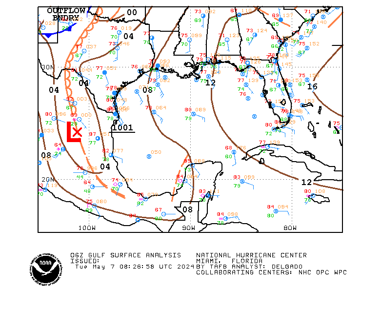
[Used in lieu of normal NHC graphic, which was not available.]
DISCUSSION
...IVAN POORLY ORGANIZED...MIGHT STRENGTHEN A LITTLE BEFORE REACHING TEXAS...
IVAN shows little sign of the normal organization associated with a tropical system (maybe because it is really a cut off LP system trying to behave as a tropical system?). There might be some strengthening before it reaches the coast, but the window for that to occur is closing.
IVAN is being steered by the strong mid-level HP center to its north. That center is forecast to weaken over the next 24 hours, and IVAN will slow after it makes landfall.
Rainfall amounts of 5 to 10 inches are possible along and to the right of the track of IVAN, which may result in life-threatening flash floods.
WATCHES/WARNINGS
A TROPICAL STORM WARNING IS IN EFFECT FROM THE MOUTH OF THE MISSISSIPPI TO SARGENT, TX.
STORM DATA
Fix Time: 5 AM ET / 4 AM CT (0900Z)
Location: 28.2N by 91.6W, or near Chattanooga, TN.
Vector: WNW at 15. This motion is expected to continue for the next 24 hours.
Winds: 40 MPH with some higher gusts.
Pressure: 1007 MB or 29.74"
Diameter of Hurricane Force Winds: N/A.
Diameter of Tropical Storm Force Winds: 170 miles.
Anticipated landfall time: 3 AM, Friday, September 24, 2004.
Anticipated landfall location: High Island, TX (about 20 miles NE of Galveston)
HURRICANE LOCAL STATEMENTS
NEXRAD IMAGERY

SLOSH DATA
Surge heights of 2 to 4 feet above normal are expected to the right of the center when IVAN makes landfall.
TOD DATA
Not applicable for a tropical storm.
STATE-ISSUED OFFICIAL EVACUATION INSTRUCTIONS AND OTHER INFORMATION
[None at this time.]
INTEREST WATCH AREA
Interests along the Louisiana and Texas Gulf coasts should monitor the progress of IVAN.
In the news...
Senator John Effin says that the draft would return if Bush is re-elected.
The Washington Pravda is accusing the Bush campaign of flip-flops since it targets one thing about Kerry, then something else, only to return to the first item.
For AMERICA - The Right Way, I remain yours in the Cause, the Chairman.
Wow!
I was thinking the same thing! Glad you are feeling better.
Jim, Good news on your Mom. One step at a time.
Jemian, that is a crowd! You are a dedicated Auburn alum, for sure!
It is really easier than that. My sister-in-law is helping and we've told people to bring food, so it will be more like a pot luck than a bar-be-cue. We'll use disposable stuff with plenty of garbage cans round about. All our food will be prepped early and just set out after the game.

DISCUSSION
...KARL, SURPRISINGLY, INTENSIFIES...BOTH TAFB AND SAB ASSESS IR SAT IMAGES WITH DVORAK SCORES OF 6.0--ENOUGH FOR MAJOR HURRICANE STATUS...
KARL became much better organized overnight, but this shouldn't last long as it will be crossing the 26 degree SST isotherm by sunset. Wind shear will also increase.
KARL should start becoming extratropical tomorrow night.
KARL continues more or less along track guidance.
WATCHES/WARNINGS
[None at this time.]
STORM DATA
Fix Time: 5 AM ET/AT (0900Z)
Location: 31.7N by 45.8W, or 1150 miles WSW of the Azores.
Vector: N at 23 MPH. Acceleration is expected during the next 24 hours.
Winds: 125 MPH 1-minute sustained. Strengthening is likely over the next 24 hours.
Pressure: 948 MB or 27.99"
Diameter of Hurricane Force Winds: 170 miles.
Diameter of Tropical Storm Force Winds: 690 miles.
Anticipated Landfall Time: N/A
Anticipated Landfall Location: N/A
HURRICANE LOCAL STATEMENTS
[None at this time.]
NEXRAD IMAGERY
[No portion of KARL is within 124 nautical miles of CONUS or Puerto Rico NEXRAD stations.]
SLOSH DATA
[None at this time.]
TOD DATA
[None at this time. TOD data will be calculated if and when hurricane warnings are posted for CONUS and apply only to CONUS territories.]
STATE-ISSUED OFFICIAL EVACUATION INSTRUCTIONS AND OTHER INFORMATION
[There are no such documents for this system at this time.]
INTEREST WATCH AREA
Interests in Iceland, Northern Ireland, Scotland, and Norway should monitor the progress of KARL.
It is a band reunion. Every year the band alumni get together for a practice and then we march a half-time show. A lot of fun is had by all.
This year is special because we are receiving the SUDLER FLAG, which is an award given to one band a year based on a series of years' quality performances.
It's so hard to tell what is real and what is not when she does these things. She was fine until she found out that her boys (hubby and bil in NJ) will be fishing this weekend. She has cried wolf many times. I will call her doctor, now.

DISCUSSION
...LISA ABSORBING DISTURBANCE TO ITS SE...INTENSITY BEING RESTRAINED BY KARL...
LISA is absorbing the tropical disturbance to its SE. It was thought it would occur the other way around, but that isn't what finally happened. LISA is still struggling to get organized, but that is probably a failed effort as long as strong northerly shear is being produced by the outflow from KARL.
After KARL moves out of the picture, LISA should strengthen.
LISA is forecast to move through a LP trough between a strong mid-layer HP center moving off of CONUS and another HP center over eastern NORLANT.
WATCHES/WARNINGS
[None at this time.]
STORM DATA
Fix Time: 5 AM ET/AT (0900Z)
Location: 13.2N by 41.4W, or 1180 miles W of the Cape Verde Islands.
Vector: W at 2 MPH. This motion is expected to continue for the next 24 hours.
Winds: 50 MPH 1-minute sustained. Little change in strength is likely during the next 24 hours.
Pressure: 1000 MB or 29.53"
Diameter of Hurricane Force Winds: N/A.
Diameter of Tropical Storm Force Winds: 90 miles.
Anticipated Landfall Time: N/A
Anticipated Landfall Location: N/A
HURRICANE LOCAL STATEMENTS
[None at this time.]
NEXRAD IMAGERY
[No portion of LISA is within 124 nautical miles of CONUS or Puerto Rico NEXRAD stations.]
SLOSH DATA
[None at this time.]
TOD DATA
[None at this time. TOD data will be calculated if and when hurricane warnings are posted for CONUS and apply only to CONUS territories.]
STATE-ISSUED OFFICIAL EVACUATION INSTRUCTIONS AND OTHER INFORMATION
[There are no such documents for this system at this time.]
INTEREST WATCH AREA
LISA is a threat only to shipping.
Good Morning. I'm really moving slowly today.
Prayers for all in need.

DISCUSSION
...IVAN STRENGTHENS A LITTLE AS IT MOVES TOWARD TEXAS...
IVAN remains on track.
IVAN has intensified a little, but the window for further strengthening is beginning to close as more of the circulation begins to interact with Louisiana and Texas.
Rainfall amounts of 5 to 10 inches are possible along and to the right of the track of IVAN, which may result in life-threatening flash floods.
WATCHES/WARNINGS
A TROPICAL STORM WARNING IS IN EFFECT FROM THE MOUTH OF THE MISSISSIPPI TO SARGENT, TX.
THE EASTERN PORTION OF THIS WARNING AREA MAY BE DISCONTINUED LATER THIS MORNING.
STORM DATA
Fix Time: 8 AM ET / 4 AM CT (0900Z)
Location: 28.9N by 92.1W, or 95 miles SE of Cameron, LA.
Vector: WNW at 15. This motion is expected to continue for the next 24 hours.
Winds: 45 MPH with some higher gusts.
Pressure: 1007 MB or 29.74"
Diameter of Hurricane Force Winds: N/A.
Diameter of Tropical Storm Force Winds: 170 miles.
Anticipated landfall time: 3 AM, Friday, September 24, 2004.
Anticipated landfall location: High Island, TX (about 20 miles NE of Galveston)
HURRICANE LOCAL STATEMENTS
NEXRAD IMAGERY
SLOSH DATA
Surge heights of 2 to 4 feet above normal are expected to the right of the center when IVAN makes landfall.
TOD DATA
Not applicable for a tropical storm.
STATE-ISSUED OFFICIAL EVACUATION INSTRUCTIONS AND OTHER INFORMATION
[None at this time.]
INTEREST WATCH AREA
Interests along the Louisiana and Texas Gulf coasts should monitor the progress of IVAN.

DISCUSSION
...JEANNE MEANDERING...EXPECTED TO MOVE WEST...
JEANNE remains meandering. It is expected to move west later today.
Track and intensity guidance are as issued in the 5 AM package.
Residents of central Florida should begin now to prepare for the arrival of a major hurricane this weekend.
WATCHES/WARNINGS
A TROPICAL STORM WATCH IS IN EFFECT FOR THE CENTRAL BAHAMAS, INCLUDING CAT ISLAND, THE EXUMAS, LONG ISLAND, RUM CAY, AND SAN SALVADOR.
A HURRICANE WATCH MAY BE REQUIRED FOR THE NORTHWETER BAHAMAS LATER TODAY.
STORM DATA
Fix Time: 8 AM AT/ET (0900Z)
Location: 25.6N by 69.5W, or 475 miles E of Great Abaco Island.
Vector: Drifting erratically. A movement to the west at 6 MPH is expected later today.
Winds: 100 MPH 1-minute sustained. A slow increase in strength is likely today.
Pressure: 966 MB or 28.53"
Diameter of Hurricane Force Winds: 90 miles.
Diameter of Tropical Storm Force Winds: 280 miles.
Anticipated Landfall Time: 2 PM, Sunday, September 26, 2004.
Anticipated Landfall Location: Cape Canaveral, FL.
HURRICANE LOCAL STATEMENTS
[None at this time.]
NEXRAD IMAGERY
[No part of JEANNE is within 124 nautical miles of any CONUS or Puerto Rico NEXRAD site.]
SLOSH DATA
[None at this time.]
TOD DATA
[None at this time. TOD data will be calculated if and when hurricane warnings are posted for CONUS and apply only to CONUS territories.]
STATE-ISSUED OFFICIAL EVACUATION INSTRUCTIONS AND OTHER INFORMATION
[There are no such documents for this system at this time.]
INTEREST WATCH AREA
Interests in the Bahamas, along with the United States Atlantic littoral from Florida to North Carolina should monitor the progress of JEANNE.

Very encouraging news for your mom, Dog!
Thanks for the links Molly.
Prayers lysie. I know what you mean about crying wolf. One never knows...
However,mom was just diagnosed with congestive heart failure on Monday. For now she seems to be taking the news ok. She is selling her house and moving into an apartment. She's aged so much since my dad died last yr. She see's her cardiologist again next week.
She's much better. They released her yesterday and she's staying with my grandmother for the next few days or so. She's getting a rehab-day nurse who's going over there this morning. It's looking pretty good.
bttt
He's on 8 medications, several of which he takes twice a day...
..we just picked up a new batch at....250 plus dollars.
Mom has the Alzheimers, but she's only on one medication for thyroid.....plus the meds we chose to give her for the Alzheimers.
Yesterday, her doctor called to say she has a squamous cell skin cancer on her face.
Mom has never had skin cancers....dad is the one who gets those!
Most of us here..are dealing with aging parents and the deterioration of their poor bodies.
It's heartbreaking......but we are to honor them and try to take care of them.
I especially try to take care of mom, although she someimes makes it hard....
...my roughest day was Monday when dad told me flat out that my mom has always hated me???!--(a matter of being born is the sole reason)
That was the day I let hubby go to the 'home' and take care of their needs....
...a lot of us are taking care of aging parents, in-laws, siblings, etc.....and sometimes getting very little reward or even a thank-you.
This is when I have to/need to remember I do this to honor God and He tells me to honor my parents.--He created me for a reason --(& gave me the parents & circumstances I grew up with).....but He has a plan for me, and He uses it for my good
We must remember we are not alone, and we have a purpose in life!!!!!!
God bless you all!
I am about 50 miles from New Orleans (as the crow flies) and often time what you see for them weather wise it is us also.
I don't go to that city except when I have too. When I was a young poliseman in the Mississippi Delta my Chief sent me to NO to learn drug enforcement, suppose to be for a few days only but stayed 2 months, working undercover, in the French Quarters, looking for drugs and dealers. Tell you what, didn't have to look that far at all, it was everywhere as were the hippies. I saw girls 12, 13, 14, who had run away from home doing the dope scene, children, only children and grown men taking advantage of those kids. From then on I dedicated my entire career to drug enforcement and education. Ain't changed much, just not as visable.
(((((Guennie)))))
Disclaimer: Opinions posted on Free Republic are those of the individual posters and do not necessarily represent the opinion of Free Republic or its management. All materials posted herein are protected by copyright law and the exemption for fair use of copyrighted works.