Posted on 01/09/2018 7:38:36 PM PST by BenLurkin
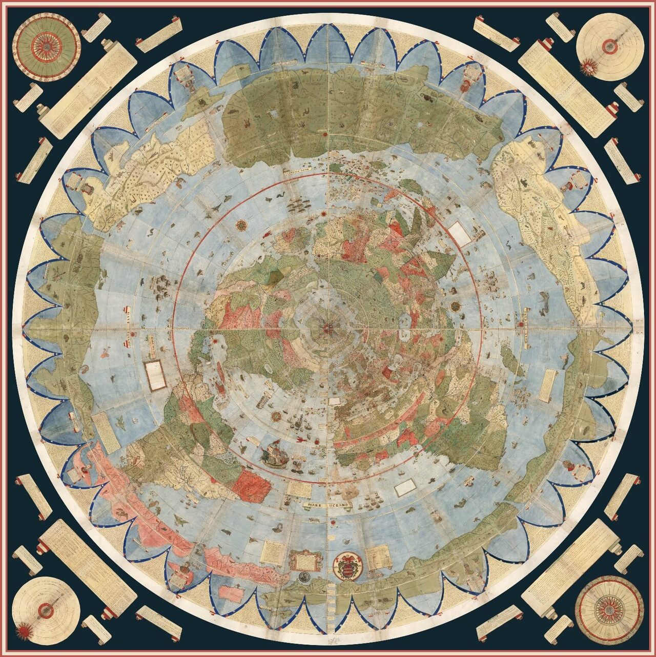
Monte envisaged the component maps—60 in all—being stitched together, and so left detailed instructions for how to turn them into one giant representation of the world, over nine feet in diameter. Included in the four volumes are also charts showing the lengths of days at different times of year and an extended geographical treatise on the world and cosmology. Unlike many modern maps, which use the Mercator projection from around the same time, his map shows the world from directly above the North Pole. Today, this perspective is known as the north polar azimuthal projection...
Once assembled, the map shows a lush, highly personalized take on the world, with a surprisingly large collection of real and fantasy beasts carousing and cavorting on land and sea. Rumsey’s scan and digital assembly of the cartographic puzzle represents the first time that Monte’s work has been seen in its full glory: It is the single largest world map of the 16th century, and one largely forgotten or overlooked by cartographers and scholars.
...
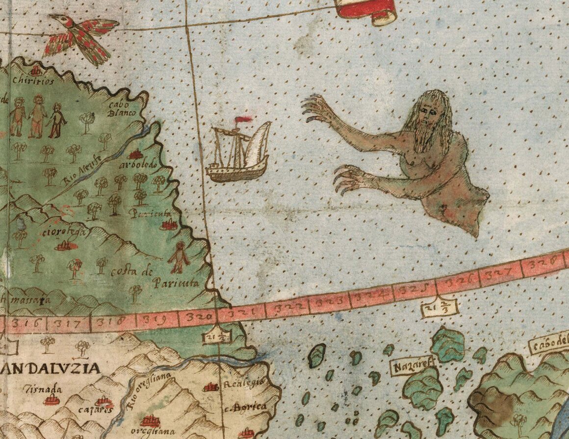
Throughout the world, Monte took time to sketch exotic fauna—crocodiles, camels, lions, and more. Near a coast labeled “Terra Incognita” (somewhere around Alaska), a wolf with a cub looks watchfully over its shoulder. Elsewhere there are more fantastic beasts, including griffins and what looks like a huge bird clutching an elephant. The seas feature many-tailed mermen and fleets of well-armed ships. Political leaders, including Philip II of Spain, also make an appearance, as do several portraits of Monte himself. Mapmakers of the time didn’t like empty spaces, Rumsey told CBC Radio. “There were many places that they did not know the names of towns and locations, so they filled them up with trees, monsters,” he said.
(Excerpt) Read more at atlasobscura.com ...
Of possible interest.
Here be dragons.
Have to admit, it is an addiction of mine.
Map bookmark
Can’t be real.
No big turtle with back riding elephants.
Thanx for posting this map
No mermaids, sea serpents or Krakens.
Bogus.
You should be watching the series “What On Earth?”
Loads of freaky satellite images, laced with mystery.
They ask, "could this be", too many times.
“Hic etiam homines magna cornua habentes longitudine quatuor pedum, et sunt etiam serpentes tante magnitudinis, ut unum bovem comedant integrum.” (”Here, indeed, are men who have large horns of the length of four feet, and there are even serpents so large, that they could eat an ox whole.”)
Thank you for posting.
Well, “Some ancient astronauts theorists suggest...” was already taken.
I am more into snooping Russian bases. Some fascinating stuff there, particularly if you use the time option. Was watching a Typhoon SSBN either being loaded or tubes plugged over a period of months.
A Backfire base with a couple dozen planes scattered around, almost abandoned looking.
Russian ABM radar and missile sites, etc.
Interesting map. Thanks for posting!
A roc.


Classic!
I wonder where that was filmed.
Also the “could this be”’s they come up with are stupid.
Disclaimer: Opinions posted on Free Republic are those of the individual posters and do not necessarily represent the opinion of Free Republic or its management. All materials posted herein are protected by copyright law and the exemption for fair use of copyrighted works.