Posted on 09/19/2017 10:20:31 AM PDT by BenLurkin
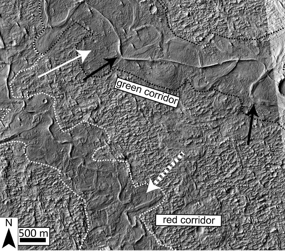
For years, Aeolis Dorsa has been of interest to scientists since it contains some of the most densely-packed sedimentary layers on Mars, which were deposited by flowing water (aka. fluvial deposits). These deposits are visible from orbit because of the way they have undergone a process known as “topographic inversion” – which consists of deposits filling low river channels, then being exhumed to create incised valleys.
By definition, incised valleys are topographic lows produced by “riverine” erosion – i.e. relating to a river or riverbank. On Earth, these valleys are commonly created by rising sea levels, and then filled with sediment as a result of falling sea levels. As sea levels rise, the valleys are cut from the landscape as the waters move inland; and as the sea levels drop, retreating waters deposit sediment within them.
According to the study, this process has created an opportunity for geophysicists and planetary scientist to observe Mars’ geological record in three dimensions and across significant distances. As Cardenas told Universe Today via email:
“Sedimentary rocks in general record information about the environments under which they were deposited. Fluvial (river) deposits specifically record information about the way rivers migrated laterally, the way they aggraded vertically, and how these things changed over time.”
Here on Earth, the statigraphy (i.e. the order and position of sedimentary layers) of sedimentary rocks has been used by geologists for generations to place constraints on what conditions were like on our planet billions of years ago. It has only been in recent history that the study of sedimentary layers has been used to place constraints on what environmental conditions were like on other planetary bodies (like Mars) billions of years ago.
(Excerpt) Read more at https: ...
Link not working
They are conflating speculation with fact.
“Settled Science” does not allow for alternative explanations.
working link:
https://www.universetoday.com/137230/study-martian-sedimentary-layers-reveals-planets-past/
Thanks to iowamark and Ben Lurkin.
Looks like an interesting article
I’ll bite......what’s the alternative explanation?
Here you go:
The Lightning Scarred Planet Mars
https://www.youtube.com/watch?v=tRV1e5_tB6Y&list=PLwOAYhBuU3UfvhvcT1lZA6KbSdh0K2EpH&index=4

OK, I admit I didn’t watch the full one hour, twenty-three minutes and fifty seconds of the video at that link.
But i got the gist of it.
Short version:
Scale of “erosion” features much larger than anything on “watery” Earth.
NASA cannot account for Valles Marineris.
Canyons that have no inlet or outlet.
Cleanly cut alcoves... sharply scalloped walls.
Tributaries that have rounded, cleanly-cut terminations, not connected to feeder streams at all.
NASA cannot account for Olympus Mons.
Crater chains.
These features can be simulated by electrical discharge/electrical machining.
Thank you. I was just about to bring up the Electric Universe theory, regarding the inexplicable features on Mars. Valles Marineris is five miles deep, and over three thousand miles long. It's the largest feature of its kind in the solar system, and cannot be explained using standard models of geology or cosmology.
Watch this video for the best explanation to date, of how it was formed:
Global warming no doubt destroyed Mars.
Disclaimer: Opinions posted on Free Republic are those of the individual posters and do not necessarily represent the opinion of Free Republic or its management. All materials posted herein are protected by copyright law and the exemption for fair use of copyrighted works.