Signs of an eyewall replacement cycle perhaps taking place on satellite? Presentation of the storm not as good as it was earlier today on satellite. While still impressive at the moment, it may be starting a weakening trend.
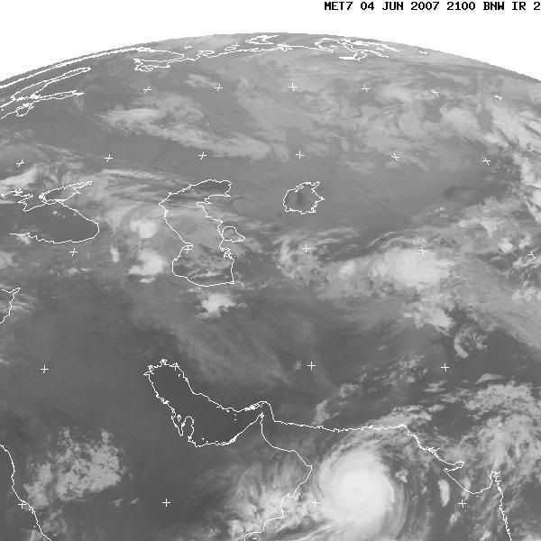
The only thing that will impact this storm will likely be dry air that's over the Arabian deserts, which will get sucked into the storm as it approaches the Oman coast tomorrow. Some meteorologists are speculating a Cat 2 or Cat 3 landfall intensity, which is unprecedented for the Arabian Peninsula. Some discussion is available at StormVista on the storm, including a really great set of satellite shots.
Excerpt from Bloomberg.com Tropical Cyclone Gonu strengthened into a Category Four storm with 150 mile-per-hour winds in the Arabian Sea south of Pakistan and is forecast to head for Oman, the U.S. Navy said. The cyclone is moving northwest at 11 miles per hour on a path Navy forecasters expect will take it toward the Gulf of Oman, an important shipping lane for tankers carrying oil from the Gulf.
I would not be surprised to see Tropical Storm Watches or Warnings (at a minimum, Gale Warnings) issued up to Delaware or New Jersey. Winds gusting up to 29 mph at Wildwood, NJ, in the last hour. Storm really getting its act together too.
http://philadelphiaweather.blogspot.com/2006/08/super-typhoon-ioke-bears-down-on-wake.html There is some information on Ioke's history in the Central Pacific that I found at the Central Pacific Hurricane Center. Also a couple of satellite shots, etc. This is a great storm to track and thankfully is only having minimal impact on life and property (two islands so far). One computer model, for what it's worth, has been putting Ioke on a collison course with Japan in about a week.
Hurricane Alice formed on December 30th and continued into early January of 1955. Zeta and Alice share the latest formation date in history in the Atlantic basin.

 Source:
  I'd hate to be here now....
  I also have some