Posted on 09/04/2017 2:02:19 PM PDT by NautiNurse
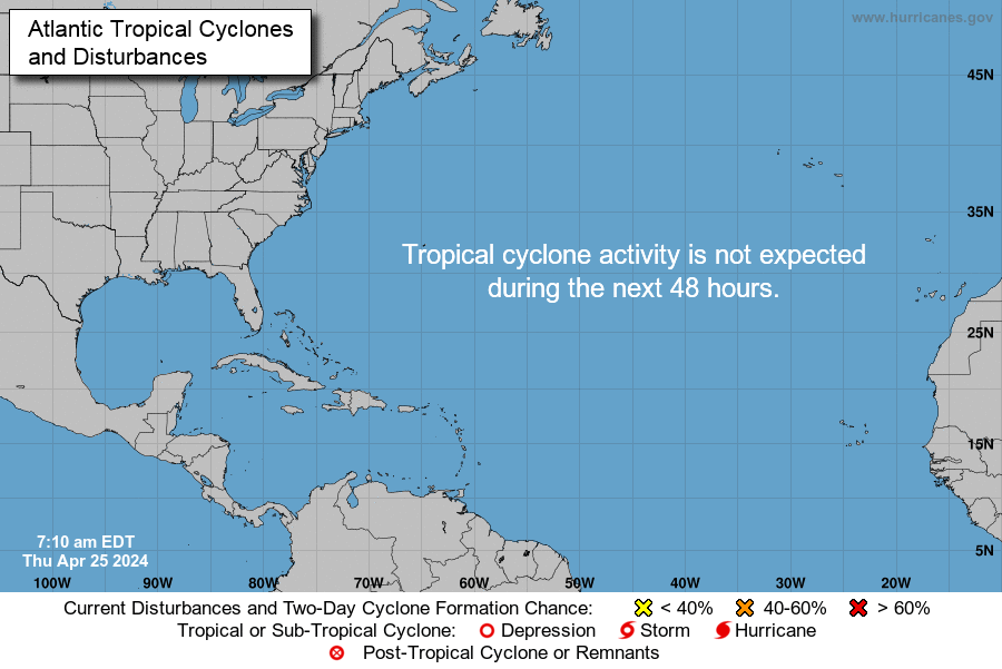
While thoughts and prayers are with our Texas FRiends and neighbors, we are at the peak of the Atlantic Tropical Storm season. Hurricane Irma continues its trek from Cape Verde across the pond and toward the Hebert Box (see below). People with interests in the Southeastern U.S. and Gulf of Mexico should be alert to the forecast path updates for this powerful storm. It is important to note that the average NHC track errors are about 175 and 225 statute miles at days 4 and 5, respectively.
Hurricane Irma originally had a small wind field. In the past 24 hours, however, the wind field has expanded with hurriance force winds up to 40 miles from the center, and tropical storm force winds up to 140 miles from the storm center.
FL Governor Rick Scott reminds Floridians: Families should take time today to make sure you have a disaster plan and fully-stocked Disaster Supply Kit. Florida residents from West Palm Beach to Tampa Bay are heeding the alert. Store shelves are emptying of bottled water.


Mash image to find lots of satellite imagery links
Public Advisories
NHC Discussions
NOAA Local Weather Statements/Radar San Juan, Puerto Rico
NHC Local Weather Statements/Radar Miami, FL
NHC Local Weather Statements/Radar Key West, FL
Buoy Data Caribbean
Buoy Data SE US & GOM

Hebert Box - Mash Pic for Tutorial
Credit: By J Cricket - Modification of map from Wiki
225 MPH winds measured about 500 feet above surface
Where are you now?
What state?
I’m in NY and *I* went to Sam’s today and picked stuff up.
And BJ’s and Wegmans, got gas as that’s going up in price.
I'm going to do it again if Irma will give us a break.
Meanwhile, the local tv news and alerts are going gaga just now that the GFS model has shifted significantly east.
Unbelievable.
I see you do not believe me.
Go to the Drudge Report site with a list of articles in regards to Hurricane Irma.
I do not help TROLLS and I am not going to start now.
Latest dropsonde transmitted at 7:01pm EDT from NE eyewall:
937mb (Surface) Unavailable
934mb 95° (from the E) 167 knots (192 mph)
932mb 95° (from the E) 173 knots (199 mph)
927mb 100° (from the E) 154 knots (177 mph)
925mb 100° (from the E) 151 knots (174 mph)
918mb 100° (from the E) 173 knots (199 mph)
915mb 100° (from the E) 196 knots (226 mph)
There’s no surface measurement but that 192mph is not far off the surface at all (3 mb).
Hi Janet—one part-time hurricane watcher asked—what happened to the BAM models. Are they still around? Different name?
HMON replaced the GFDL, which was my favorite model. I saw the BAM series earlier in the season, but it might be being re-coded, too.
im not sure what happened to them....there hasn’t been a major hurricane to hit the US til this year since 2005 so I haven’t really been paying attention tp details til now
USAF plane in the eye now..pressure still falling fast


Also consider back routes. The interstates and the Turnpike will be bumper to bumper.
8:00 PM AST Tue Sep 5
Location: 17.2°N 60.5°W
Moving: W at 15 mph
Min pressure: 916 mb
Max sustained: 185 mph

Hurricane Irma is so strong it’s registering on devices designed to detect earthquakes
http://www.freerepublic.com/focus/f-news/3583450/posts


This storm is so well defined and powerful....my dear God.
Tstorms preceding cold front now passing thru north central Louisiana, heading south.
EF scale is the one to use
keep in mind that scale is also the 3 second gusts....Irma has gust over 200

Disclaimer: Opinions posted on Free Republic are those of the individual posters and do not necessarily represent the opinion of Free Republic or its management. All materials posted herein are protected by copyright law and the exemption for fair use of copyrighted works.