Posted on 08/26/2017 5:17:29 AM PDT by Kaslin
One way for environmentalists, who tend to be on the political Left, to curry favor with conservatives is to try to tie their concerns to national defense, or “military readiness.” That’s certainly become a major theme of warnings about global warming-driven sea-level rise of late.
Tying global warming, sea-level rise, and national defense together stretches back a number of years, but it seems to have become more common recently. Here are just a few examples.
On September 3 of last year, the New York Times published perennial climate alarmist Justin Gillis’s “Flooding of Coast, Caused by Global Warming, Has Already Begun,” in which Gillis wrote:
As the problem worsens, experts are warning that national security is on the line. Naval bases, in particular, are threatened; they can hardly be moved away from the ocean, yet much of their land is at risk of disappearing within this century.
“It’s as if the country was being attacked along every border, simultaneously,” said Andrea Dutton, a climate scientist at the University of Florida and one of the world’s leading experts on rising seas. “It’s a slow, gradual attack, but it threatens the safety and security of the United States.”
On February 7, National Geographic ran a story titled “Who’s Still Fighting Climate Change? The U.S. Military.” It claimed:
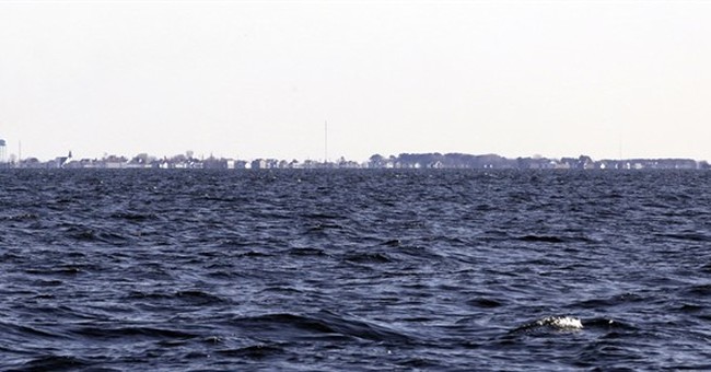
Norfolk station is headquarters of the Atlantic fleet, and flooding already disrupts military readiness there and at other bases clustered around the mouth of the Chesapeake Bay, officials say. Flooding will only worsen as the seas rise and the planet warms. Sea level at Norfolk has risen 14.5 inches in the century since World War I, when the naval station was built. By 2100, Norfolk station will flood 280 times a year, according to one estimate by the Union of Concerned Scientists.
On March 31 National Public Radio ran a program titled “Rising Seas Threaten Coastal Military Bases.” It began this way:
[HOST DAVID GREENE:] And we’re going to look now at one line - one line - in President Trump’s executive order on the environment. It’s a line that did not get much attention. In it, President Trump revoked President Obama’s directive that federal departments including the Pentagon should treat climate change as a national security threat. For the Navy, one of those threats is the sea itself. Reporter Jay Price of member station WUNC visited a spot in Norfolk, Va., where sea level rise is measured.
JAY PRICE, BYLINE: We’re on a pier at the world’s largest Navy base. Navy destroyers behind us, and in front, a white cabinet not much bigger than a refrigerator.
DEAN VANDERLEY: It’s called the Sewell’s Point tidal gauge.
PRICE: Captain Dean VanderLey heads engineering for Navy infrastructure along much of the East Coast.
VANDELEY: Not really much to look at, but it’s operated by NOAA.
PRICE: That’s the National Oceanic and Atmospheric Administration.
VANDELEY: And they’ve had a tidal gauge out here since 1927. So, you know, I think when it comes to monitoring the sea level on the East Coast, this is, you know, one of the places that they’ve got the most data.
PRICE: And that data shows that the water has risen almost 15 inches here in Hampton Roads in under a hundred years. That’s the most on the East Coast. Flooding already is so routine that giant rulers have been erected along city roads outside the base to show where the water is too deep for a car to drive through. And in little more than two decades, the main road into the base could be flooding almost daily at high tide.
On June 14, Forbes.com published “Actual Scientists Say Sea Level Rise is a Threat to Tangier Island, Virginia,” including this dark paragraph:
Cities throughout coastal Virginia have started to plan for regional challenges associated with flooding and storm surge. Mohammad Shar told a Daily Press reporter, “We are brainstorming to see what’s going on as far as sea level rise and trying to manage it as a region.” A recent NOAA report discussed the increase in “sunny-day” or “nuisance flooding” associated with high tides. Virginia Beach and Norfolk are homes to significant U.S. Navy assets and they have long been concerned about sea-level changes because many of their installations and infrastructure are at or below sea level. The Navy Times reported in 2016 that new reports suggested that three feet of sea level rise could threaten 128 military based (valued at $100 billion). While the President dismissed the threat of sea level rise, my ”bottom line feeling” is that the military does not plan for hoaxes because there is too much at stake.
The Washington Post on July 14 published “National Study puts timeline on impact of sea-level rise in Maryland, Virginia,” which also specifically mentioned Norfolk.
All of that sounds pretty alarming (and it’s supposed to). But people with more than a passing interest in the study of sea-level rise will, if they’re paying attention, recognize immediately that all of it betrays a fundamental misunderstanding. Tide gauges don’t measure “sea level.” They measure the level of the sea relative to a particular piece of coastline. One way to distinguish the two is by referring to the former as “global sea level” and the latter as “local sea level.” But remember, in the latter case what’s really being measured is the local sea level relative to the local coastline.
Norfolk lies on the Virginia coast at the southern end of the Chesapeake Bay. Tide gauges along the bay have certainly shown a change in sea level relative to the surrounding land. But is that happening because sea level itself is rising?
The answer might seem obvious: “Well of course it’s because sea level is rising! The land’s stable, after all.”
But what seems obvious is also wrong. The land along the Chesapeake Bay, including at Norfolk, is anything but stable.
As Dr. Roger Bezdek, an economist with over 30 years’ experience in the energy, utility, environmental, and regulatory areas, points out in “Water Intrusion in the Chesapeake Bay Region: Is It Caused by Climate-Induced Sea Level Rise?“ in the Open Access journal Scientific Research:
Land subsidence has been known and observed in the southern Chesapeake Bay region for many decades and is a factor that must be considered by urban planners and natural resource managers. Land subsidence in the Chesapeake Bay region was first documented over four decades ago by Holdahl and Morrison who reported results of geodetic surveys completed between 1940 and 1971 and found land surfaces across the region were sinking at an average rate of 2.8 mm/yr. with rates ranging from 1.1 to 4.8 mm/yr. ... The National Geodetic Survey has computed velocities for three of these stations between 2006 and 2011 and found an average subsidence rate of 3.1 mm/yr.
In other words, the changing relative heights of the land and the sea in the Chesapeake Bay area are driven by something on the order of 3 to 5 mm/year of land subsidence. And what causes the land subsidence? Glacial isostatic adjustment (the slow and very-long-term response of the earth’s crust to loading and unloading due to erosion, deposition, saturation, drying, glaciation, and deglaciation), at about 1 mm/year, and most of the rest, 2 to 4 mm/year, from groundwater extraction.
The UN Intergovernmental Panel on Climate Change estimates the rate of global sea-level rise as something in around 3 mm/year. That implies that the 3 to 5 mm/year of land subsidence in the Chesapeake Bay area is equal to, or up to 2/3 faster than, global sea level rise.
But the IPCC’s estimate of global sea level rise is itself likely too high. As I noted elsewhere, one of the world’s foremost experts on sea level, Nils-Axel Mörner recently presented extensive empirical data from tide gauges around the world that show a long-term rate of global sea-level rise of ”between ±0.0 and +1.0 mm/yr.” That, coupled with the National Geodetic Survey’s estimate of the area’s land-subsidence rate between 2006 and 2011 of 3.1 mm/year, would imply that of the roughly 3.8 mm/year of local sea-level rise in the Chesapeake Bay area (calculated from the 15 inches reported as having occurred over roughly the last 100 years), at least 4/5, and perhaps all of it, can be attributed to land subsidence rather than global sea-level rise.
In short, at least at Norfolk, it’s not global sea-level rise that threatens trouble to a naval installation. It’s local land subsidence. And that means that fighting global warming will have no impact on the problem.
Don’t get me wrong. This doesn’t mean relative sea-level rise can’t be a problem for any naval installations. It can be. But the solution isn’t likely to be fighting global warming. It’s more likely a combination of raising the buildings and piers and finding ways to slow groundwater extraction to reduce its contribution to land subsidence, both of which are much simpler and cheaper than trying to control the average temperature of the whole globe by depriving billions of people of the abundant, affordable, reliable fossil-fuel energy indispensable to lifting and keeping whole societies out of poverty.
How do we know its not just the earth’s surface shell doing what it always does - adjusts to varying pressure from Sun, Moon, volcanic pressures, etc. Maybe the base land is sinking under a tectonic plate somewhere out of sight. For the sea levels to rise, everywhere, implies more water in the ocean everywhere. What we seem to have here is a local, relative to the earth’s surface, bulge in a continental land mass.
No
...but...but...what about the dry-docks? ==8-O
continental drift, tectonic subsistence
“Erosion or subsidence versus water level rise. Semantics?”
That’s what I’m thinking. The doofuses are looking out to sea for the problem when it’s equally likely that it’s the water table and drainage in the surrounding land that are causing the problems.
Yes. Fresh water in the 'Glades has to maintain 3 ft. of 'head' to prevent salt water intrusion.
The fresh water being pumped out of the ground for the population is causing the intrusion.
At least that's what I've read.
I have beachfront property in Central Florida—at least it was 200,000 years ago. ;)
The system of drainage canals around Homestead worked both ways. Salt water can come in and fresh water was going out. Florida Bay was dead. The ‘Glades once mitigated the effect.
Draining the Florida swamp to make all of that sub-tropical real estate in the 30’s came at a cost. Homestead was cris’crossed with canals dug by what amounted to giant ditch witches grinding through coral. Great place to be a walking catfish.
I’ve lived near the Chesapeake bay for several decades, and have not notice any increase in the mean water level. There are reports that the land in this area is slowly subsiding.
Seems like it would be a two-fer...
So,... women are safe now, to ride across Bridges in a car driven by a Kennedy.
My backyard ends at a saltwater stream - no change in the last 40 years.
Unless liberal elites can show us a glass of water where water on one side of the glass is higher than the other side, I'm calling BS on this story too.
Who knew that NAS China Lake would soon be on the coast?
It goes beyond semantics when some regional subsidence is used to justify international global warming policies.
I’m pretty amazed at the serious replies to my query
There was a story in the newspaper not long ago in which the Mayor of Tangier Island said claimed he could prove the island is disappearing not from sea rise, but rather by the constant washing away of the land by the bay currents over the many years.
Which leads to the question: why not sea walls and jetties.
Having lived on the shores of the Chesapeake bay since 1989, I can testify that, based on maintaining 2 docks on my property, there as been no appreciable change in the level of the average water level...Except during the tides...And hurricane Elizabeth which left 5-feet of water and mud in the first floor of my house.
But since then America has been obsessed with buying cheap crap from China spawning the need for more and bigger container vessels. And the Cruise industry has more than quadrupled in the same time adding even more ships to the worlds oceans. Both China and North Korea have increased their numbers of submarines, superstitiously adding to the perceived sea level rise (an ice cube held under water still displaces the water!).

“Who knew that NAS China Lake would soon be on the coast?”
When the Big One hits the San Andreas...
Disclaimer: Opinions posted on Free Republic are those of the individual posters and do not necessarily represent the opinion of Free Republic or its management. All materials posted herein are protected by copyright law and the exemption for fair use of copyrighted works.