Thousands Flee As Hurricane Ivan Roars Toward U.S.
Ivan Adds to Oil Price Pressure
Awaiting Ivan in the Big Uneasy


Post what ya know, saw, heard, thought, or feel! Our heartfelt wishes to everyone in this monster's path.
Posted on 09/14/2004 10:41:58 PM PDT by lainie
Thousands Flee As Hurricane Ivan Roars Toward U.S.
Ivan Adds to Oil Price Pressure
Awaiting Ivan in the Big Uneasy
Post what ya know, saw, heard, thought, or feel! Our heartfelt wishes to everyone in this monster's path.


God almighty, that is a big storm.
Last time I rode something like that out was Hugo. Please pray for my Girlfriend's grandmother, she decided to stay and ride out the storm in Destin Florida.
|
Current Information
|
| Mobile, Alabama : Radar / Loop |
| New Orleans, Louisiana : Radar / Loop |
| Regional Radar Loop (Eastern Gulf of Mexico) |
| Regional Radar Loop (Northern Gulf of Mexico) |
| Southeast US Radar Composite |
| Southeast US Radar Loop |
| Vortex : Hurricane Hunter Messages |
| --Decoded Vortex Message |
| Gulf of Mexico Sea Surface Temperatures (Ivan position included on map) |
| Deep Water Wave Height (Northern Gulf of Mexico) |
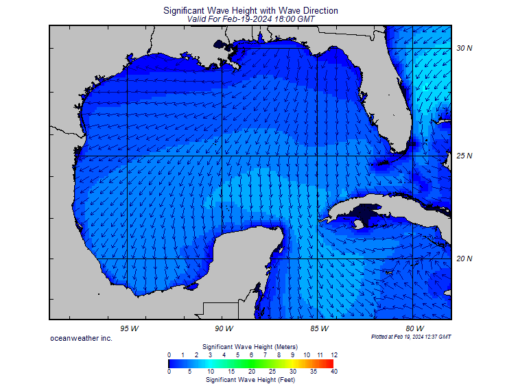
| Significant Wave Height (Gulf of Mexico) |


I-10 looks wide open to me
Am I mistaken, or does the Weather Channel keep saying it will make landfall in Fla? Looks like LA to me..
| Alabama Media |
| Alabama Broadcast Stations |
| Mobile |
| News Radio 710 WPMI-AM |
| NBC 15 : Close to Home (Mobile, Pensacola, Ft. Walton Beach) |
| CBS 5 WKRG (Mobile, Pensacola) |
| Mobile Police Scanner |
| al.com : Everything Alabama |
| Birmingham |
| ABC 33/40 : Alabama's News Leader |
| Louisiana Media |
| New Orleans |
| Talk Radio 690 WTIX : LISTEN LIVE |
| WGNO-TV : ABC26 New Orleans |
| WWLTV.Com : News for New Orleans |
| NOLA.Com : Everything New Orleans |
| 870 News Talk and Sports |
| TheNewOrleansChannel.Com |
| Cox.net for New Orleans |
| Mississippi Media |
| Biloxi |
| WLOX-TV - The News for South Mississippi |
But sitting here in Orlando, we're just waiting for that beast to take the same unexpected right turn Charley did.
Bill
Rain from North Carolina to Cancun! I would say that is big!
|
High Resolution Satellite Images
|
| 8-Image Close-Up Visible Loop |
| Rapid Scan Operational Real-Time Imagery (Click 'Floater' Links) |
| Full Color Disk Satellite (Western Hemisphere) |
| Interactive GOES East Satellite Viewer |
The Weather Channel has been saying that for, what, five days now. I don't get it. Most people don't get it.
What we won't know is whether the storm will still try to make landfall at the mouth of the Mississippi or if it will turn at the last moment into the Gulf coast of Mississippi and Alabama. My mother is in a nursing home in Fairhope and the home is planning to hunker down and ride out the storm. I think they'll be okay if they don't get a direct hit. It's a pretty sturdy one-story brick but I am concerned about tornadoes, flying debris, etc. that could strike.
My sister and her husband are leaving Baldwin County, AL and moving inland to some family members in Mississippi. They have horses and their house is a wood frame so I have my concerns about that too. Plus, they're down the street from a bunch of mobile homes.
I don't wish the storm for anyone but I do hope the ye comes ashore somewhere along the Mississippi-Louisiana state line as it is not heavily populated there and there is quite a bit of vegetation to weaken it as it comes ashore.
It won't be another Camille but then that whole area wasn't built up then nearly as much as it is today.
TWC just said this could cause 30ft surge! Anyone know when high tide is on the coast?
On that Weather Channel Map Room link, on the Africa map, is that where all these storms come from? The band of storms right in the middle?
They have reporters (or whatever they call them) in Pensacola, Mobile, Panama City, and maybe Grand Isle?
Disclaimer: Opinions posted on Free Republic are those of the individual posters and do not necessarily represent the opinion of Free Republic or its management. All materials posted herein are protected by copyright law and the exemption for fair use of copyrighted works.