Posted on 10/06/2016 11:52:17 AM PDT by UMCRevMom@aol.com
US National Weather Service Jacksonville Weather.gov/JAX@NWSJacksonville
The storm poses an imminent threat of tropical storm and/or hurricane conditions to SOME PORTION of the Warning area.
Heed the advice of Local officials. Be careful about rumors, erroneous social media posts and unwarranted speculation.
Major Hurricane Matthew Briefing Situation Overview
...THIS IS NOW A WORST CASE STORM SURGE SCENARIO...
Catastrophic Damage is Anticipated for Coastal Areas.
Major Hurricane Matthew is still expected to move DANGEROUSLY CLOSE the Florida First Coast and Southeast Georgia Coast Friday through Friday night into Saturday with catastrophic impacts expected along and near the coast.
A major hurricane has not impacted this area in 118 years, since October 2nd 1898. There is NO local living memory of the potential of this event. If a direct landfall occurs this will be unlike any hurricane in the modern era. . The western eyewall is expected to move along a portions of the coast with sustained winds 115 to 125 mph and gusts in the most affected areas! Winds will be higher in high rise structures in Downtown Florida possibly strong Category 4 to Category 5 intensity!
Some of the lowest barrier islands will be completely overtopped with large battering wave and life threatening flooding. Barrier islands are likely to breached and it is extremely possible that new inlets will be cut in the worst affected areas.
Please, Please heed the advice of public and emergency management officials. 40 people in New York and New Jersey did not heed these warning during Sandy and died in the storm surge! This will be a MUCH Greater surge than Sandy had along the New Jersey Shore!

That looks a little rough. Better roll the car windows up.
The fist of Satan!
Hacker Releases Tons Of Emails From Clinton State Department Insider
Thank you for sharing for those staying on this thread :)
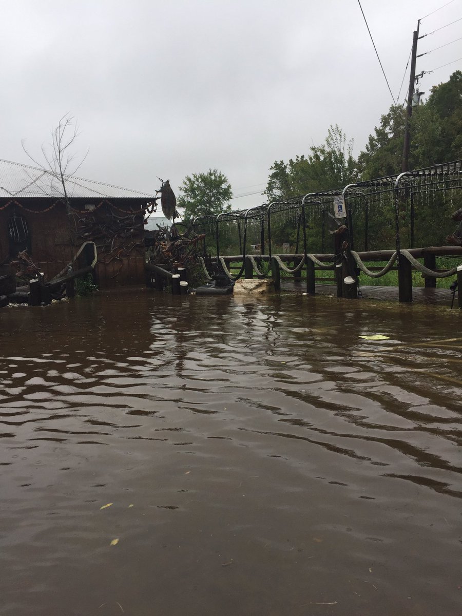
Parking Lot at Clark's Fishing Camp....

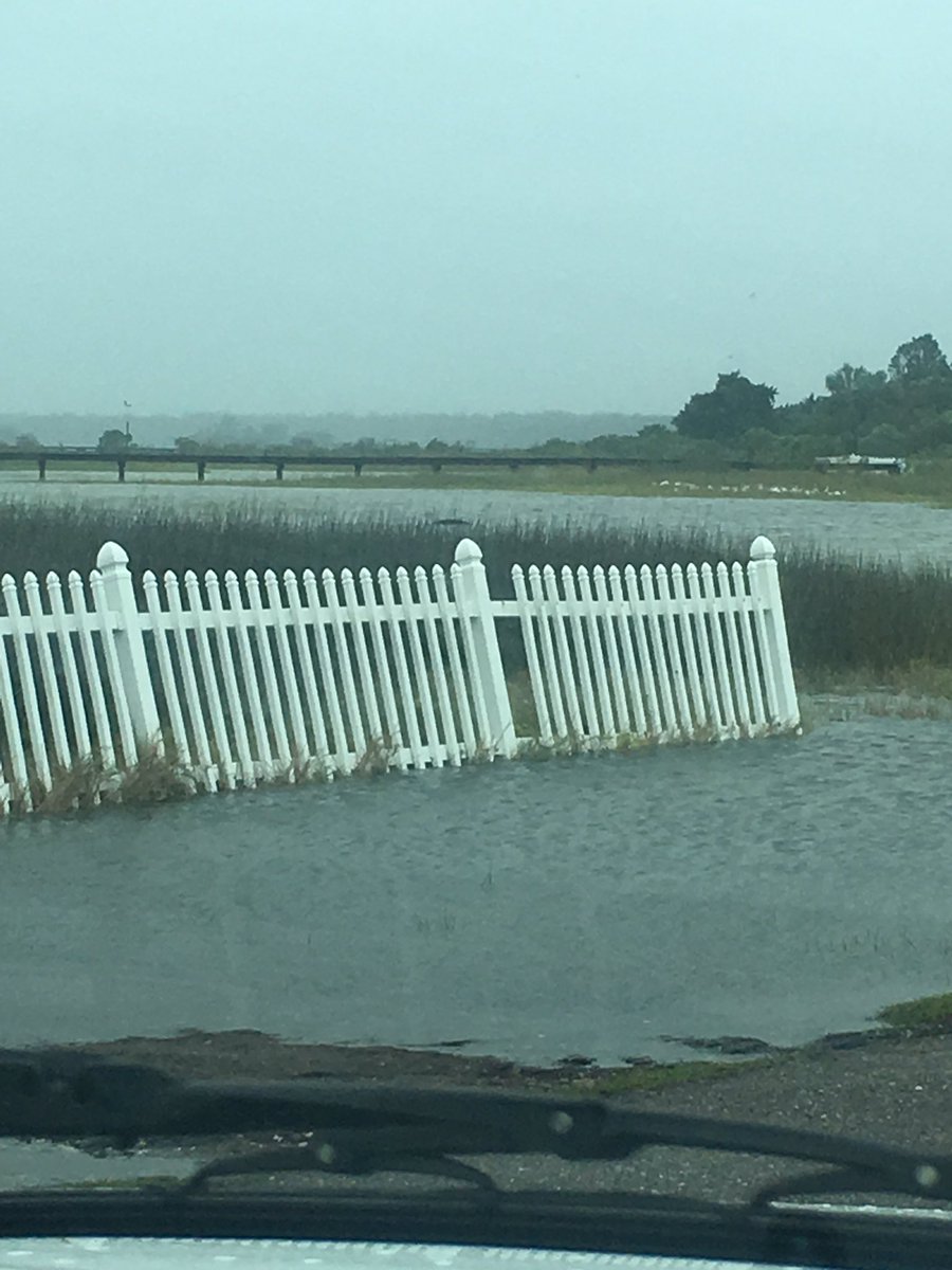
Black Hammond Island on the Northside of Jacksonville

Maybe we’ll have a new coach by then.
-—Are these areas not hardened against this sort of thing?-—
I would suggest go visit the next hurricane event and all your questions will be answered...
Wow
Charlie Strong?
LOL, you never know. Actually the funny thing is that I did want Strong when Meyer left.
Very very happy to hear that news!! God Bless!!
Think Katrina. Only worse. Katrina was a Cat 3 when it hit.
Praying. Hard. Our fellow Americans don’t deserve this.
Our Father who art in heaven, hallowed be Thy Name, They kingdom come, Thy will be done on earth as it is in Heaven. Give us this day our daily Bread, and forgive us our trespasses as we forgive those who trespassed us against us, and lead us not into temptation, but deliver us from evil. Amen.
You can’t harden a structure to sustain 130+ mph winds unless you build it like a ground level concrete bunker.
That picture reminds me of the picture have seared into my brain walking out my front door and seeing Andrew roll into Florida...
My second thought was: “I am so screwed”...
“WTF isn’t Obama down there stopping this thing?”
Yeah, didn’t he say he was going to lower the sea level when he was first elected?
Liar!
Wow, great snapshot.
Good Luck either way. Gives FLA a chance to heal up.
They’re not overhyping this one. Google before and after pics of Pass Christian, MS as a result of Katrina. Katrina was a cat 3. This is a cat 4.
That’s a mandatory evacuation of essentially all of Savannah and Brunswick for those not familiar with the area.
Wow. I hope they write their names on their arms. If their bodies are found, it’ll be easier to identify them.
Disclaimer: Opinions posted on Free Republic are those of the individual posters and do not necessarily represent the opinion of Free Republic or its management. All materials posted herein are protected by copyright law and the exemption for fair use of copyrighted works.