| This thread has been locked, it will not receive new replies. |
| Locked on 08/29/2005 2:09:55 PM PDT by Admin Moderator, reason: |
Posted on 08/29/2005 2:47:45 AM PDT by NautiNurse
Category 4 Hurricane Katrina is approaching landfall in Eastern Louisiana. At 4:00AM EDT the storm's center was about 90 miles south of New Orleans.
The following links are self-updating:
Public Advisory Currently published every 3 hours 5A, 8A, 11A, 2P, etc. ET
NHC Discussion Published every six hours 6A, 11A, 6P, 11P
Three Day Forecast Track
Five Day Forecast Track
Navy Storm Track
Katrina Track Forecast Archive Nice loop of each NHC forecast track for both three and five day
Forecast Models
Alternate Hurricane Models via Skeetobite
Bouy Data Louisiana/Mississippi
Buoy Data Florida
Lake Ponchartrain Real Time Water Level
Images:
New Orleans/Baton Rouge Experimental Radar Subject to delays and outages - and well worth the wait
Ft. Polk, LA Long Range Radar Loop
Northwest Florida Long Range Radar
Storm Floater IR Loop
Storm Floater Still & Loop Options
Color Enhanced IR Loop
Other Resources:
Hurricane Wind Risk Very informative tables showing inland wind potential by hurricane strength and forward motion
Central Florida Hurricane Center
New Orleans Web Cams Loads of web cam sites here. The sites have been very slow due to high traffic
New Orleans Music Online Couldn't resist--love that jazz
Golden Triangle Weather Page Nice Beaumont weather site with lots of tracks and graphics
Hurricane City
Crown Weather Tropical Website Offers a variety of storm info, with some nice track graphics
Live streaming:
Cut and Paste:
http://www.wwltv.com/perl/common/video/wmPlayer.pl?title=beloint_khou&props=livenoad
Fully-linked version of the live feeds (just in case a few people don't want to first open up WMP to cut-and-paste) -
WWL-TV/DT New Orleans (WMP) - mms://beloint.wm.llnwd.net/beloint_wwltv
WVTM-TV/DT Birmingham (WMP) - mms://a1256.l1289835255.c12898.g.lm.akamaistream.net/D/
1256/12898/v0001/reflector:35255
WDSU-TV/DT New Orleans (WMP) - http://mfile.akamai.com/12912/live/reflector:38202.asx
Hurricane City (Real Player) - http://hurricanecity.com/live.ram
ABCNews Now (Real Player) - http://reallive.stream.aol.com/ramgen/redundant/abc/now_hi.rm
WKRG-TV/DT
Mobile (WMP) - mms://wmbcast.mgeneral.speedera.net/wmbcast
.mgeneral/wmbcast_mgeneral_aug262005_1435_95518 WDSU-TV/DT New Orleans via WESH-TV/DT Orlando - http://mfile.akamai.com/12912/live/reflector:38843.asx
Hurricane Katrina Live Thread, Part VII
Hurricane Katrina Live Thread, Part VI
Hurricane Katrina Live Thread, Part V
Hurricane Katrina, Live Thread, Part IV
Hurricane Katrina Live Thread, Part III
Katrina Live Thread, Part II
Hurricane Katrina Live Thread, Part I
Tropical Storm 12
| Category | Wind Speed | Barometric Pressure | Storm Surge | Damage Potential |
|---|---|---|---|---|
| Tropical Depression |
< 39 mph < 34 kts |
Minimal | ||
| Tropical Storm |
39 - 73 mph 34 - 63 kts |
Minimal | ||
| Hurricane 1 (Weak) |
74 - 95 mph 64 - 82 kts |
28.94" or more 980.02 mb or more |
4.0' - 5.0' 1.2 m - 1.5 m |
Minimal damage to vegetation |
| Hurricane 2 (Moderate) |
96 - 110 mph 83 - 95 kts |
28.50" - 28.93" 965.12 mb - 979.68 mb |
6.0' - 8.0' 1.8 m - 2.4 m |
Moderate damage to houses |
| Hurricane 3 (Strong) |
111 - 130 mph 96 - 112 kts |
27.91" - 28.49" 945.14 mb - 964.78 mb |
9.0' - 12.0' 2.7 m - 3.7 m |
Extensive damage to small buildings |
| Hurricane 4 (Very strong) |
131 - 155 mph 113 - 135 kts |
27.17" - 27.90" 920.08 mb - 944.80 mb |
13.0' - 18.0' 3.9 m - 5.5 m |
Extreme structural damage |
| Hurricane 5 (Devastating) |
Greater than 155 mph Greater than 135 kts |
Less than 27.17" Less than 920.08 mb |
Greater than 18.0' Greater than 5.5m |
Catastrophic building failures possible |
Can someone get a good screen capture of Steve Harrigan for us FNC deprived.
I do not need a reporter constantly standing outside ...in danger of getting struck by flying debris..to tell me about a storm..I think a little of that goes a long way..
I saw a local weather reporter give the best visual on those bands and why coming down from the north toward Lake Ponchatrain will be the nail biter...
I also heard the Hyatt guests in NO are herded into the ballroom because of broken windows.
I think the brunt of the storm will hit NO in about an hour?
Lots of hotels and motels full in Houston..and shelters have been set up.
I don't usually watch TV news programs, I get the skinny on the goings on in the world from the net.
However, I've been watching Steve Harrigan on FOX and I have to say I'm impressed. He's not out there for fun, he's out there to bring what's happening into your living room and mine. The guy has guts. Style too. I just may watch the news from time to time because of him. LOL.
I think Orlando whatshisname is doing a good job too.
What's going on with the roof of the dome in NO, anyone know? TIA - Anij.
Hmmm, well that's a good sign. I'd rather they be on the ground than anywhere else.
That's only if conditions remain status quo. Since the storm is now moving over land, it will only weaken at this point as it's deprived of warm water.
I hope they can track down and interview Jackie , our inspiration from last night, after this.
I think reporters are looking for a live kill on television. This is just nuts.
it's not that the wind is a- blowin'
it's WHAT the wind is blowin'
if you get hit by a volvo , those 100 sit -ups ya did this mornin'
aint gonna help much .
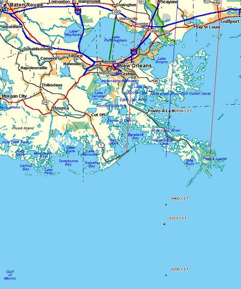
New graphic posted based on the 0709 (CDT) Vortex data, eye center located 13.7 miles east of Pointe A La Hache, 41.7 miles SE of downtown New Orleans, other plots in red and green, blue line represents adjusted forecast track, red lines indicate eyewall diameter and maximum storm surge.
http://i4.photobucket.com/albums/y138/jeffers_mz/Katrina/7amplots.jpg
Harrigan seems to be really into this reporting!
WDSU-TV had got someone inside the Superdome, they are pretty much giving reports as they happen.
Heh heh.
Harrigan "I can smell something burning"
Keep me posted. Need to grab a cup of coffee, then I'll be back to get an update. :-)
He's a war correspondent. It takes a certain kind to like that.
The rain looks like it is hurting his face, he keeps lifting up a towel to it.
While no one likes to get hurt, let's face it, some people get a thrill from stamding out in storms. In the MOSI near my house, they have a hurricane tunnel so people can experience the wind of a hurricane. It's always full.
Oh! and I thought that it was just his ole miss educaation.
I like him too and it's why I want him safe. If I were his wife, oh boy. The nagging...
Steve H. smells "something burning"...I feel like I'm watching Bob Newhart.
sw
Think I just saw him blow away.
Disclaimer: Opinions posted on Free Republic are those of the individual posters and do not necessarily represent the opinion of Free Republic or its management. All materials posted herein are protected by copyright law and the exemption for fair use of copyrighted works.