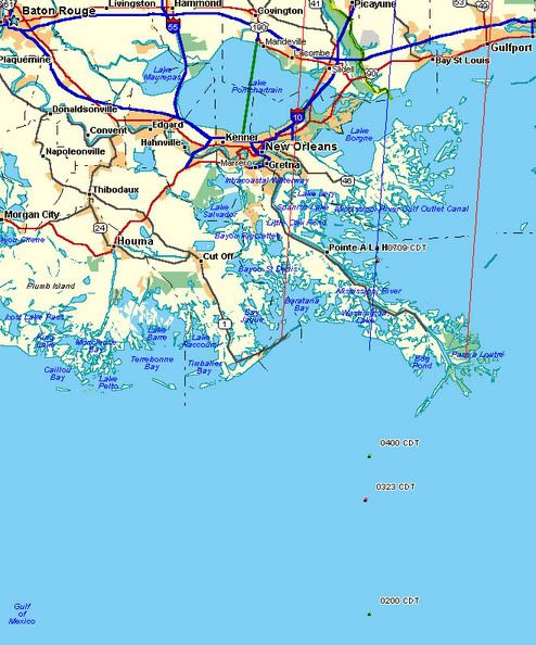
New graphic posted based on the 0709 (CDT) Vortex data, eye center located 13.7 miles east of Pointe A La Hache, 41.7 miles SE of downtown New Orleans, other plots in red and green, blue line represents adjusted forecast track, red lines indicate eyewall diameter and maximum storm surge.
http://i4.photobucket.com/albums/y138/jeffers_mz/Katrina/7amplots.jpg
Tornado warnings for areas north east of the storm.