| This thread has been locked, it will not receive new replies. |
| Locked on 08/28/2005 8:10:53 PM PDT by Admin Moderator, reason: |
Posted on 08/28/2005 2:38:16 PM PDT by NautiNurse
Extremely dangerous Hurricane Katrina is bearing down on the North Central Gulf of Mexico and New Orleans metro area. Thousands of people did not evacuate New Orleans. Outer bands of Katrina are reaching the Louisiana coast.
Due to the size and intensity of this storm, all interests in the North Gulf of Mexico should be in their safe locations.
The following links are self-updating:
Public Advisory Currently published every 3 hours 5A, 8A, 11A, 2P, etc. ET
NHC Discussion Published every six hours 6A, 11A, 6P, 11P
Three Day Forecast Track
Five Day Forecast Track
Navy Storm Track
Katrina Track Forecast Archive Nice loop of each NHC forecast track for both three and five day
Forecast Models
Alternate Hurricane Models via Skeetobite
Bouy Data Louisiana/Mississippi
Buoy Data Florida
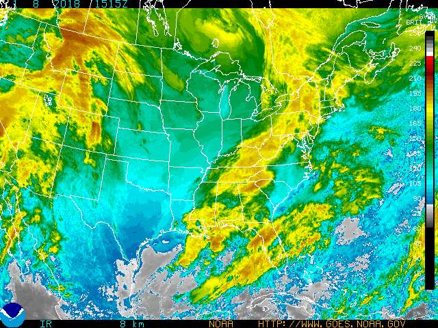
Images:
New Orleans/Baton Rouge Experimental Radar Subject to delays and outages - and well worth the wait
Ft. Polk, LA Long Range Radar Loop
Northwest Florida Long Range Radar
Storm Floater IR Loop
Storm Floater Still & Loop Options
Color Enhanced IR Loop
Other Resources:
Hurricane Wind Risk Very informative tables showing inland wind potential by hurricane strength and forward motion
Central Florida Hurricane Center
New Orleans Web Cams Loads of web cam sites here. The sites have been very slow due to high traffic
New Orleans Music Online Couldn't resist--love that jazz
Golden Triangle Weather Page Nice Beaumont weather site with lots of tracks and graphics
Hurricane City
Crown Weather Tropical Website Offers a variety of storm info, with some nice track graphics
Live streaming:
WWL-TV/DT New Orleans (WMP) - mms://beloint.wm.llnwd.net/beloint_wwltv
WVTM-TV/DT Birmingham (WMP) - mms://a1256.l1289835255.c12898.g.lm.akamaistream.net/D/1256/12898/v0001/reflector:35255
WDSU-TV/DT New Orleans (WMP) - http://mfile.akamai.com/12912/live/reflector:38202.asx
Hurricane City (Real Player) - http://hurricanecity.com/live.ram
ABCNews Now (Real Player) - http://reallive.stream.aol.com/ramgen/redundant/abc/now_hi.rm
WKRG-TV/DT Mobile (WMP) - mms://wmbcast.mgeneral.speedera.net/wmbcast.mgeneral/wmbcast_mgeneral_aug262005_1435_95518
| Category | Wind Speed | Barometric Pressure | Storm Surge | Damage Potential |
|---|---|---|---|---|
| Tropical Depression |
< 39 mph < 34 kts |
Minimal | ||
| Tropical Storm |
39 - 73 mph 34 - 63 kts |
Minimal | ||
| Hurricane 1 (Weak) |
74 - 95 mph 64 - 82 kts |
28.94" or more 980.02 mb or more |
4.0' - 5.0' 1.2 m - 1.5 m |
Minimal damage to vegetation |
| Hurricane 2 (Moderate) |
96 - 110 mph 83 - 95 kts |
28.50" - 28.93" 965.12 mb - 979.68 mb |
6.0' - 8.0' 1.8 m - 2.4 m |
Moderate damage to houses |
| Hurricane 3 (Strong) |
111 - 130 mph 96 - 112 kts |
27.91" - 28.49" 945.14 mb - 964.78 mb |
9.0' - 12.0' 2.7 m - 3.7 m |
Extensive damage to small buildings |
| Hurricane 4 (Very strong) |
131 - 155 mph 113 - 135 kts |
27.17" - 27.90" 920.08 mb - 944.80 mb |
13.0' - 18.0' 3.9 m - 5.5 m |
Extreme structural damage |
| Hurricane 5 (Devastating) |
Greater than 155 mph Greater than 135 kts |
Less than 27.17" Less than 920.08 mb |
Greater than 18.0' Greater than 5.5m |
Catastrophic building failures possible |
Well south central L.A. could use a good clean up...
It looks like a East Coast path though, if not a right turn and miss land one.
yeah....I am not optimistic it is going to happen.
At this point it is not the size that matters (hehe), when you look at the IR notice the deep reds and purples that completely encircle the perfectly circular eye, and look at the visible images that show what looks like a perfectly round stadium (think the Vet in Philly) right smack dab in the center.
That is what is known as an annular Hurricane. A 1 MB move is not indicative of weakening, we can hope and pray it continues to go up, but the reality is Katrina is Steady State now - she will come in at 900-905 MB and 165-180 MPH.
Geeeze, I always thought you DID open windows a crack--not so, though, eh?
You know that for a fact? (I need for future reference in FL)
C'mon...is this little arguement necessary?
Besides, I never saw or heard Janice Dean cry---she was just concerned that people were putting WAY too much faith in the Superdome to keep those people safe.
Wow. It is going to be a long night. I couldn't sleep last nite worrying about this.
The Dome will become a huge "petri dish". Barf.
LOL, I was expecting that.
yep.
Gas is going to be easily up over $3.50 a gallon.
probably higher.
it has to spike, there is no way around it. The supply is going to be virtually nil for a while.
Fingers crossed.
Well, Andrew pretty much couldn't do any more damage. There was nothing left in it's path.
To South Floridians there's Before Andrew and After Andrew.
If this one is worse....god help these folks.
FReepmail
Thanks I will keep that in mind if I'm in a tornado.
Had some 80mph winds here one night that was about enough for me.
The host asked the pics not be posted, just links. I just go with the flow.
Is Jeff Morrow of TWC still in NO? Or has TWC moved their crew to a safer area?
...does anyone believe there will still BE a New Orleans after this? (I'm so sad...)
Good and disturbing insight (as to how the heck to get in and out of dome if water seals entrances) . . .
Disclaimer: Opinions posted on Free Republic are those of the individual posters and do not necessarily represent the opinion of Free Republic or its management. All materials posted herein are protected by copyright law and the exemption for fair use of copyrighted works.