| This thread has been locked, it will not receive new replies. |
| Locked on 08/28/2005 8:10:53 PM PDT by Admin Moderator, reason: |
Posted on 08/28/2005 2:38:16 PM PDT by NautiNurse
Extremely dangerous Hurricane Katrina is bearing down on the North Central Gulf of Mexico and New Orleans metro area. Thousands of people did not evacuate New Orleans. Outer bands of Katrina are reaching the Louisiana coast.
Due to the size and intensity of this storm, all interests in the North Gulf of Mexico should be in their safe locations.
The following links are self-updating:
Public Advisory Currently published every 3 hours 5A, 8A, 11A, 2P, etc. ET
NHC Discussion Published every six hours 6A, 11A, 6P, 11P
Three Day Forecast Track
Five Day Forecast Track
Navy Storm Track
Katrina Track Forecast Archive Nice loop of each NHC forecast track for both three and five day
Forecast Models
Alternate Hurricane Models via Skeetobite
Bouy Data Louisiana/Mississippi
Buoy Data Florida
Images:
New Orleans/Baton Rouge Experimental Radar Subject to delays and outages - and well worth the wait
Ft. Polk, LA Long Range Radar Loop
Northwest Florida Long Range Radar
Storm Floater IR Loop
Storm Floater Still & Loop Options
Color Enhanced IR Loop
Other Resources:
Hurricane Wind Risk Very informative tables showing inland wind potential by hurricane strength and forward motion
Central Florida Hurricane Center
New Orleans Web Cams Loads of web cam sites here. The sites have been very slow due to high traffic
New Orleans Music Online Couldn't resist--love that jazz
Golden Triangle Weather Page Nice Beaumont weather site with lots of tracks and graphics
Hurricane City
Crown Weather Tropical Website Offers a variety of storm info, with some nice track graphics
Live streaming:
WWL-TV/DT New Orleans (WMP) - mms://beloint.wm.llnwd.net/beloint_wwltv
WVTM-TV/DT Birmingham (WMP) - mms://a1256.l1289835255.c12898.g.lm.akamaistream.net/D/1256/12898/v0001/reflector:35255
WDSU-TV/DT New Orleans (WMP) - http://mfile.akamai.com/12912/live/reflector:38202.asx
Hurricane City (Real Player) - http://hurricanecity.com/live.ram
ABCNews Now (Real Player) - http://reallive.stream.aol.com/ramgen/redundant/abc/now_hi.rm
WKRG-TV/DT Mobile (WMP) - mms://wmbcast.mgeneral.speedera.net/wmbcast.mgeneral/wmbcast_mgeneral_aug262005_1435_95518
| Category | Wind Speed | Barometric Pressure | Storm Surge | Damage Potential |
|---|---|---|---|---|
| Tropical Depression |
< 39 mph < 34 kts |
Minimal | ||
| Tropical Storm |
39 - 73 mph 34 - 63 kts |
Minimal | ||
| Hurricane 1 (Weak) |
74 - 95 mph 64 - 82 kts |
28.94" or more 980.02 mb or more |
4.0' - 5.0' 1.2 m - 1.5 m |
Minimal damage to vegetation |
| Hurricane 2 (Moderate) |
96 - 110 mph 83 - 95 kts |
28.50" - 28.93" 965.12 mb - 979.68 mb |
6.0' - 8.0' 1.8 m - 2.4 m |
Moderate damage to houses |
| Hurricane 3 (Strong) |
111 - 130 mph 96 - 112 kts |
27.91" - 28.49" 945.14 mb - 964.78 mb |
9.0' - 12.0' 2.7 m - 3.7 m |
Extensive damage to small buildings |
| Hurricane 4 (Very strong) |
131 - 155 mph 113 - 135 kts |
27.17" - 27.90" 920.08 mb - 944.80 mb |
13.0' - 18.0' 3.9 m - 5.5 m |
Extreme structural damage |
| Hurricane 5 (Devastating) |
Greater than 155 mph Greater than 135 kts |
Less than 27.17" Less than 920.08 mb |
Greater than 18.0' Greater than 5.5m |
Catastrophic building failures possible |
LOL!
Well hopefully FEMA is doing the planning, NO mayor certainly doesn't appear to have done it.
TD-13 will likely become "Lee" in a couple of days, and is heading generally for the SEastern US. We'll worry about that one later.
Great pic of the causway below. I am not putting the pic up to save bandwidth.
http://images.ibsys.com/no/images/weather/auto/causewaycam_640x480.jpg
They are always longer.
"You broke into the WRONG rec room this time!"
Damn.
Just damn.
965 miles E of the Lesser Antilles. Sigh.
Nope, that is the myth being put out by the governor and mayor to try and excuse why they were so slow to react. I went back and checked, and there were computer models predicting an LA hit as early as 7am Friday, strong model agreement on such by 2pm, at 4pm there was a weather service call to move the track west towards a S. Mississippi hit with possible further westward shifts, and by 8pm Friday night Gov. Blanco had declared a state of emergency.
http://www.freerepublic.com/focus/news/1472323/posts?page=2374#2374
It's appreciated so much!
((Hugs))
I just talked to my Pop and he said it was lower right now than it was earlier today, but he knows it's coming.
Anyone want to say when the ACLU put in its first lawsuit for checking people's belongings while waiting online? or is it something else? They will figure their way into this, I am sure.
yeah...exactly...
and we are at the BEGINNING of the most active part of the season.
see post # 72
WLOX.com (ABC 13 Biloxi) has a live stream on their website as well. Forecaster says MS coast can get hit just as badly as NO. 40-60 mile eye diameter. 4PM update: track looks the same, tornado watches all over the map.
"Damn" is all you've got to say? Just damn? :-)
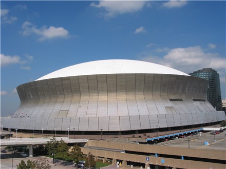
The Dome was built 30 years ago. To replicate it today, reinforced concrete and all would cost LOTS AND LOTS of money; money that municipalities nor NFL teams would be willing to come up with -- even if they thought they wanted to.
Disclaimer: Opinions posted on Free Republic are those of the individual posters and do not necessarily represent the opinion of Free Republic or its management. All materials posted herein are protected by copyright law and the exemption for fair use of copyrighted works.