|
|
Posted on 08/28/2005 5:08:20 AM PDT by ThreePuttinDude
Katrina heads for Gulf Coast at 160 mph
|
|
|
NEW ORLEANS (AP) -- Coastal residents jammed freeways and gas stations as they rushed to get out of the way of Hurricane Katrina, which was upgraded to a Category 4 storm Sunday, with sustained winds of 160 mph, the National Hurricane Center said.
The massive storm appeared headed for New Orleans and the Louisiana coast.
"Ladies and gentlemen, this is not a test. This is the real deal," New Orleans Mayor C. Ray Nagin said at a news conference. "Board up your homes, make sure you have enough medicine, make sure the car has enough gas. Do all things you normally do for a hurricane but treat this one differently because it is pointed towards New Orleans."
Katrina gained strength overnight, become a Category 4 monster with 145 mph sustained winds as it moved over the warm waters of the Gulf of Mexico early Sunday.
(Excerpt) Read more at hosted.ap.org ...
I'm assuming AP would know the scale, yet they state 160MPH and Category 4 in the same sentence? AP never gets anything right.
Related threads:
http://www.freerepublic.com/focus/f-news/1472123/posts
http://www.freerepublic.com/focus/f-news/1472187/posts
http://www.freerepublic.com/focus/f-news/1472213/posts
Live broadcast from New Orleans WWl-TV (The weather reports are awesome):
http://www.wwltv.com/perl/common/video/wmPlayer.pl?title=beloint_wwltv&props=livenoad
(Disclaimer And Copyright Statements At End Of The Discussion)
TODAY'S FUN LINK:
National Hurricane Center / Tropical Prediction Center
WEATHER SUMMARY THROUGH NEXT 72 HOURS
The 0z Aug 28 runs of the various numerical models showed a slight, but important, bend to the right in depicting the projected track of Hurricane Katrina. While the New Orleans LA metro is not "out of the woods" as yet, there are some fairly strong synoptic indicators and teleconnections which point toward a northeast, rather then due north, adjustment in the path of the hurricane. It is well agreed upon by the longer term schemes that Katrina will eventually phase with the deep upper low and trough over the Great Lakes region. To do that, the hurricane would have to move rightward to end up where the 500MB ends up, over extreme E QC on Day 5/6. This scenario eliminates a trajectory into the Ohio Valley and favors a pathway along the spine of the Appalachian Mountains. You may also note the subtropical disturbance just east of the Carolinas and Mid-Atlantic states. As this feature is booted northward by rising heights over the Western Atlantic Ocean, IcP/mTw frontogenesis should get underway from N VA into central New England. So when Katrina moves inland (yes, I still think near Panama City FL, but locations such as Mobile Al and even Biloxi MS still have sizable landfall threats), the storm will move along the path of least resistance. Which in this case should be the thermal boundary that develops about 50-100 miles to the left of the Interstate 95 corridor. But Katrina will not affect that region until Day 4.
I think it wise to go into a day-by-day breakdown of what Hurricane Katrina may do. It should be stated that changes to this forecast plan are to be expected, but we are close enough to landfall that a sort of "last call" should be in place. Given the dangerous nature of Katrina, three critical weather issues are highlighted:
Today, August 28
Coastal front sets up below Gulf shoreline while cP/mTw boundary reforms from Ouachita Plateau into middle Appalachia. Disturbance to right of Cape Hatteras NC draws in the thermal separation, setting up a transition zone along a Tyler TX....Memphis TN....Hazard KY....Winchester VA....Joppatown MD....Oxford PA....Port Jervis NY....Danbury CT....Springfield MA....Concord NH line. Katrina hits higher Category 4 status and assumes a due north motion in the central Gulf of Mexico.
Trouble spots: tropical downpours along central Gulf Coast and along Interstate 95 corridor from near Richmond VA to about Bridgeport CT. Spin up tornadoes and waterspouts in Interstate 10 communities from Slidell LA to Tallahasses FL
Monday, August 29
Katrina may reach Category 5 status or something very close, taking on a north-northeast motion over 90 F SSTs. Thunderstorms explode from Mississippi Delta vicinity into FL Panhandle and SW GA, then torrential rain gets underway and pushes inland. Katrina makes landfall just west of Panama City FL around midnight. Interstate 10 from Biloxi MS to Tallahassee FL should be avoided at all costs. Meanwhile, coastal impulses and resultant thunderstorms inundate the Interstate 95 corridor as 500MB heights rise over the Gulf of Maine, forcing energy and mTw values inland. Cooler air advances into Tennessee Valley and upper Ohio Valley and strong upper low continues eastward march through ON.
Trouble spots: About 12-15 inches of rain is likely in spots from S MS through most of FL Panhandle. Tornado and hurricane force wind damages will be devastating along and to the right of the listed track (see below). Some acceleration of the eyewall into Mobile Bay and various coastal inlets in the FL Panhandle could produce a huge surge late Monday night.
Tuesday, August 30
Katrina may mimic Hurricanes Opal (1995) and Ivan (2004) by chewing up much of N FL, AL, and GA. It appears that the introduction of energy into the hurricane from the upper trough may give the feature a somewhat sheared look while also maintaining a strong pressure and wind core. I fully expect the Atlanta GA metro to be battered by Katrina, through the "three terrors": tornadoes, winds, and flooding rains. By nightfall, the hurricane may be nearing tropical storm status while inducing overrunning rain in N GA....E TN....W NC....W SC. We should be seeing an "Interstate 85 path" on Tuesday evening.
Trouble spots: The 0z Aug 30 NAM shows a UVV signature which practically screams "tornado" in a box bounded by Gulf Shores AL....Perry FL....Toccoa GA....Carrollton GA. High vorticity and helicity measures seem to zero in on a twister event affecting Macon GA and Atlanta GA. Overrunning and/or convection could generate rainfall totals of 8-12 inches in E AL....N FL....GA....W SC....W NC....E TN. While winds will decelerate, there is an even chance that velocities could exceed hurricane force as the eye of Katrina passes into Dekalb/Cobb counties in GA. Downpours will continue to affect parts of the Northeast.
Of course, other areas in North America have important developments in sensible weather! Specifically, the string trough and cold front now edging into the Pacific Northwest will set off strong thunderstorms over the northern Rocky Mountains while drawing up a fetch of very hot (cT+mT) values through the Intermountain Region. This warm advection will accelerate downstream digging and motion, thus assuring a more rightward path for Hurricane Katrina.
Short-Range Numerical Weather Prediction Models
(red dot indicates preferred model)
______________________________________________________________________
WRF RUC NAM. NAM 06z NAM 18z NGM GFS-5 DGEX
RGEM SREF MM5 CRAS UKMET COAMPS RAMS EPS Maps
Rutgers University Forecast Model Animator
Tabular NGM and NAM FOUS Output
______________________________________________________________________
Online Weather Information Guides WW2010 Helper Section Index Weather Information Plotting/Mapping U.S. National Satellite Perspectives Next-Generation Weather Satellite Demonstration Project Canada Satellite Perspectives National Radar Summaries MesoNet Data Solar, Lunar, Astronomy Information Satellite-Derived Forecast Products Upper Air Analyses Around North America Aviation Weather Analyses And Forecasts ___________________________________________________________________________ SEVERE WEATHER OUTLOOK
Weather Calculator
COMET Case Study Library on the WWW
Climate Normals For The U.S.
Golden Gate Weather ENSO Page
Plymouth State Weather Center
Dr. Bob Hart's Coolwx.com
Infrared Visible Vapor
Hawaii Infrared Hawaii Visible
Alaska Infrared Alaska Visible Alaska Vapor
Environment Canada Satellite Image Directory
Satellite Animations And Multi-Channel Imagery
RAMSDIS ONLINE
NOAA Polar Satellite Views Around North America
Quicklook Swaths Browser
AVHRR Dynamic Tracking Windows
Milan Konecny's NOAA Satellite Views
Savannah-Weather.Com
NOAA HRPT Weather Satellite Images
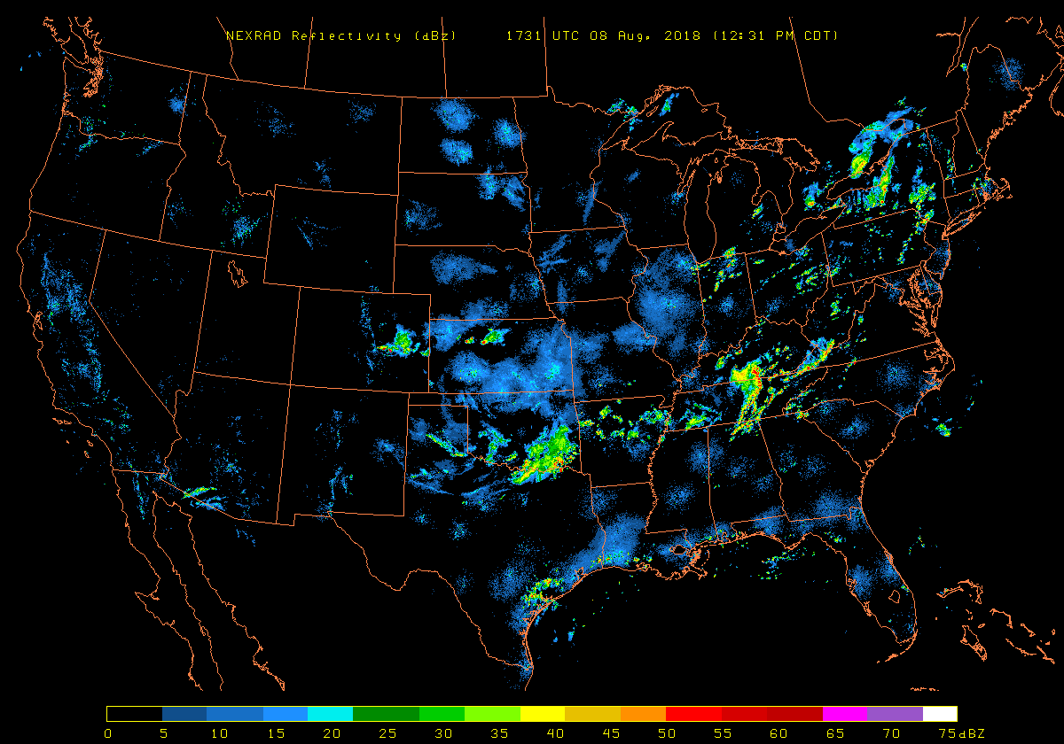
National NEXRAD Summary
Environment Canada Radar Summary
Numerical Model Temperature Forecasts
Current NWS MOS Forecast Products
Links To Current Weather Conditions
Around North America And Worldwide
Current Weather Observations
Ocean Prediction Center - Unified Surface Analysis
National Data Buoy Center
MeL: Space & Astronomy
SpaceWeather.Com
Tonight's Sky Sky & Telescope Interactive Sky Chart
Human Space Flight - NASA-TV Solar Terrestrial Activity Report
NOAA/NESDIS/ORA Forecast Products
Near Real-Time Polar Products
Upper Air Data From University Of Wyoming
Soundings from Commercial Airliners
Aviation Weather Center (AWC)
ORA Projects Page
ADDS - Turbulence
Environment Canada Aviation Products
National Soil Moisture Levels
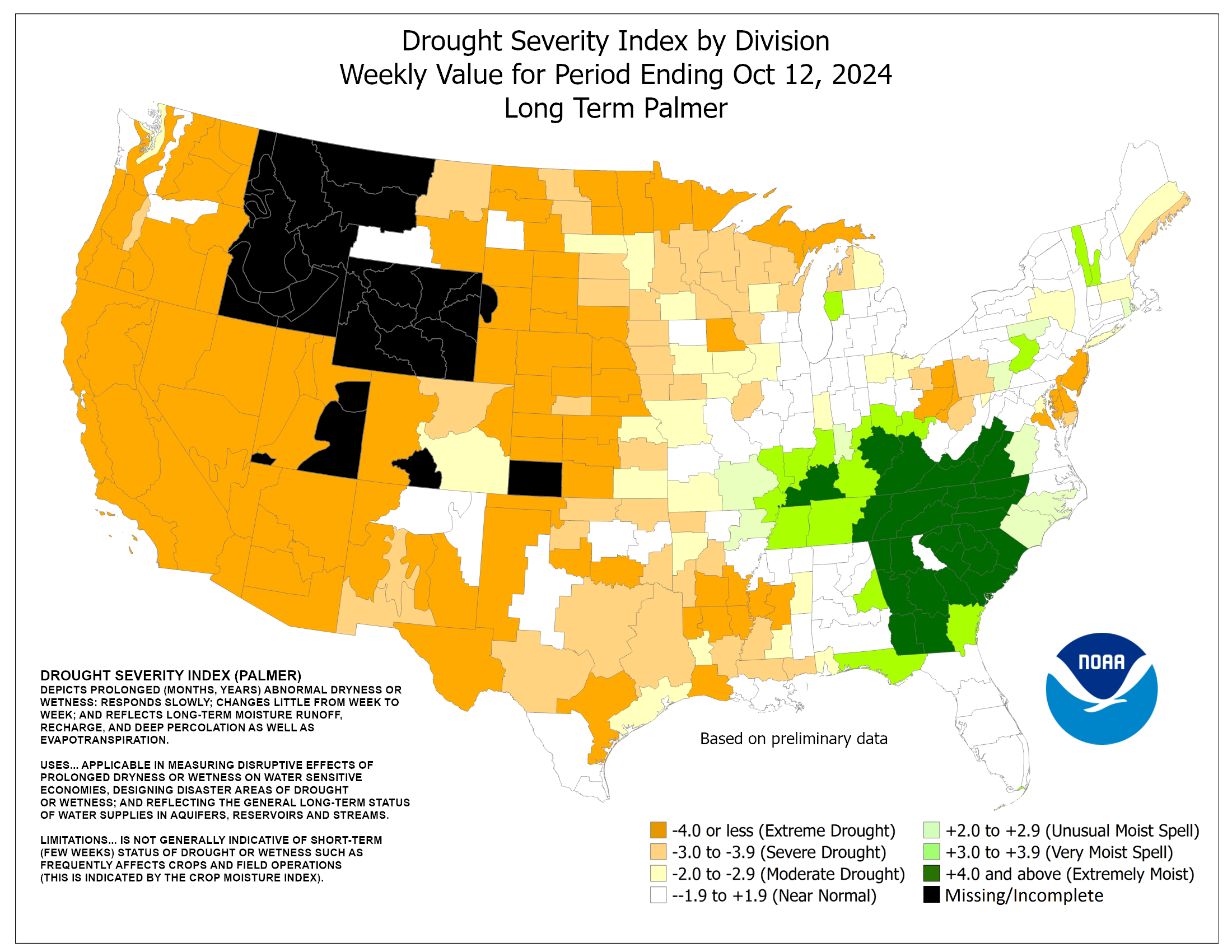
Palmer Index Map (For Soil Moisture)
Drought Monitor
(potential for tornadoes, damaging winds, and large hail within the next 24 hours)
ISOLATED Severe Thunderstorms
(Microbursts, Large Hail, Isolated Tornadoes)
E NM....W TX....OK Panhandle....W, C KS....S NE
ISOLATED Severe Thunderstorms
(Microbursts, Large Hail, Isolated Tornadoes)
BC....WA
ISOLATED Severe Thunderstorms
(Microbursts, Waterspouts, Tornadoes)
SE LA....S MS....S AL....FL....S, C GA
HEAVY RAINFALL OUTLOOK HEAT ADVISORY
(potential for an inch or more total rainfall within the next 24 hours)
Isolated Locations In
QC Eastern Townships....E NY....E PA....DE....NJ
(QPF 1-2")
Isolated Locations In
KY
(QPF 1-2")
Isolated Locations In
E NM....W TX....OK Panhandle....W, C KS....S NE
(QPF 1-2")
Scattered Locations In
SE LA....S MS....S AL....FL....S, C GA
(QPF 1-4")
Isolated Locations In
BC....WA
(QPF 1-2")
(potential for daily maximum temperature exceeding 95 F)
Scattered Locations In
Interior CA....SE OR....S ID....W, C MT....WY....UT....CO....NM....AZ....NV
______________________________________________________________________
IPS Meteostar Regional Radar Summaries
Northeast Southeast North Central
South Central Northwest Southwest
Useful Television Station And Commercial
Doppler Radar Sites
WeatherMatrix Radar Supersite : TV Radars
Doppler Radar Images From Government Sources
National Weather Service Doppler Radars
Environment Canada Doppler Radars
Experimental Radar Images From The National Weather Service
National Lightning Detection Map
Vaisala Lightning Explorer Environment Canada Lightning Map
Local Lightning Detection Sites
_____________________________________________________________WA Woodinville
NV Las Vegas
BC Cranbrook
AB Edmonton
WY Laramie
UT Oakley
OK Norman
KS Great Bend
NE Lincoln
LA Monroe
QC La Salle
ME Topsham
RI Charlestown
WV Barrackville
SC Greenville
BARBADOS Worthing VIRGIN ISLANDS St. Croix
_____________________________________________________________
Media Resources, Online Mapping And Travel Aids
Kevin Brewster Storm Spotting Frequencies Page MEDIUM RANGE OUTLOOK The disturbance now seen on satellite imagery over western Canada will dig southeastward into the Great Lakes, helping to accelerate the Katrina remnants and the upper low in QC and LBR. A weakness or 500MB trough will become aligned close to 80 W Longitude, between the reforming Sonoran and Bermudan heat ridges. Two areas of concern for thunderstorms are along the northern tier states, as impulses in the semizonal flow close to the International Border trigger convection along the upper rim of the hot air dominating the U.S. between the West Coast and Mississippi River. The Northeast and Maritime provinces also must be monitored, as very warm and unstable air comes into contact with waves along the weak IcP/mT front likely to set up from VA into extreme E QC. Note also that some risk exists for a tropical feature to get caught up in the flow (much like that during the near term), especially after September 2. Medium Range Numerical Weather Prediction Models GFS GFS 06z GFS 18z UKMETx ECMWF. NOGAPS GGEM MM5x KMA DAVA RSM JMA CPTEC GBL Ensembles
TV Station Web Page Directory
Radio-Locator
National Traffic and Road Closure Information
MapQuest Maporama
Microsoft TerraServer Google Earth
The National Atlas of the United States of America
Where On Earth - Latitude Longitude Finder
Map-It - A GMT3 Map Generator
(weather trends through the next 6 to 10 days)
As a first matter, we should look at the Days 4 and 5 effects of Katrina. A track up the spine of the Appalachian Mountains (or perhaps a shade to the right) appears likely at this point, with the hurricane remnants become wrapped up with the cP low over the Gulf of St. Lawrence by Friday. Since there will be a full phase of the warm-core system with the extratropical low and front, the Katrina-related low center may actually undergo an intensification phase as it passes through the Northeast later this week. Overrunning and orographic lifting may help to produce rainfall totals as high as 4-8 inches in parts of W SC....W, C NC....W VA....E WV....W, C MD....C, E PA....NW NJ....E NY....NW CT....W, C MA....S VT....NH....W ME. The mainly convective rain shield immediately to the right of the hurricane vestiges could see as much as 2-4 inches of water. Severe weather (principally spin-up tornadoes and microbursts) will be a consideration along much of the Interstate 95 corridor on Wednesday into Thursday.
(red dot indicates preferred model)
______________________________________________________________________
NCEP AVN-GFS Ensembles NOGAPS Ensembles
Medium Range NWP Verification Statistics
______________________________________________________________________
Worldwide and International Satellite Images
Earth Viewer: View Any Location from Any Satellite
______________________________________________________
GOES 12 (The Americas, Atlantic Ocean)
Visible Infrared Vapor
______________________________________________________
GOES 10 (Eastern Pacific Ocean)
Visible Infrared Vapor
______________________________________________________
GMS 5 (Asia, Australia, Pacific Ocean)
Visible Infrared Vapor
______________________________________________________
METEOSAT 5 (Central Asia)
Visible Infrared Vapor
______________________________________________________
METEOSAT 7 (Europe And Africa)
Visible Infrared Vapor
______________________________________________________
Arctic Sea
Europe Infrared Europe Visible Europe Vapor
Russia The Middle East The Orient India
Australia New Zealand South America Africa
Antarctica
______________________________________________________________________
International Weather Radar Sites
WeatherMatrix Radar Supersite : World Radar Data
Domestic And International Weather Cameras
EarthCam - Webcam Network
TROPICAL WEATHER OUTLOOK
(systems to watch in the lower latitudes in and near North America)
A 500MB trough over the Azores is breaking up ITCZ impulses over western Africa. But one disturbance is developing rapidly over the Equatorial Eastern Atlantic Ocean. This system is nearing depression status, and must be watched carefully as the strengthening Bermuda High may act as a steering mechanism and aim the formative storm at the northeastern U.S. in about 6 or 7 days.
Satellite Images Of Individual Tropical Systems
NRL Monterey Tropical Cyclone Page QuikSCAT
Satellite Images Of Tropical Regions
GHCC - Interactive GOES-8 Infrared Hurricane Sector
Atlantic Basin Satellite Services Division - Tropical Atlantic Satellite Imagery
Mexico And Pacific Coastal Waters
Central Pacific Ocean
Oceania And Tropical Western Pacific Ocean
Indian Ocean
Tropical Forecast Models And Analyses
Experimental Tropical Cyclone Formation Probability Product
CIMSS Atlantic Basin System NHC Models
Experimental Forecast Tropical Cyclone Genesis Potential Fields
Sea Surface Temperatures
NODC Coastal Water Temperature Guide
Great Lakes Sea Grant Coastwatch Homepage
NCODA Sea Surface Temperatures
NCODA Sea Surface Temperature Anomaly
NCODA Sea Surface Temperature Climatology
Marine Weather Information
WWW Tide/Current Predictor - Site Selection
Office of Coast Survey - Home - Nautical Charts
Regional Ocean Forecast System (ROFS)
NOAA/NCEP WAM Global Swell Data
Environment Canada Ocean Wave Forecasts
NOAA WAVEWATCH III Wave Models (interactive)
Great Lakes Water Levels
Prepared by Meteorologist LARRY COSGROVE on
August 28, 2005 at 4:55 A.M. ET
Disclaimer:
The previous statements are my opinions only, and should not be construed as definitive fact. Links provided on this newsletter are not affiliated with WEATHERAmerica and the publisher is not responsible for content posted or associated with those sites.
Copyright 2005 by Larry Cosgrove
All rights reserved.
This publication may not be reproduced or redistributed in whole or in part without the expressed written consent of the author.
Hey, this has nothing to do with their "agenda for change" so I doubt they know anything more than they get over the wire or read off the teleprompter.

Impressive in a "HOLY SH!T, IT'S COMING RIGHT FOR US WE'RE ALL GONNA DIE!" kind of way..
19 28/0300Z 25.0N/86.2W 115 140 WNW 7 939 Hrricn
20 28/0600Z 25.1N/86.8W 145 175 WNW 8 935 Hrricn
21 28/0900Z 25.4N/87.4W 145 175 WNW 10 935 Hrricn
22 28/1200Z 25.7N/87.7W 160 195 WNW 12 908 Hrricn
I have been in the eye of a cat 3 hurricane. It is like being in the rage of God. And that one was a minimum cat 3 at that.
They left home at 4am and are on the road headed north to Marksville.
One fellow is an offshore rig operator.
He's done this move before.
If I was there I would be headed west or east, not north still in the projected path of the storm.
Actually, best direction is northwest. East VERY BAD---NOT SMART. From the last map I saw, Marksville is on the very western edge of the possible path, and probably safe enough. Personally, I'd head for Shreveport, but these folks probably are heading to "roost with kin".
Katrina and the waves . . . . They won't be walkin' on sunshine.
Prayers from TX.
Just returned from Shreveport. Every hotel is full, room rates at the Fairfield Inn are now $204 per night. Must be some rule that allows them to get around anti-gouging laws.
Of course, Shreveport has little in common with N.O., so the city fathers may have decided that gouging the Cajuns is A-OK.
You should read the update...Katrina is making a bead on New Orleans
I read something on a hurricane hitting New Orleans a few years ago. The article indicated that if something worst case happened, like what we're seeing now, the city would be under 20 feet of water for something like 6 months. And this water is highly contaminated with sewage and fuel, with a high probability of fires. In other words, New Orleans will be pretty much destroyed. Anyone else hearing this?
Also, this has got to impact oil prices in a bad way.
God Bless all of you in the way, get out and stay safe.
Does anyone know what the tide is for midnight tonight at NO? Obviously high tide is the worst case possible.
Disclaimer: Opinions posted on Free Republic are those of the individual posters and do not necessarily represent the opinion of Free Republic or its management. All materials posted herein are protected by copyright law and the exemption for fair use of copyrighted works.