Skip to comments.
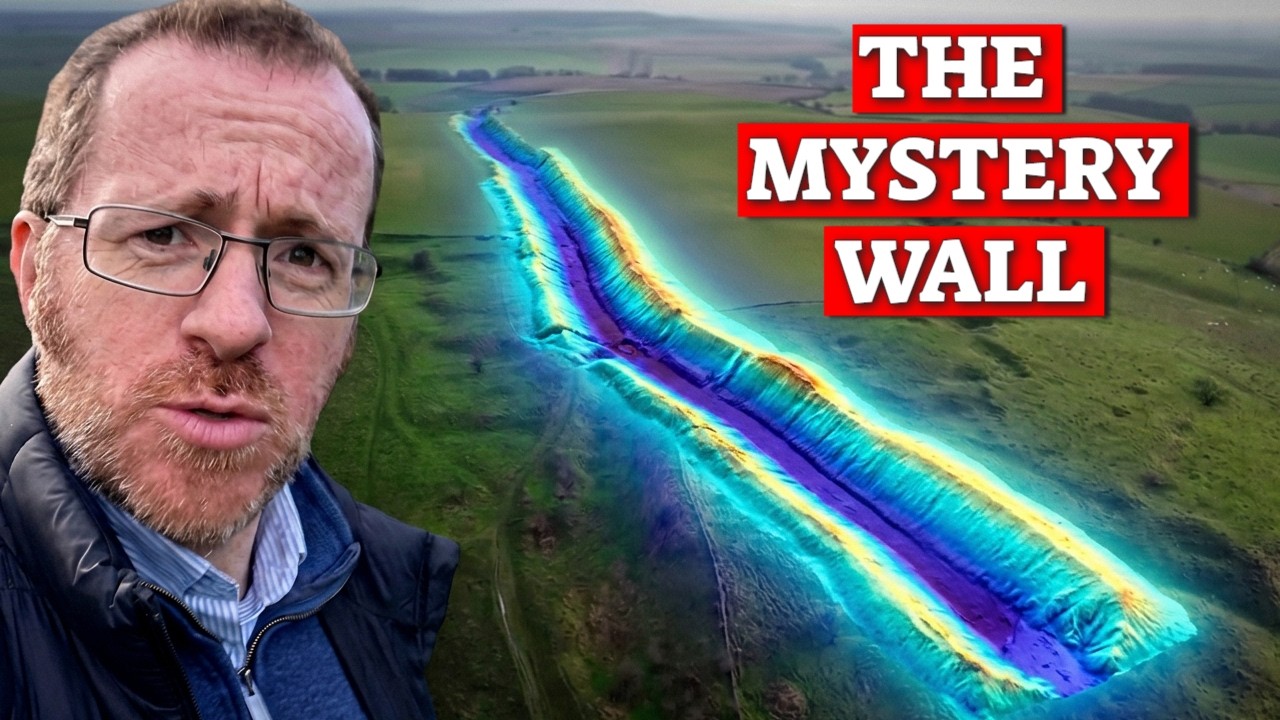
Why Is There a Wall Across Southern England? [18:22]
YouTube ^
| November 8, 2026
| Paul Whitewick
Posted on 11/18/2026 9:42:20 PM PST by SunkenCiv
For years now I have know about a few seperate Bank and ditch systems that run through Southern England, north to south... I have never considered them as one. BUT.. it turns out 200 years ago they were. Join us as we try and piece this together. Why Is There a Wall Across Southern England? | 18:22
Paul Whitewick | 275K subscribers | 160,655 views | November 8, 2026
(Excerpt) Read more at youtube.com ...
TOPICS: History; Science; Travel
KEYWORDS: godsgravesglyphs; paulwhitewick; wansdyke
Chapters to follow:
00:00 - A New Ditch
05:02 - The End that would not End
10:58 - New Wall
15:52 - What Is it?
YouTube transcript reformatted at textformatter.ai *may* follow. It's back! For now. Did some touch-ups on spelling, but the YT transcript placenames and such may be a mess.
1
posted on
11/18/2026 9:42:20 PM PST
by
SunkenCiv
To: StayAt HomeMother; Ernest_at_the_Beach; 1ofmanyfree; 21twelve; 24Karet; 2ndDivisionVet; 31R1O; ...
2
posted on
11/18/2026 9:42:58 PM PST
by
SunkenCiv
(TDS -- it's not just for DNC shills and jihadists anymore -- oh, wait, yeah it is.)
Transcript
Chapter 1: A New Ditch
Okay, I think I’ve just found a wall, so think offers dyke the Antonine Wall. That kind of huge border wall. I think we’ve missed this. And I think potentially this could hold a lot of significance towards Britain’s history. We’re here now near Marlborough, maybe three or four miles in that direction. And this heads towards the south coast, potentially for 25–30 miles.
Well, when I first started looking into this to see if I was the only one that had talked about this, well, of course not. In fact, as far back as 200 years ago. So Richard Colt Hoare rode this entire length of this linear ditch, and he said it went all the way down to Cholderton and beyond. He said it was one long, continuous, unbroken defensive ditch. So who exactly would build such a grand wall here? Is it defensive? Maybe against the Romans, the Saxons and Normans, part of a medieval frontier of some kind.
So I started digging. I drew maps. I visited numerous locations of this huge earthwork. I consulted the LIDAR at length, and importantly, what people have said about this 200 years ago. This was quite the journey, one that I researched and wrote a 10-page script for. When I came out on the ground and started looking at this thing, well, I may as well have just chucked that away.
First of all, I need to show you a drawing in a book. Now, if I lower the book, there we go. Well, that, that is, that’s that, that’s the image that this person drew in the book. But there’s something drastically wrong with it. Let’s go and take a look.
Now, when I can find a decent opening, I’m going to invite you to climb inside this hedge with me to show you what’s inside. It’s quite mad. In here is a huge bank and ditch. And when I say huge, I mean at least 6 m in places. But this gets even stranger when we look at the maps. In fact, this map from the late 1800s clearly states Wansdyke.
Now, Wansdyke is probably an early medieval linear defensive earthwork dividing Wessex in the south from Mercia to its north. It stretches from Bath in the west all the way to Savernake Forest, right across southern Britain. Just climb down inside it. Well, here we’re about two or three miles east of the end of Wansdyke. And what’s more, well, this runs north–south. In fact, that way is directly south.
So, as it turns out, not only would I be going on a physical journey of about 30 mi in that direction towards the south coast, but also, the more I learned about this, the more I think we’ve missed something significant from the Dark Ages. So before we start chasing this down towards the south coast from here to see what we can find, well, first of all, we need to understand exactly what we’re looking for.
Now, just up ahead of me is a feature called Wansdyke. And when you stand next to that bank and ditch, it’s enormous. And yet something not many outside of archaeology have heard of, despite probably driving past it numerous times, is a huge defensive bank and ditch stretching from Bath across southern Britain to just here, south of Marlborough. Now, in places, Wansdyke can be sort of 30 to 40 m across and up to 10 m deep in places. Somebody organized a frankly ridiculous amount of labor to get this built, and they did it for very good reason.
Now, we understand at the moment Wansdyke to be early medieval. There’s a paper coming out soon, so watch this space. Now, traditionally, it’s been interpreted as some kind of frontier associated with Wessex and Mercia. Now, we’re pretty confident this wasn’t simply about stopping people. Perhaps it was about controlling them: who crosses the boundary, where they cross it, and potentially what they’re carrying with them.
One site can also tell us something else really useful. Now, I’m just climbing up the bank on its southern side here. And, uh, down below me there, you can’t see much because there’s vegetation about a meter and a half deep, but I’m now probably about 4 m above that ditch in front of me. And as I said, importantly, I’m on the southern side. So that tells us that the people to the south there were very much concerned with what was happening on the north side, enough to build this monumental earthwork. The bank is here on the south. The ditch is on the north.
Now remember that; that’ll become useful very soon because much later on we’re going to need it. But for now, follow Wansdyke across Wiltshire, and eventually you approach Savernake Forest. Well, before we get there, about half a mile from here, Wansdyke just stops. At least, that’s what we tell ourselves today.
Now, I’ll carry on with why Wansdyke is crucial very shortly. But in the meantime, I’ve started making a map of my north–south ditch using some Richard account and searching on the ground. We’ll dip in and out every so often. I’ll even play you this funky music so you know when.
Well, I was just looking for the column section of what Sir Richard described as Wansdyke here, and I’ve just come across this. Now, this is a huge bank and ditch. There are a couple in this field, which is odd. It runs in the right direction. Um, we are west-facing, oddly. Now, I know this isn’t the one. I don’t think this is the one that Sir Richard found because I think that’s about a kilometer across the valley on the top of that hill. So seeing this huge earthwork right here is a little bit odd. Now, as I say, the end of Wansdyke officially is half a mile in that direction.
3
posted on
11/18/2026 10:00:34 PM PST
by
SunkenCiv
(TDS -- it's not just for DNC shills and jihadists anymore -- oh, wait, yeah it is.)
Chapter 2: The End that Would Not End
And now, that’s not just an arbitrary ending point which archaeologists just came up with. Throughout the 19th and 20th century, there were repeated sort of surveys and digs trying to understand exactly which way it would have carried on. And eventually, the conclusion was fairly clear: it didn’t. So since that point, new buildings have been labeled the end of Wansdyke.
But there is a bit of a problem with that whole notion because for the last 200 years people have continued to find things to the east of that. The old maps contain sporadic mentions of Wansdyke both east and south of here, miles beyond where it’s supposed to end. Now, some of those almost certainly aren’t Wansdyke, and perhaps maybe none of them are Wansdyke, but throughout that sort of antiquarian era, antiquarians were trying to make sense of the landscape. They were trying to make sense of this Wansdyke, this ditch. It traveled across the country, and there was one in particular who was perhaps a little bit more obsessed than anyone else.
So Richard, in the 19th century, Sir Richard traveled across Wiltshire recording ancient monuments, and he became convinced that Wansdyke continued. So here’s where things get interesting for us today because Sir Richard Colt Hoare didn’t just grab a map and guess where it went. He claimed he followed it. He described a bank and ditch running from Bedwyn area through Braydonwood, across Shalbourne, down past Collingbourne, across Chute Down, and all the way to Park House near Charlton. Well, that’s miles. And secondly, that’s not towards the east. That’s definitely towards the south.
Now, Sir Richard sketches this, and he tells us where it’s really visible. And he tells us where cultivation has damaged it to a degree. And then he just continues further on with this. So back to where we started, the huge bank and ditch in the hedge, the piece of art in that book. Well, this was all seen as part of the Wansdyke system by Sir Richard and others, even though it went north–south.
If Sir Richard really did follow this for two centuries before the vast majority of plowing took place and destroyed significant sections of it, then it really doesn’t matter what it’s called. The point of this is we have a significant monumental earthwork traveling from here that way south for 25 or 30 mi. What a great linear earthwork this is. I’m in the ditch. We’ve got no counterscarp here whatsoever, just the bank.
And of course, there is potentially one other reason why we should take Sir Richard’s account of this linear earthwork seriously, because was he the first person to write about this? Well, it turns out he wasn’t. Try a thousand years before him. Someone wrote something down in 778 AD. Now, after we’ve looked at that, we’re going to come back to the map because there’s something at the southern end of Sir Richard Colt Hoare’s route that he doesn’t mention, and that’s where this wall comes into its own.
Right. So, we have a ditch in front of me, and we have behind it there, we have a bank probably a couple of meters high. Okay, whilst I waffle away there and get myself confused, let’s voice this instead because this is the southern end of Sir Richard Colt Hoare’s north–south wall. He said it ended here, Park House, Cholderton. And we have two or three significant observations here.
Number one, this is facing west. Now, that’s the same as the three others that I found so far on this north–south wall. They all face west. And secondly, it also looks over a valley to the west. The position of this is similar to the others as well. But get a load of this. This was the southern end, as I suggested, of the route that Sir Richard found. But if I head further south, look at this. It carries on for quite some distance. Well, again, we’ve got the bank on this side, on the eastern side, and we’ve got the ditch and the slope down here on the western side.
So, in 778 AD, more than a thousand years before Sir Richard Colt Hoare would ride through this land, well, the king of Wessex at the time, Cynewulf, granted a chunk of land at Little Bedwyn to a man called Bica. Now, miraculously, that document still survives. It’s known as Charter 264. It’s a grant of land. Now, we’re not interested in the land itself. We’re interested in the border on the outside. There are no maps. Instead, it literally walks us around the landscape: follow this valley, go to the gate, along this boundary, past this enclosure, and then it says something really interesting. Valum, an earthwork, and then it does it again. And then later, one more. Three separate references in 778 AD used to describe how the landscape looked here.
And what’s really weird about this is it never at one point refers to them as Wansdyke or not even Bedwyn Dyke. In fact, it doesn’t really seem to care what this is called at all. It just refers to them as Vallum. Now, when we see Wansdyke in other charters back where Wansdyke is, what it’s called Wansdyke or Woden’s Dyke or Woden’s Ditch or many variations of, we do have a few clues in there which we can interpret. One of which is Putton Healh. Now, that’s been interpreted as Putin Farm today. So that still survives today. But it’s up on the northwest of this map. Not really helpful for our wall marked here in black. But as I mentioned, we have two other valla in this charter.
Firstly, another near Baldwin’s Heath. We’re not sure exactly where that is, but importantly for us, Harendine, now interpreted as Harding Farm, and this sits exactly on the alignment of our wall. So now we have a recorded note of this wall in 778, which gives us the last possible construction date. So was this earthwork part of one that we discussed earlier? Are they just sort of separate individual sort of boundaries that we’re seeing instead? We don’t know. But remember what Colt Hoare claimed to have followed through here more than a thousand years later. I promise you we’d go back to his map. And there’s something Sir Richard apparently didn’t notice. Yep. As we found earlier, this goes further south than Sir Richard Cult recorded at Park House. This is Colt Hoare’s route.
4
posted on
11/18/2026 10:00:54 PM PST
by
SunkenCiv
(TDS -- it's not just for DNC shills and jihadists anymore -- oh, wait, yeah it is.)
Chapter 3: New Wall
He claims to have followed this enormous bank and ditch from Bedwin landscape through Shelbourne, Colenborn, Chute, and eventually down to Park House near Chelertton, and that’s where the horse stops. We have another substantial earthwork running across the landscape at Qually Hill, and it keeps heading south. And then we enter Port and down, which is really useful because this area hasn’t been touched for decades, and once again, earthworks.
Now, this is where I sat staring at this map for quite a while. Because now we’re not just talking about a ditch near Bedwin, albeit quite a sizable one. We’re looking at a corridor of earthworks stretching nearly 30 miles across southern England, predominantly north-south.
Okay, time for a windy warning and a caveat. Now, I’m not suggesting that we have definitely found a 30m linear structure, a defensive earthwork. We could be joining up gaps. We could be making things that aren’t the same age sort of appear like they are one age and not necessarily contemporary with one another. They could be hundreds of years apart, thousands of years apart. Look at that. And drawing a line between them on a map proves precisely nothing. The most important thing for me is Sir Richard Colt Hall rode this on horseback, and he said it was one long linear structure. We mustn’t forget that. And this was, of course, long before the plow tore up much of the landscape and the antiquities that went with it.
And here we are now. I am in now what is a significant part of this ditch. And I am probably, uh, 3 m deep below the bank, which is just up here. And, uh, yeah, this would have now be full of all sorts of detritus, leaves, soils, you name it. So this would have been deeper. This is much more akin to the Wansdyke. Or maybe, if I could find similar relationships with all of these earthworks that go from Bedwin down to Lockham Corner — things like the depth, the scale, the way it’s facing, the way it was built, the counter scarp, all those different things — well, maybe then we can piece together something really important about why these were built. If they are part of the same earthwork, one huge, enormous linear structure, or if they are indeed just separate individual, uh, earthworks in their own right.
Right, found it. So, uh, yeah, if I come down here into the ditch, we’ve got the bank there. We got the ditch here in front. And, uh, yeah, again, we’re talking about a meter, meter and a half maybe. Here’s another bit. This is a good cross-section, actually. If I’m here, if I get down here, you can see the bank there and the ditch that I’m in. Now, again, we’re not really talking anything sizable. If we are in any way defensive, and I don’t believe we are at this stage, then we’re facing west. So, we’re protecting ourselves on the east from whatever is on the west. Don’t think this has been plowed at all. Got some very old trees. Is this really what Richard Cult said was very similar to ones like and took this long route? There are no other earthworks in this vicinity that go the north-south route. So, it must be. We’re just not quite seeing what’s a Sir Richard Colt Hoare did.
Okay, let’s get back in the ditch here at Colon Woods. I’ve now had the opportunity to see at least two, three, four other bits of this linear earthwork which I seem to have joined, uh, together. Now, when I wrote the script for this, I absolutely assumed these would not really join together. They’d be from different eras. Some would be medieval, some would be Bronze Age, maybe late Iron Age, sort of linear defining earthworks. Here’s my script to prove that. That was my conclusion, pretty much. But now I’ve had that opportunity to have a look at these in detail. All of these on the southern section contain a few strikingly similar details. Number one, they all face west. They are defending what was on the east if they are indeed defensive. And the other thing, we find them all at the top of a hill looking over a valley as if we’re defending across that valley. Now, sure, we could be looking at linear boundaries like the Grims ditches of the world, late Bronze Age, early Iron Age, but we have this one long, continuous, like 30 mile linear structure with some very, very similar features. We need to dig deeper.
Okay, so there is a fairly big problem with everything I’ve just talked about in this video because what if this dyke here, the Bedwin dyke, and onward South wasn’t a wall at all? Because archaeologist Ben Lennon, well, he kind of disagrees with that entire theory. He argues that the surviving pieces we see today here, Bedwin, Colinborn, or all in between weren’t part of a continuous wall at all. He argued they could be a series of cross valley dikes. Now, I disagree with this. Firstly, I couldn’t see the southern dyke on LIDAR or in person on his map here, but more importantly, we see ditches like these near hill fors very often, but never this deep, which tells me it’s been repurposed.
5
posted on
11/18/2026 10:01:35 PM PST
by
SunkenCiv
(TDS -- it's not just for DNC shills and jihadists anymore -- oh, wait, yeah it is.)
Chapter 4: What Is it?
So, where exactly does that leave us? Well, I don’t think that our north-south line for starters is actually one at all. I don’t think so. Richard was correct in his assumption for a number of different reasons. Now, we have looked at the end of the ones like here in the east, and we’ve looked at new buildings. We’ve scoured and surveyed beyond it, and no one has come up with anything. Modern archaeology says that is where it ends. Then there’s our charter from 778, and it describes earthworks around Bedwin, but it doesn’t call them Wansdyke. It doesn’t really call them anything. They’re simply features in the landscape which are already old enough or at least obvious enough to be used as boundary markers.
Well, then perhaps there’s the biggest problem of all. Why would Wansdyke just take an immediate turn to the south? If Wansdyke really was protecting Wessex and its borders and monitoring trade, well then effectively you’d be cutting out a significant part of Wessex, including places like Winchester. That bit doesn’t add up. So, if this isn’t Wansdyke, exactly what is it? And are we looking at one structure?
Okay, so we’re near the end of the video, and I’ve filmed a conclusion like 20 times now out on site. That’s that’s the video there. That’s me saying the conclusion, and I’m not happy with what I’ve said. So, we’re going to give it one more go here in the edit room in person.
So, number one, I’ve known about these individual earthworks in their own individual right for a long time now. And I just assumed they were sort of late Bronze Age, early Iron Age, you know, linear boundaries and demarcating the land. We’ve seen a lot of those in the Grim’s Ditch kind of forms, but that was until I mapped them and I drew them all on one continuous map. And now you can see why I’m thinking, do we have one long structure here? We do still have gaps, but don’t forget we have Sir Richard who I don’t think saw many gaps at all, and he rode that one long monument with a bank and a ditch. Add to that the landscape itself. Well, we have them all facing the west with a bank on the east, and we have them all with a wonderful view looking over a valley or a something with a great view and a good vantage point. So, I’m still not convinced. I really don’t know.
So the question now is over to you. Leave a comment below. What do you think? Are we looking at one long, continuous structure or are we looking at separate individual more enclosure type structures? I’d love to know your thoughts. Click subscribe. I’ve been Paul, and we’ll see you this time next week.
6
posted on
11/18/2026 10:01:58 PM PST
by
SunkenCiv
(TDS -- it's not just for DNC shills and jihadists anymore -- oh, wait, yeah it is.)
Disclaimer:
Opinions posted on Free Republic are those of the individual
posters and do not necessarily represent the opinion of Free Republic or its
management. All materials posted herein are protected by copyright law and the
exemption for fair use of copyrighted works.
FreeRepublic.com is powered by software copyright 2000-2008 John Robinson

