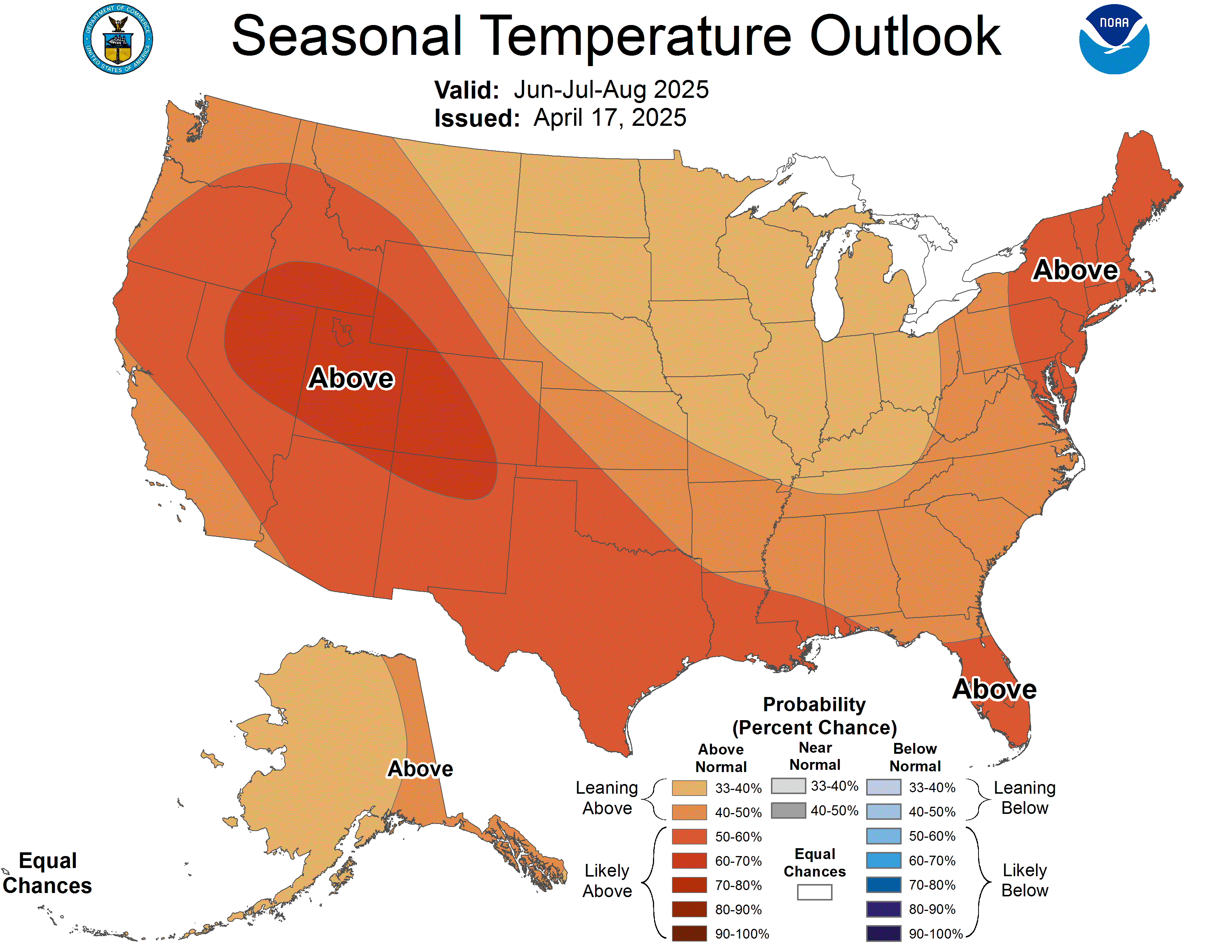
The NOAA statesthat "No part of the U.S. is favored to have below-average temperatures this winter," and instead predicts, "Winter Outlook: Warmer than average for many, wetter in the North Drought improvement expected in the Southeast.
The greatest likelihood for warmer-than-normal conditions are in Alaska and Hawaii, with more modest probabilities for above-average temperatures spanning large parts of the remaining lower 48 from the West across the South and up the eastern seaboard.
The Northern Plains, Upper Mississippi Valley, and the western Great Lakes have equal chances for below-, near- or above-average temperatures.

Abnormally dry conditions are present across much of the Southern U.S., with areas of the most severe drought in the Four Corners region of the Southwest, central Texas and parts of the Southeast.
Drought development is expected to occur in parts of central California. https://www.noaa.gov/media-release/winter-outlook-warmer-than-average-for-many-wetter-in-north
Here was the 3.5 prediction from the NOAA in August 15 for Sept. thru Nov.:
![off04_temp[1]](https://live.staticflickr.com/65535/48629210523_ffa208e7e3_z.jpg) " alt="" border="0">
" alt="" border="0">
And the very extended forecast made at that time:
![t[1]](https://live.staticflickr.com/65535/48657654668_c54549ceaa_b.jpg) " alt="" border="0">
" alt="" border="0">
AccuWeather likewise predicted on Oct. 24,
Despite a few cold spells across the Northeast during autumn, winter’s chill won’t arrive until at least the end of 2019.
Northeast
AccuWeather Expert Long-Range Forecaster Paul Pastelok said, “I think you’re going to see a touch of winter come in in December. But I think its full force will hold out until after the new year.”
Once the wintry weather does get underway, an active season will be in store.
“Whether or not it’s snowstorms, ice storms or mixed events, I do feel this is going to be an active year for the Northeast,” he said. Above-normal snowfall could be in store for areas from New York City to Boston.

Southeast
While the Northeast braces for snow and cold, the Southeast is more likely to experience a wet couple of months.
Water temperatures from the Gulf of Mexico to the Southeast and mid-Atlantic coasts are running higher than normal, Pastelok said.
As storms move into the east early on in the season, the warm water could generate a significant amount of rain.
North/Central Plains and Midwest
Last January the polar vortex unleashed a record cold snap across much of the U.S., but at least for the first part of winter, the polar vortex isn’t expected to make a debut, according to Pastelok...
Instead, cold air that could reach the Midwest at times early in the season is likely to originate from a Siberian Connection, rather than straight from the North Pole, and that has implications on just how cold it will get.
However, conditions may change and allow the polar vortex and accompanying Arctic air to bust loose later during the winter, he said.
Pastelok predicts near- to below-normal snowfall across the northern Plains, with near- to above-normal totals in the central Plains...
Southwest and California
A cool, unsettled pattern is in store for the Southwest and California this season.
“At times, these areas could also have back-and-forth conditions, between some periods of dry weather and some active weather in the early winter, which is not really typical,” he said.
In California, the winter will yield enough precipitation to stave off drought conditions into the spring. More at link: https://www.accuweather.com/en/weather-news/accuweathers-2019-2020-us-winter-forecast/592125
Of course the Old Farmer’s Almanac is part of the collection of weather predictions, which states
In the U.S., prepare to shiver with below-normal winter temperatures from the Heartland westward to the Pacific and in the Desert Southwest, Pacific Southwest, and Hawaii but above normal winter temperatures elsewhere. The cold will continue through Valentine’s Day—providing the perfect excuse to stay indoors and snuggle! But be warned: Winter will not be over yet!
For some parts of the country, frigid and frosty conditions will last well into spring, bringing little relief to the winter-weary. “This could feel like the never-ending winter, particularly in the Midwest and east to the Ohio Valley and Appalachians, where wintery weather will last well into March and even through the first days of spring,” says Almanac editor Janice Stillman.
Finally we have some commentary from FITSNews:
Frigid Winter On Tap For 2020
How will it fit into the debate over climate change?
“So ubiquitous is the belief in man-made global warming (a.k.a. anthropogenic climate change) that to speak so much as a syllable against it is to open oneself up to hostility and ridicule,” we wrote in a post two years ago. “Climate change ‘deniers’ in our society are derided as tin foil hat-wearing troglodytes, unenlightened rubes with no business participating in the marketplace of ideas.”..
Irrespective of what the data may suggest …
We also believe it is important to maintain a healthy skepticism of those seeking to make acceptance of their views compulsory. Especially when they want to make you pick up the check....
Yet as these definitive, increasingly dire pronouncements of a warming globe are being made by various governmental entities … forecasters are calling for a brutally cold winter in 2019-2020. One author, Michael Snyder of TMIN, is predicting a “catastrophically cold winter” – one caused in part by the sun entering a so-called “grand minimum” (a.k.a. “solar minimum”) phase.