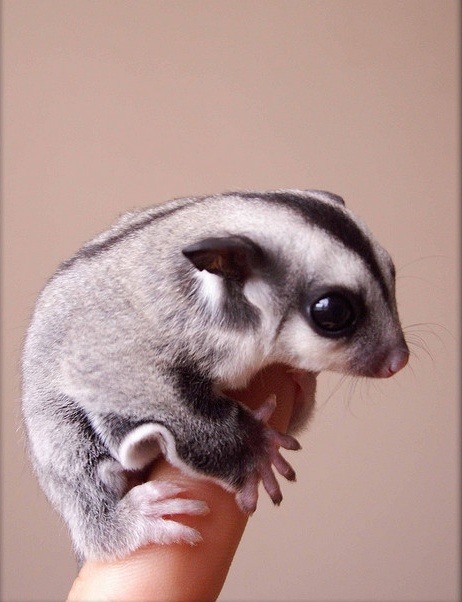
 Baby sugar-glider. Australia has a large number of small marsupials. The cutie I posted wasn't identified. Feral cats are a problem.
Posted on 11/08/2017 9:13:17 AM PST by BenLurkin
A rare map of Australia from the 17th century —before Europeans had fully explored the continent —resurfaced after 350 years. Now, it's finally been restored and put on public display in Australia's capital, Canberra.
Dutch cartographer Joan Blaeu created the map called "Archipelagus Orientalis," or "Eastern Archipelago," in 1659. (This newfound copy was printed in 1663.)
Much of the eastern coastline of the continent is missing in this vision of Australia. But the map is notable for including the earliest details of the sighting of Tasmania by the seafarer Abel Tasman, who planted a Dutch flag on the island during his expedition aboard the Zeehaen in 1642.
...
The delicate map measures more than 5 feet (1.5 meters) in width. It has letter-pressed text around the outside telling the story of Tasman's voyages. The map had been printed on paper and mounted on cloth, and some pieces were cracking, flaking off or missing when it resurfaced. It required years of conservation work before it was ready for display.
The map is believed to have gone into storage in Sweden in 1950, when the antiquarian bookseller who owned it went out of business, according to news.com.au. But not much is known about the map's whereabouts before then.
(Excerpt) Read more at livescience.com ...
What p[ray tell is that cutie? A mouse or a miniature wombat?
Baby sugar-glider. Australia has a large number of small marsupials. The cutie I posted wasn't identified. Feral cats are a problem.
Looks like a glider, like a flying squirrel.
We have feral cats here too,but they do not survive the winters. The racoons clean up most of them in the fall.

But then, so do the million camels, countless wild pigs, wild dogs, foxes etc.
That one is HUGE.
Amazingly rich environment there for animals!
Disclaimer: Opinions posted on Free Republic are those of the individual posters and do not necessarily represent the opinion of Free Republic or its management. All materials posted herein are protected by copyright law and the exemption for fair use of copyrighted works.