Operation Roi Recovery assesses damages to Kwajalein Atoll infrastructure
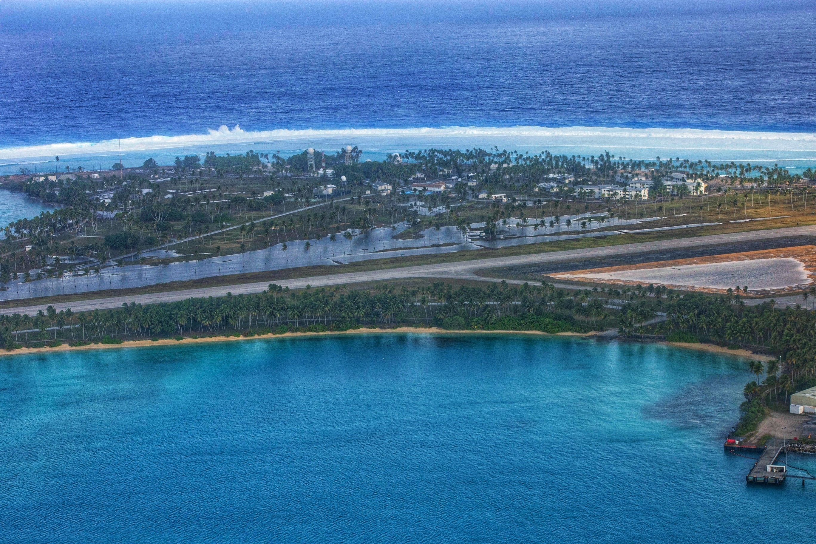
ROI-NAMUR, Marshall Islands — A series of weather-driven waves Jan. 20, 2024 resulted in significant flooding of the island of Roi-Namur. The island is the second-largest island of the Kwajalein Atoll in the Republic of the Marshall Islands.
U.S. Army Garrison-Kwajalein Atoll supports the U.S. Space and Missile Defense Command’s Ronald Reagan Ballistic Missile Defense Test Site. The test site serves as a space and missile defense test range for the Department of Defense.
USAG–KA personnel evacuated 80 of the approximately 120 personnel who call Roi-Namur home. Sixty people remain to assess damage and restore basic services while continuing the water and fuel runs that sustain the island of Enniburr, the island south of Roi-Namur where the Marshallese workforce resides.
“Clearing the runway on Roi-Namur and assessing its safety is our top priority now that we have evacuated personnel not required for the initial response efforts,” said Col. Drew Morgan, USAG–KA garrison commander. “Once the runway is open, we can move people and equipment back and forth to start the recovery process.”
Flooding from the waves damaged much of the unaccompanied personnel housing. The dining facility, Outrigger Bar and Grill, the chapel and the Tradewinds Theater were moderately to severely damaged. The automotive complex remains under water.