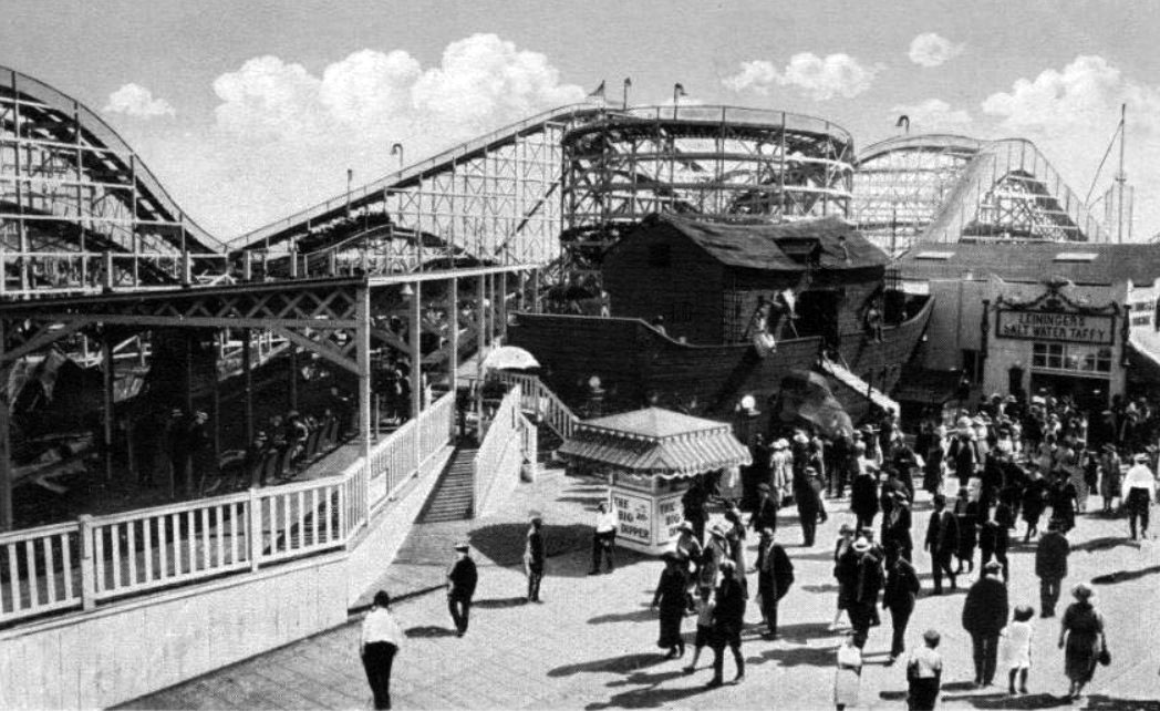
Scroll through that "Water and Power Association" site for lots more historical photos of Venice.
Posted on 01/09/2018 7:38:36 PM PST by BenLurkin
Monte envisaged the component maps—60 in all—being stitched together, and so left detailed instructions for how to turn them into one giant representation of the world, over nine feet in diameter. Included in the four volumes are also charts showing the lengths of days at different times of year and an extended geographical treatise on the world and cosmology. Unlike many modern maps, which use the Mercator projection from around the same time, his map shows the world from directly above the North Pole. Today, this perspective is known as the north polar azimuthal projection...
Once assembled, the map shows a lush, highly personalized take on the world, with a surprisingly large collection of real and fantasy beasts carousing and cavorting on land and sea. Rumsey’s scan and digital assembly of the cartographic puzzle represents the first time that Monte’s work has been seen in its full glory: It is the single largest world map of the 16th century, and one largely forgotten or overlooked by cartographers and scholars.
...
Throughout the world, Monte took time to sketch exotic fauna—crocodiles, camels, lions, and more. Near a coast labeled “Terra Incognita” (somewhere around Alaska), a wolf with a cub looks watchfully over its shoulder. Elsewhere there are more fantastic beasts, including griffins and what looks like a huge bird clutching an elephant. The seas feature many-tailed mermen and fleets of well-armed ships. Political leaders, including Philip II of Spain, also make an appearance, as do several portraits of Monte himself. Mapmakers of the time didn’t like empty spaces, Rumsey told CBC Radio. “There were many places that they did not know the names of towns and locations, so they filled them up with trees, monsters,” he said.
(Excerpt) Read more at atlasobscura.com ...
I was just getting ready to Ping you, but you are already here!
Amateur spook ;)
Yup. Insulting, even.
Yup. Insulting, even.
(albeit, I like seeing the pictures)
I like it anyway.
That and Strange Evidence, Mysteries Of The Abandoned, Secrets Of The Underground, and Forbidden History.
Love that brain candy.
:)
If they just up and said “Well, it’s algae” right off the bat, where’s the fun?
It’s cool seeing the Texas coast on a map from back then.
It’s a map of the world the way democrats see it. No ice cap, no glaciers. Europe is gone, Russia is miniscule, and Africa looms large. There are lots of islands - maybe that’s where all the movie stars went after the climate apocalypse.

Scroll through that "Water and Power Association" site for lots more historical photos of Venice.
Very cool. Thank you!
Bkmk.
Map
“Scroll through that “Water and Power Association” site for lots more historical photos of Venice.”
Wow! I just spent over an hour on that site.
Thank you. Great pics and info on the San Fernando Valley too.

The headline says the map is from 1588. It looks like they have some of the Great Lakes, or perhaps Hudson Bay on it. Although Hudson Bay wasn’t “discovered” (by Europeans anyway) until 1610 according to google.
Heh. :-)
Thanks!
Thanks BenLurkin.

Disclaimer: Opinions posted on Free Republic are those of the individual posters and do not necessarily represent the opinion of Free Republic or its management. All materials posted herein are protected by copyright law and the exemption for fair use of copyrighted works.