I think that’s why he needed a simulator — to practice landing on topography like that or on a short strip of asphalt road or in a crabrun on the beach or in the waters just offshore.
The first investigators must have suspected this or gotten a heads-up from his computer — note their yellow NTSB flight path. It ends up right at New Amsterdam — right on the last Inmarsat arc:
https://www.facebook.com/178566888854999/photos/pcb.740971779281171/740971732614509/?type=1&theater
And IIRC early on there was a significant air and sea search of the waters right there.
He may not have made it but it doesn’t mean that he didn’t try — that is, if that is the island in his computer.
https://www.facebook.com/178566888854999/photos/pcb.740971779281171/740971732614509/?type=1&theater
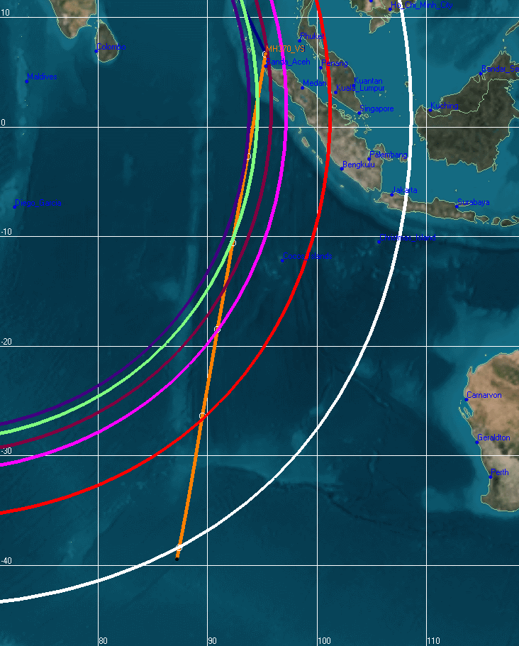
Red flight path to S28 E98.1 as MH370 flies @ 460mph would be 3336 miles from KLA.
Yellow flight path to Amsterdam Island S37.84 E87.55 as the MH370 flies @ 518mph would be 4230 miles from KLA and that path is here:
http://www.duncansteel.com/wp-content/uploads/2014/04/V_2D_2.png
http://en.wikipedia.org/wiki/%C3%8Ele_Amsterdam