
KEEP FREE REPUBLIC ALIVE!!!
PLEASE MAKE YOUR CONTRIBUTION TODAY!!!!
Posted on 05/11/2013 5:06:17 PM PDT by SunkenCiv
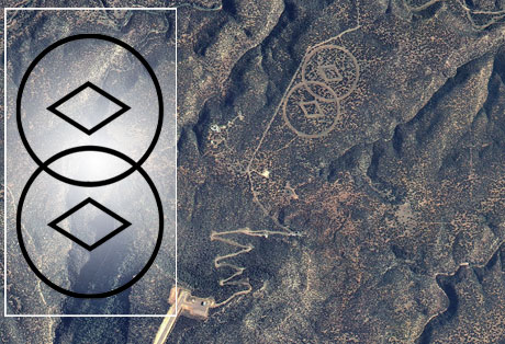
Wind erosion has lead to an incredible discovery through google maps.
Comparable to the Nasca Lines in size, and even more impressive in intricacy, a potential massive lost city or site has been revealed in an area of the “verneukpan” an inhospitable area of salt flats in southern Africa .
For over a year now, a young determined Dutchman has been using Google earth to map the world’s ancient sites, very much a crowd-sourced project, with over 900 place markers so far of sites that are known about and links to Wikipedia articles about them.
Archeomaps is the brainchild of Jaimy Visser, who posted this image yesterday on his facebook page after Shaun Kirwen brought it to his attention.
Jaimy had found that in his research he was finding many unexplained circular structures around the globe and started project “Esthar” to try and map these as well, in the process he has found huge areas of desert with evidence of similar ancient civilizations around the globe though none quite as striking as these which bear resemblance to carvings at Knowth, Newgrange, Malta and various other prehistorical sites.
The complex in the image is over five square miles, with less striking patterns spread over around twenty square miles at least.
(Excerpt) Read more at exposingthetruth.co ...
A poster writes:
We visited that place last year on a boys weekend and that is not the correct explanation.
The farmer made that drenches using donkeys tied to a rope that is tied to a short post in the ground. The reason for that is to loosen the surface so that plants can start growing again.
Mash spuds and gravy, mmmmmmm.
It’s a common technological response to long-term drought / dessication, hence it’s found in currently uninhabited desert lands. :’)
Holy cow, thanks for that link
SunkenCiv=Awesome
Freegards
That’s very intriguing.
During my sheltered existence I’ve not seen anything quite like it.
Where can I read about it?
(Although I still think the crooked camels idea is more fun.)
:-)
The “Circles” were cut by currently living humans.
http://imageshack.us/photo/my-images/28/loeries00181.jpg/
Peter van der Linden
And below is a copy of one of the comments to the linked article:
******************************************************************
Hehe – people, people – THIS IS NOT A LOST CITY!!
I live in Cape Town – South Africa and belong to a group of Adventure Riders in SA. One of our members was involved in creating these “irrigation/plowing circles” to assist with water retention…………
We have actual pictures of the chap and his plough doing the work…………..
This is surely the best laugh I’ve had in a long time…………… next our esteemed scientists will say we come from Mars!
Reply

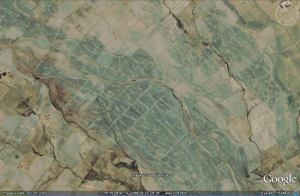
The above image reminds me of:
GEOFORMS ON THE BOLIVIAN ALTIPLANO:
One example,
'They' were here before us.
A maze training ground for young warriors?
I booked marked this thread to show it to more informed others!
I wonder how many volumes of encyclopedias could we fill with what we don’t know....
I jsut saw this thread and was thinking of pinging you to it.
Bookmark
The devil, you say!
Disclaimer: Opinions posted on Free Republic are those of the individual posters and do not necessarily represent the opinion of Free Republic or its management. All materials posted herein are protected by copyright law and the exemption for fair use of copyrighted works.