1 posted on
07/07/2015 1:40:59 PM PDT by
NYer
Navigation: use the links below to view more comments.
first 1-20, 21 next last
To: NYer
2 posted on
07/07/2015 1:51:05 PM PDT by
Excellence
(Marine mom since April 11, 2014)
To: NYer
There was one in the Arctic that actually was a disguised key for the Fortress of Solitude. You had to be pretty strong to pick it up and use it.
3 posted on
07/07/2015 1:52:21 PM PDT by
DBrow
To: NYer
We used t’be the baddest ass on the planet .... ‘cause we COULD !
4 posted on
07/07/2015 1:52:22 PM PDT by
knarf
(I say things that are true, I have no proof ... but they're true.)
To: NYer
And pilots landed without navigation computers, glide slope indications, ILS beacons, and other aides. If they were too low the computer didn’t blare the message “warning terrain, pull up...” over and over.
5 posted on
07/07/2015 1:56:56 PM PDT by
LukeL
To: NYer
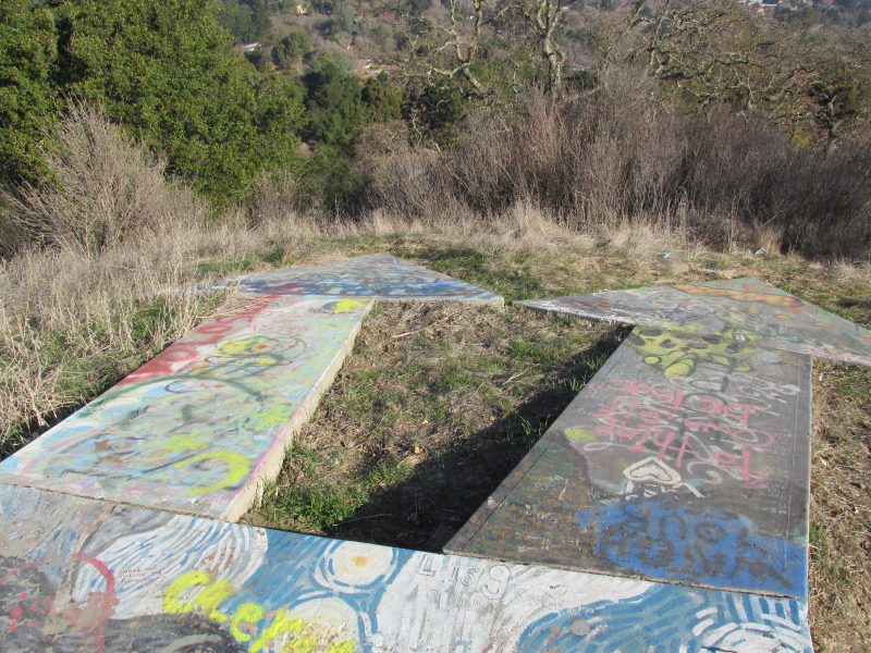
That’s the second biggest arrow I’ve ever seen.
6 posted on
07/07/2015 1:57:37 PM PDT by
bramps
To: NYer
an were visible from a distance of 10 miles up.Darn, did not realize those guys putted along at 50,000 feet back then! Impressive.
To: NYer
Visible from 10 miles up . . . but they disappear when you get to 52,801 feet.
8 posted on
07/07/2015 1:59:32 PM PDT by
Fester Chugabrew
(Even the compassion of the wicked is cruel.)
To: NYer
The “Shanghai Beacon” tower still stands on Third Hill Mountain in Berkeley Co, WV. I don’t remember seeing a concrete arrow next to it ... I’ll have to look next time I’m out that way.
9 posted on
07/07/2015 1:59:38 PM PDT by
NorthMountain
("The time has come", the Walrus said, "to talk of many things")
To: NYer
I remember the new fangled Omni beacons that my girl friend told me about on my first long VFR flight assisting her in 1968. We had no radio, only a compass for Wichita to New Jersey so we couldn’t utilize them.
11 posted on
07/07/2015 2:06:29 PM PDT by
KC Burke
(Ceterum censeo Islam esse delendam)
To: NYer
IBNLR
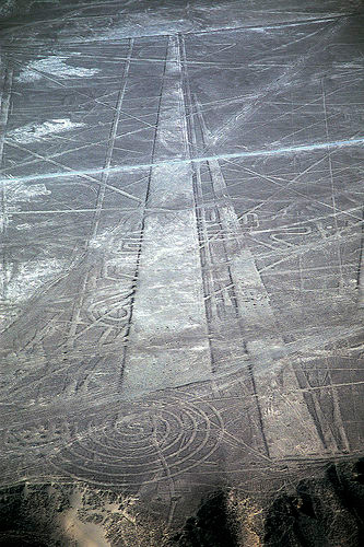
(In Before Nasca Lines Reference)
12 posted on
07/07/2015 2:06:55 PM PDT by
null and void
(She who uses rope to contain reporters during her candidacy will use rope to hang them when in power)
To: NYer
13 posted on
07/07/2015 2:08:56 PM PDT by
kjam22
(my music video "If My People" at https://www.youtube.com/watch?v=74b20RjILy4)
To: NYer
Wow! I wasn’t expecting to find my little hometown here in Indiana on that map. I’ll have to make a trip to the airport and check it out.
To: NYer
There were also things called blue and red airways. For night flying there were those colored beacons and you flew from one to another.
15 posted on
07/07/2015 2:46:56 PM PDT by
SkyDancer
( "Nobody Said I Was Perfect But Yet Here I Am")
To: NYer

That's nothing.
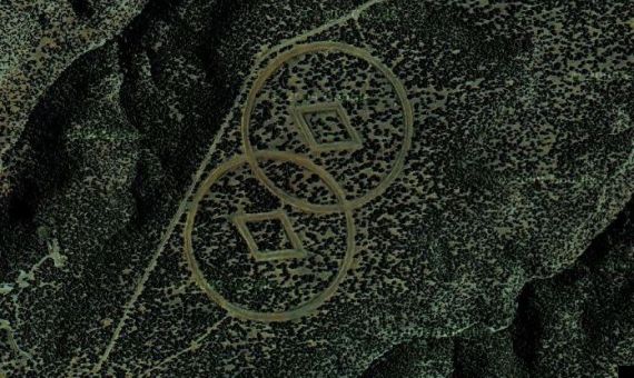
L Ron Hubbard and Tom Cruise built these symbols to guide intergalactic aliens here to earth..........Trementina NM.
16 posted on
07/07/2015 2:58:37 PM PDT by
fishtank
(The denial of original sin is the root of liberalism.)
To: NYer; Jeff Head
18 posted on
07/07/2015 2:59:16 PM PDT by
Squantos
( Be polite, be professional, but have a plan to kill everyone you meet ...)
To: NYer
Good job NYer
Thanks for a neat history lesson.
19 posted on
07/07/2015 2:59:34 PM PDT by
Joe Boucher
( Obammy is a lie, a mooselimb and pond scum.)
To: NYer
They also used to paint the name of the towns on warehouse roofs. Saved my butt one day.
20 posted on
07/07/2015 3:02:31 PM PDT by
dljordan
(WhoVoltaire: "To find out who rules over you, simply find out who you are not allowed to criticize.")
To: NYer
There are the remains of two arrows within a few miles of where I am sitting. Easy lunch runs with a 4X4.
To: NYer
Before GPS getting lost under VFR was all part of the fun. Now it is thought of as an in flight emergency.
24 posted on
07/07/2015 3:10:46 PM PDT by
central_va
(I won't be reconstructed and I do not give a damn.)
To: NYer
A rare double arrow (route split) near Lafayette, California.

29 posted on
07/07/2015 5:41:37 PM PDT by
kik5150
Navigation: use the links below to view more comments.
first 1-20, 21 next last
FreeRepublic.com is powered by software copyright 2000-2008 John Robinson


