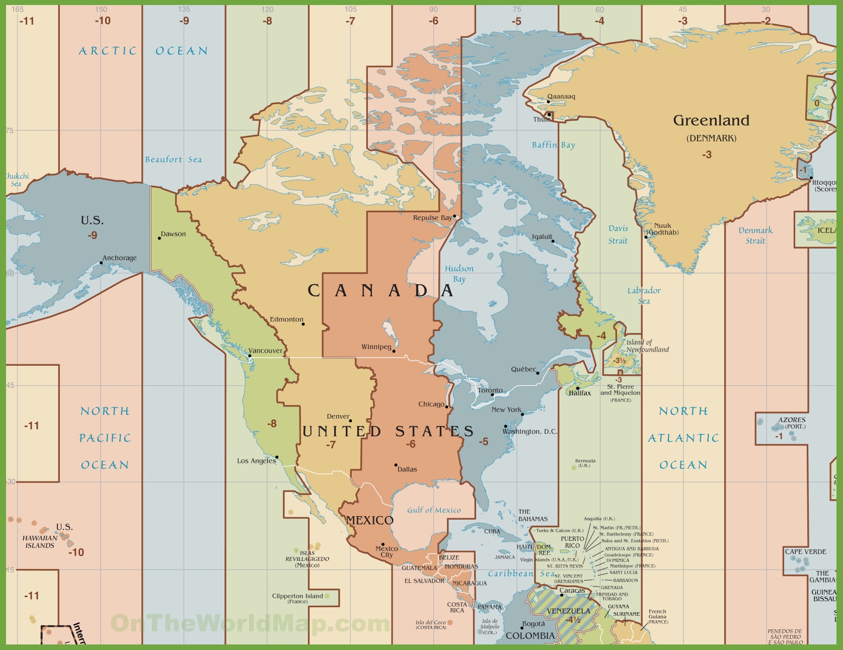
Look at this one instead. The land masses are distorted by the projection onto a flat map with perpendicular north-south and east-west coordinates, but it does show the relative locations of various places correctly in an east-west direction. No doubt about it -- the Eastern Time Zone is much wider than it should be ... probably because there was an attempt in both the U.S. and Canada to cram as many places into the same time zone as the government (Washington and Ottawa) and financial (New York and Toronto/Montreal) centers of the two countries.