Posted on 09/04/2017 2:02:19 PM PDT by NautiNurse
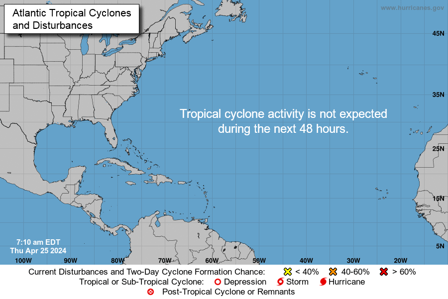
While thoughts and prayers are with our Texas FRiends and neighbors, we are at the peak of the Atlantic Tropical Storm season. Hurricane Irma continues its trek from Cape Verde across the pond and toward the Hebert Box (see below). People with interests in the Southeastern U.S. and Gulf of Mexico should be alert to the forecast path updates for this powerful storm. It is important to note that the average NHC track errors are about 175 and 225 statute miles at days 4 and 5, respectively.
Hurricane Irma originally had a small wind field. In the past 24 hours, however, the wind field has expanded with hurriance force winds up to 40 miles from the center, and tropical storm force winds up to 140 miles from the storm center.
FL Governor Rick Scott reminds Floridians: Families should take time today to make sure you have a disaster plan and fully-stocked Disaster Supply Kit. Florida residents from West Palm Beach to Tampa Bay are heeding the alert. Store shelves are emptying of bottled water.


Mash image to find lots of satellite imagery links
Public Advisories
NHC Discussions
NOAA Local Weather Statements/Radar San Juan, Puerto Rico
NHC Local Weather Statements/Radar Miami, FL
NHC Local Weather Statements/Radar Key West, FL
Buoy Data Caribbean
Buoy Data SE US & GOM

Hebert Box - Mash Pic for Tutorial
Credit: By J Cricket - Modification of map from Wiki
That is because they are always very reluctant to publicly commit to the latest computer models until they are well established. The Weather Channel even admitted this a few years ago, saying that to give the public the latest information from models before it was much more certain would "only confuse the public."
So, they keep with the older data until it is obvious they have to release the new data.
Next, they feel that if they let a certain area off the hook (like the Florida Keys), then if they are wrong and the models turn back, they gave people too much of a sense of security and relief, and it is better to keep the public on edge (for safety sake).
“My beloved St. Martin... so very sad. This looks like the camera from the Sunset Bar and Grill on Maho Beach. Sniff, sniff.”
I know. My youngest can spend hours watching the planes come and go from that webcam and we love hanging out at that bar when we are in St. Maarten. I cannot imagine what it must look like now.
Correct, and they won't publish that data until it is much more certain. They feel that if they now say the Carolinas are in the cone, then Floridians (whom they now have worked into a frenzy) will let their guard down too early.
Right now, the next 36 to 42 hours will determine where will have landfall for this hurricane.
I’m trying to find info on the place we stay on Little Bay. I doubt it will be good news.

Published just a few minutes ago:
Updated models from the ECMWF, Canadian and HWRF show large eastward shifts, making the forecast uncertain. Several forecasters have said that Irma could travel along Florida's east coast and avoid landfall. TTG FOX 5 Meteorologist Mike Thomas tweeted: “EAST SHIFT! Morning models turn Hurricane Irma just east of Florida similar to Matthew last year. If right, bad but not as bad as landfall.”
No kidding. Winter was over in much of the U.S. before it began last year.
AS the next post shows, the computer models are ALL trending to show the storm will most likely go further east than the earlier models.
The NHC's job is to keep people "scared" and moving, not get them over confident that the storm will actually go east of Fla. SO the NHC doesn't know anything which would indicate the storm really will stay further west than the computer models are predicting, they want to make sure the public stays focused.
In a few days, you can look back at this misrepresentation of what the data shows as propaganda. The gov't/press thinks that is their job.
Which is true of virtually all the real meteorologists I know.
Please, this is not a wishcast prognistication thread and your United Kingdom info source is noted.
My sister is in the Midlands and is watching this like a hawk.
The problem is, the more direct a hit, the more perpendicular the storm makes landfall, the more it maintains its strength until then.
If the storm tracked up the coast a bit before making landfall, running parallel to the coast, it loses half its fuel source and weakens considerably.
Although this one has a lot to lose to weaken to the point of not being a danger to somewhere.

LOL! That’s exactly what I was thinking. I remember this well, it was a flood in Wayne, NJ about 25 yrs ago. Holy men walking on the water, SHEESH!
In their discussion, they did not move it East as much for one set of model shifts because shifting it based on one set of runs has proven premature before this.

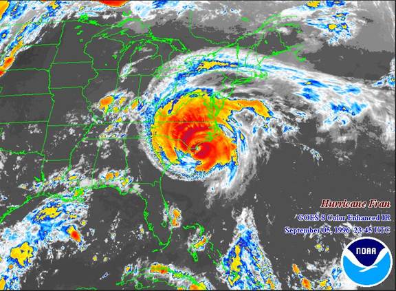
But Fran came up east of The Bahamas. What is interesting is that Fran was the second of three active storms crossing the Atlantic at the same time, the others being Eduoard and Gustav. Though it weakened considerably a couple of times and was very disorganized due to the influence of Eduoard about 800 miles ahead of her, she kept redeveloping and once Eduoard was out of the way, Fran pulled herself together and ramped up to a Cat 3 before making landfall at Cape Fear.
So true!
Not in the West or northwest. Was a record winter for snowfall. Some ski places stayed open all year.
In actuality, track to the east is much worse for my father who lives in North Carolina and for me further north. Secondly, it makes a big difference if it starts tracking further east and north for millions of people. The latest models are now showing that. I'm sorry if you don't agree, but that's what I see.
Disclaimer: Opinions posted on Free Republic are those of the individual posters and do not necessarily represent the opinion of Free Republic or its management. All materials posted herein are protected by copyright law and the exemption for fair use of copyrighted works.