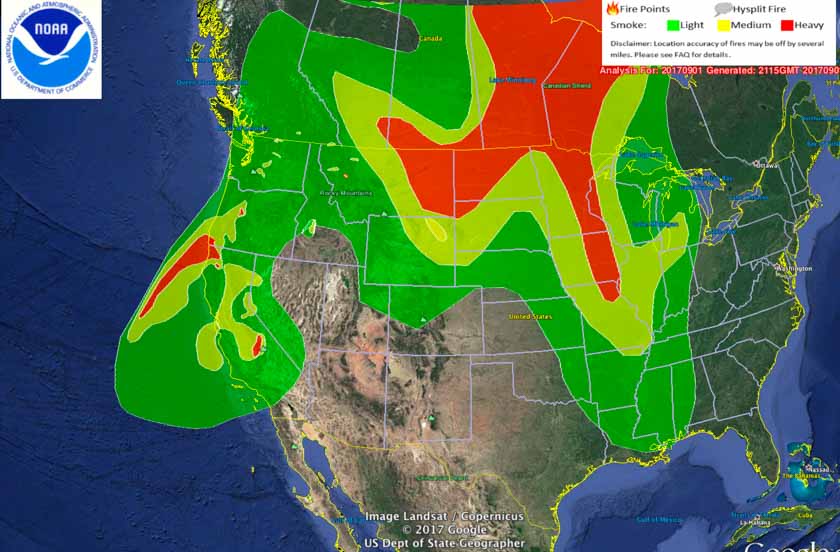

Distribution of smoke from wildfires, September 1, 2017.

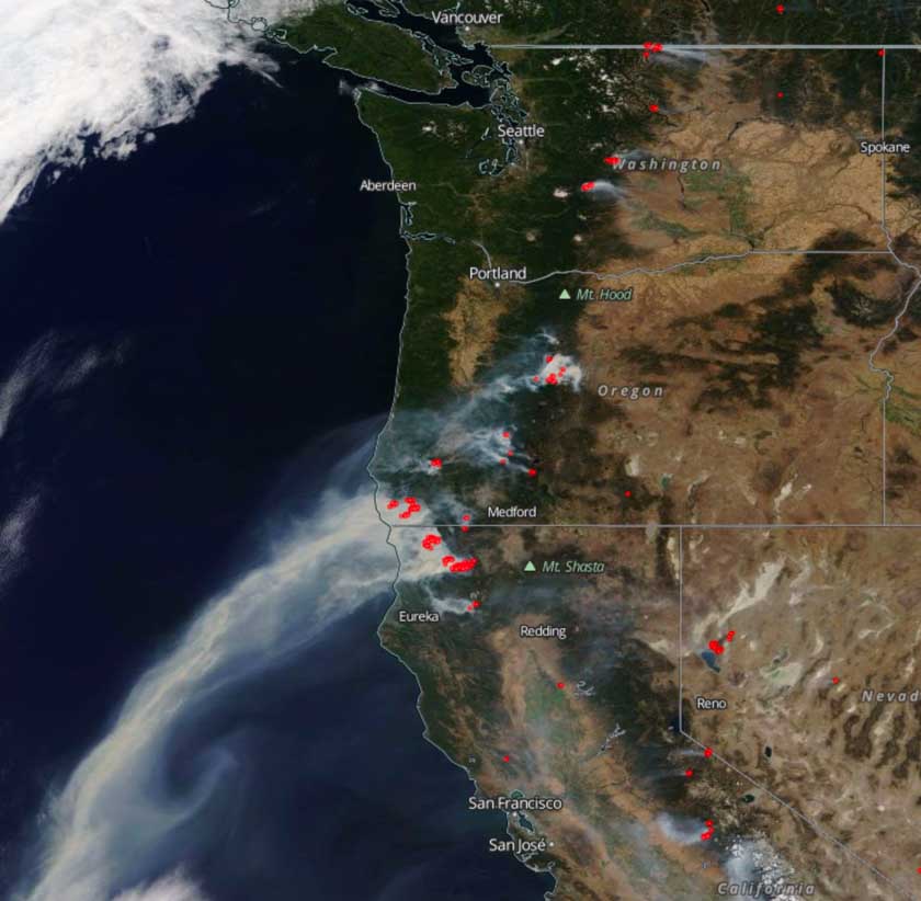
Satellite photo from September 1, 2017 showing smoke from wildfires. The red dots represent heat detected by the satellite.
Posted on 09/03/2017 12:15:36 PM PDT by goodnesswins
http://www.oregonlive.com/pacific-northwest-news/index.ssf/2017/08/more_than_320000_acres_burning.html
http://www.apnewsarchive.com/2017/Wildfires-are-threatening-thousands-of-homes-and-hindering-travel-in-the-Pacific-Northwest/id-0325ce4125ed474c82cd12e045308e20
http://www.arcgis.com/home/webmap/viewer.html?webmap=ed0a7dad32fe4848b20c6f91c74c79ea#!
http://wildfiretoday.com/2017/08/28/wildfire-smoke-map-august-28-2017/
http://www.foxnews.com/us/2017/09/02/irritating-smoke-from-wildfires-choking-us-west-turning-lives-upside-down.html
http://wildfiretoday.com/2017/09/01/satellite-photo-wildfires-in-the-northwest/
MONTANA http://www.kare11.com/news/lightning-sparks-40-more-montana-wildfires/470081743
Other lookout in the vicinity would do the same. Then the two or three would triangulate the location of the smokes and report to the HQ.
In my youth I fought fires. We didn't have the big ones like we have now. We would be on them before they became so large.
One other point: The Forest Service used to issue grazing permits for cattle and sheep. The grazing kept the meadows and brush from overgrowing.
I have lived in Oregon all my life (68yr) and this is certainly one of the worst fire seasons I can recall. A few weeks ago we had smoke from the BC fires in the Portland area, now it is coming from those down State. Chetco Bar is the biggest and this morning was >142KAc, plus all the others. Saw the smoke from the Eagle Creek fire when driving to Sandy last night. Report is it exploded to 3KAc overnight. FYI: I go to gacc.nifc.gov/nwcc for fire info during the summer fire season.
Chainsaw bad, forest fire good to eart worshipers.
Some of the fires could have been the result of sabotage.
I am in the middle of a long motorcycle trip through Oregon, Idaho, Montana, Wyoming. Except for 93 along the Salmon river the smoke has been choking and ruined the scenery.
We have less but we have it on the Coast too.
Not allowed to remove forest floor litter into large sash piles and burning them in winter.
That is the fire that has a suspicious origin. Trapped 123 hikers some of whom heard an explosion before the fire.
post 28
Bummer about the ruined scenery, stay safe!
Yes, I have thought that also.
Did not hear about the explosion....hhhmmmm....weird place for an explosion.
How much of the government owned land out west is burning?
Dang I would have loved to have seen the pics. Will keep you in prayers.


Distribution of smoke from wildfires, September 1, 2017.

Satellite photo from September 1, 2017 showing smoke from wildfires. The red dots represent heat detected by the satellite.
Thanks.
You’re welcome.
The pics all come from .gov sites, which we taxpayers fund, so we ought to make good use of them. ;-)
“100s of Thousands of acres are or have burned. Thanks to idiot environmentalists policies, mostly.”
Are the enviral nazis still stopping dead tree removal and any brush removal?
Yes, from what I understand.
Disclaimer: Opinions posted on Free Republic are those of the individual posters and do not necessarily represent the opinion of Free Republic or its management. All materials posted herein are protected by copyright law and the exemption for fair use of copyrighted works.