
Posted on 09/10/2008 2:18:37 PM PDT by NautiNurse
Texas began issuing mandatory and voluntary evacuations as Hurricane Ike continued to strengthen and slowly moved toward an uncertain landfall destination in the western Gulf of Mexico. Texas Governor Rick Perry issued a disaster declaration in advance of the storm. Louisiana Governor Jindal released several hundred buses to Texas for evacuation assistance.
Reports from Cuba indicate widespread damage from Hurricane Ike, which raked the length of the island nation. The U.S. State Department again offered Cuba humanitarian assistance after a previous offer was declined by the Cuban government.
The stock market Wednesday rose as investors bought oil stocks and and oill futures fell.
Public Advisory Updated every 3 hours
Discussion Updated every 6 hours
Buoy data: Western Gulf of Mexico
Houston/Galveston Long Range Radar
Corpus Christi Long Range Radar
Brownsville Long Range Radar Lake Charles Long Range Radar
|
||||||||||||||||||||||||||||||||||||||||||||||||||||||||
Additional Resources:
Navy Tropical Cyclone
Storm Pulse Very cool site
ABC 13 News Houston
FOX News Houston
KRIS-TV Corpus Christi
KZTV Corpus Christi
Brazoria County Emergency Management
Galveston County Emergency Management
Chambers Country Emergency Management
Liberty County Emergency Management
| Category | Wind Speed | Barometric Pressure | Storm Surge | Damage Potential |
|---|---|---|---|---|
| Tropical Depression |
< 39 mph < 34 kts |
Minimal | ||
| Tropical Storm |
39 - 73 mph 34 - 63 kts |
Minimal | ||
| Hurricane 1 (Weak) |
74 - 95 mph 64 - 82 kts |
28.94" or more 980.02 mb or more |
4.0' - 5.0' 1.2 m - 1.5 m |
Minimal damage to vegetation |
| Hurricane 2 (Moderate) |
96 - 110 mph 83 - 95 kts |
28.50" - 28.93" 965.12 mb - 979.68 mb |
6.0' - 8.0' 1.8 m - 2.4 m |
Moderate damage to houses |
| Hurricane 3 (Strong) |
111 - 130 mph 96 - 112 kts |
27.91" - 28.49" 945.14 mb - 964.78 mb |
9.0' - 12.0' 2.7 m - 3.7 m |
Extensive damage to small buildings |
| Hurricane 4 (Very strong) |
131 - 155 mph 113 - 135 kts |
27.17" - 27.90" 920.08 mb - 944.80 mb |
13.0' - 18.0' 3.9 m - 5.5 m |
Extreme structural damage |
| Hurricane 5 (Devastating) |
Greater than 155 mph Greater than 135 kts |
Less than 27.17" Less than 920.08 mb |
Greater than 18.0' Greater than 5.5m |
Catastrophic building failures possible |
Previous Threads:
Hurricane Ike Live Thread I
TS Hanna, Hurricane Ike & TS Josephine [Other than that, the tropics are calm]
Tropical Storms Hanna, Ike and Josephine, TD Gustav (Other than that, the tropics are calm)
***
http://www.stormpulse.com/hurricane-ike-2008
This is another pretty interesting site.. on it, you can look at the track and storm stats for ALL hurricanes... going back to the 1880’s.
What really scared me just now was... Hurricane Carla, which did SO much damage to Freeport and Houston.. actually came ashore south of Port O’Connor... 100 MILES SOUTH of Freeport.
It was a Cat 4, with 145 MPH winds... but, the central pressure was only ~932 mb. Ike could get pretty close to that.. IMO.
I’m in NW Houston. Got my supplies last night and today. We’re all set to hunker down. The groceries stores are very busy, but everyone is being patient... lots of appreciation to the store clerks who are working their butts off to get us on our way.
yikes
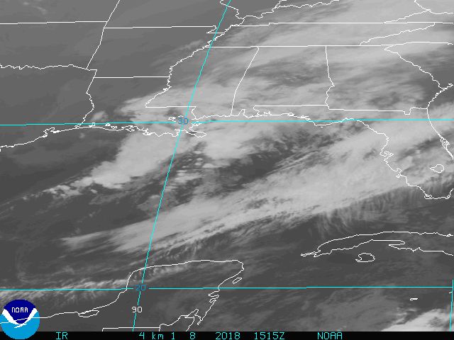
Last satellite image update was at 1:19PM Central. Hope they refresh it pretty soon. Had a lot of moisture on the backside towards Florida on the last image. Wonder if the eye will redevelop?
Appreciate your local update. Please continue to check in when you can.
The wholesale price for gasoline produced on the Gulf Coast has jumped about 30 percent as Hurricane Ike churns toward Texas.
The area is home to massive petroleum refining infrastructure. The wholesale price for a gallon of gasoline rose about $1 to $4.25 today -- topping the high price five years ago when hurricanes Katrina and Rita raked the Gulf Coast.
The Associated Press reports the spike will almost certainly lead to high pump prices for consumers.
I was kind of curious and checked. It looks like IAH is 97 feet above sea level. Does that make sense?
The storm surge is just one part of it, it loks like it will hit around high tide and with the moon almost full you can probably add another 3 feet on to the storm surge.
This storm if it hits as predicted and at the time predicted will have a storm surge higher then the Galveston sea wall.
Yes it is, but the land is flat and there is not much of a slope. In bad rains the area around IAH floods in places making it difficult to get to and from the airport.
“The long lines were starting when I was coming back from the grocery store. I heard on the news earlier that a lot of stations are out of regular gas”
I went out at noon for lunch and the 5 stations around me at Yorktown and San Felipe were all out. The Kroger at San Felipe and Voss was down to regular only and about 40 cars in line. That was at noon. I can only imagine they are out now as well.
Checking in just to get on the board. We’re just south of Magnolia, NW of Houston and about 75 miles from the Gulf. We’re staying put and will have a house full of refugee relatives from LaPorte. We figure we’ll have plenty of people to give support to and to gain support from. This family can be a lot of fun; sometimes not. Stress might put us into the “sometimes not” category, but we’ll still all pull together (not counting one cousin :-)).
The time and effort you put into tracking these storms and all the related commentary is so appreciated. Thank you.
Thank you for checking in here. You are in my prayers...especially with a house full of relatives. Please continue to check back in when you can. Hang in there!
Open, I believe.
Your local update is appreciated. Thanks, and stay safe.
The public advisory was ripped straight from NWS, which addresses local tides in the hurricane warnings.
No minced words there.
Disclaimer: Opinions posted on Free Republic are those of the individual posters and do not necessarily represent the opinion of Free Republic or its management. All materials posted herein are protected by copyright law and the exemption for fair use of copyrighted works.