Skip to comments.
Hurricane Dean Live Thread [Now Cat 4]
NOAA/NWS ^
| August 16 2007
| NOAA/NWS
Posted on 08/16/2007 4:43:17 AM PDT by NautiNurse
click here to read article
Navigation: use the links below to view more comments.
first previous 1-20 ... 501-520, 521-540, 541-560 ... 1,101-1,102 next last
To: alancarp
It just has to go in the next 41 minutes for me to win.
521
posted on
08/17/2007 9:19:26 PM PDT
by
steveegg
(I am John Doe, and a monthly donor)
To: steveegg
To: SouthTexas
So the surf is “freshening a bit?”
523
posted on
08/17/2007 9:20:28 PM PDT
by
Petronski
(Why would Romney lie about Ronald Reagan's record?)
To: SouthTexas
LAtest from the buooy is 20+ foot waves!!
Wind Direction (WDIR): NNE ( 20 deg true )
Wind Speed (WSPD): 29.1 kts
Wind Gust (GST): 38.9 kts
Wave Height (WVHT): 20.3 ft
524
posted on
08/17/2007 9:22:33 PM PDT
by
tcrlaf
(You can lead a Liberal to LOGIC, but you can't make it THINK)
To: Petronski
Looks like it!
We were taking odds on how long that bouy would last. :)
To: tcrlaf
526
posted on
08/17/2007 9:34:11 PM PDT
by
tcrlaf
(You can lead a Liberal to LOGIC, but you can't make it THINK)
To: SouthTexas
One model has it doing that. I don’t even want Mexico to get it though. In some ways it is even harder on them. The strip would be better, I think. If it doesn’t die then we will have to just deal with it. I’m thinking maybe it’s time to get the malt balls though:’)
To: NautiNurse
Dean a Category 4 storm, still growing By JACQUELINE CHARLES, TRENTON DANIEL AND MARTIN MERZER mmerzer@MiamiHerald.com
KINGSTON, Jamaica -- Already a killer storm, Hurricane Dean mushroomed in size and intensity Friday night as it took aim at some of the Caribbean's largest and most populous targets, including Jamaica, Haiti and Cuba. Officials urged residents there and in the tiny Cayman Islands to begin preparing. Tourists were advised to return home, if they can. Forecasters warned that the Category 4 monster with winds of 145 mph could grow even stronger -- possibly becoming a top-scale Category 5.
''I'm a little panicky,'' said Kerns Olibrice, 28, who lives in the Port-au-Prince suburb of Kenscoff in Haiti.
Meanwhile, emergency managers in the United States began worrying that the storm could reach the Gulf of Mexico next week -- and then strike the Gulf Coast. Someplace.
''We are coming into the peak part of the season,'' said Mike Stone, a spokesman for Florida's Emergency Management Division. ``Now is a good time to look at your plan.''
snip
http://www.miamiherald.com/574/story/207290.html

This satellite image shows Hurricane Dean intensifying in the Atlantic off the coast of South America Thursday.
Wow - here we go again ...
528
posted on
08/17/2007 9:46:26 PM PDT
by
11th_VA
(Support the troops, Support Petraeus)
To: SouthTexas
That buoy be as close as 30-40 miles to the eye wall at this point.
529
posted on
08/17/2007 9:50:18 PM PDT
by
alancarp
(How many millions have to break a law before it's inconvenient to enforce?)
To: mutley

Almost time to call Dan out of retirement ...
530
posted on
08/17/2007 9:50:18 PM PDT
by
11th_VA
(Support the troops, Support Petraeus)
To: alancarp
“That buoy MAY be...” (oy; time to cash it in for the night, obviously).
531
posted on
08/17/2007 9:51:18 PM PDT
by
alancarp
(How many millions have to break a law before it's inconvenient to enforce?)
To: CindyDawg
Yeah, I know what you mean about Mexico.
Time to stock up on whatever your favorites are!
To: alancarp
Just about, I wanted to see one more report, but don’t know if I’m going to make it. LOL
To: SouthTexas
My husband has been on the phone all evening. It looks like we may start evacuating our nursing homes (and we have a bunch) by Monday if things don’t change.
To: CindyDawg
Malt balls - I’m munching down on them right now, as I am watching the weather channel. This is going to be HUGE!
Be safe, FRiends! Be prepared for Sunday and Monday - and keep your angels close.
535
posted on
08/17/2007 10:05:42 PM PDT
by
yorkie
To: SouthTexas
Where are you? (I haven’t read all the thread)
536
posted on
08/17/2007 10:07:24 PM PDT
by
yorkie
To: CindyDawg
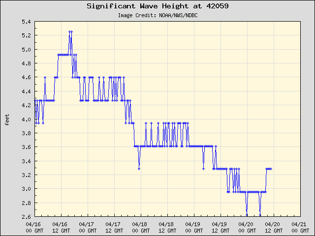
Don't think we'll know until after it collides with the Yucatan. Bouy 42059 is still up:
To: tutstar; dirtboy
I think it’s a good idea to keep Erin’s track from the Yucatan to TX in mind. The prevailing summer pattern has tended to send moisture into certain areas around the long term high pressure locations.
It’s so far out right now, minor deviations over the next 12-24hr make a huge difference at day 5. If I had to choose a landfall point right now I’d go within 200 miles either direction of Erin’s, with more error expected on the north side due to the angle of the coast.
What it does while passing the remainder of the obstacles on its course to the GOM is extraordinarily crucial. Whatever this looks like now, it could very well be a small piece of that by the time it threatens the U.S.
538
posted on
08/17/2007 10:08:11 PM PDT
by
nwctwx
To: nwctwx
Thanks, center the target on me again!
Glad you're here, but I'm done for the night, manana.
Navigation: use the links below to view more comments.
first previous 1-20 ... 501-520, 521-540, 541-560 ... 1,101-1,102 next last
Disclaimer:
Opinions posted on Free Republic are those of the individual
posters and do not necessarily represent the opinion of Free Republic or its
management. All materials posted herein are protected by copyright law and the
exemption for fair use of copyrighted works.
FreeRepublic.com is powered by software copyright 2000-2008 John Robinson