Free Republic
Browse · Search
News/Activism
Topics · Post Article

Skip to comments.

Hurricane Sally
NOAA/NHC ^ | 12 September 2020 | NOAA/NHC

Posted on 09/12/2020 10:56:19 AM PDT by NautiNurse

click here to read article


Navigation: use the links below to view more comments.
first previous 1-20 ... 341-360361-380381-400 ... 421-425 next last
To: All
...Sally Downgraded to Category 1...
Moving NNE at 4 MPH...


900 AM CDT Update
-------------------------------

Location...About 20 MI W of Pensacola FL
Max Sustained Winds...85 MPH
Moving...NNE at 4 MPH
Minimum Pressure...972 MB

361 posted on 09/16/2020 7:02:45 AM PDT by NautiNurse (Put $5000 cash in an envelope. Mail it to yourself. If this makes you queasy, vote at the polls.)
[ Post Reply | Private Reply | To 359 | View Replies]

To: zzeeman

Thank you for checking in and for your gracious feedback.


362 posted on 09/16/2020 7:03:24 AM PDT by NautiNurse (Put $5000 cash in an envelope. Mail it to yourself. If this makes you queasy, vote at the polls.)
[ Post Reply | Private Reply | To 360 | View Replies]

To: NautiNurse

looks like a depression is forming in the SW Gulf now

another slow mover


363 posted on 09/16/2020 8:08:15 AM PDT by janetjanet998
[ Post Reply | Private Reply | To 2 | View Replies]

To: NautiNurse

My people in Gulf Shores said the eye lingered forever.


364 posted on 09/16/2020 8:08:50 AM PDT by numberonepal (WWG1WGA)
[ Post Reply | Private Reply | To 361 | View Replies]

To: numberonepal

Flooding is terrible.


365 posted on 09/16/2020 8:09:56 AM PDT by rlbedfor
[ Post Reply | Private Reply | To 364 | View Replies]

To: janetjanet998


366 posted on 09/16/2020 8:27:48 AM PDT by NautiNurse (Put $5000 cash in an envelope. Mail it to yourself. If this makes you queasy, vote at the polls.)
[ Post Reply | Private Reply | To 363 | View Replies]

To: All
...Catastrophic & Life-Threatening Flooding Occurring Over
Portions of the FL Panhandle & Southern AL...


1000 AM CDT Update
-------------------------------

Location...About 15 MI WNW of Pensacola FL
Max Sustained Winds...80 MPH
Moving...NNE at 5 MPH
Minimum Pressure...975 MB

Hurricane-force winds extend outward up to 35 miles and
Tropical-storm-force winds extend outward up to 125 miles.

367 posted on 09/16/2020 8:32:28 AM PDT by NautiNurse (Put $5000 cash in an envelope. Mail it to yourself. If this makes you queasy, vote at the polls.)
[ Post Reply | Private Reply | To 366 | View Replies]

To: NautiNurse

don’t forget about me

Possible “Medicane” to Hit Greece Later This Week

https://greece.greekreporter.com/2020/09/15/severe-storms-possible-medicane-to-hit-greece-later-this-week/


368 posted on 09/16/2020 8:46:27 AM PDT by janetjanet998
[ Post Reply | Private Reply | To 366 | View Replies]

To: NautiNurse

Thank you for your work.


369 posted on 09/16/2020 8:49:33 AM PDT by Jemian (War Eagle!)
[ Post Reply | Private Reply | To 367 | View Replies]

To: janetjanet998
Where are you?

Have never heard the term Medicane before!

370 posted on 09/16/2020 8:49:56 AM PDT by NautiNurse (Put $5000 cash in an envelope. Mail it to yourself. If this makes you queasy, vote at the polls.)
[ Post Reply | Private Reply | To 368 | View Replies]

To: Jemian

Thanks. Stay high and dry. Avoid large trees with ground saturation.


371 posted on 09/16/2020 8:51:53 AM PDT by NautiNurse (Put $5000 cash in an envelope. Mail it to yourself. If this makes you queasy, vote at the polls.)
[ Post Reply | Private Reply | To 369 | View Replies]

To: NautiNurse

I so stole that!


372 posted on 09/16/2020 8:56:35 AM PDT by Islander7 (There is no septic system so vile, so filthy, the left won't drink from to further their agenda)
[ Post Reply | Private Reply | To 366 | View Replies]

To: NautiNurse

Where are you?

in Illinois :(

That medicane may be more truly tropical then usual


373 posted on 09/16/2020 9:00:37 AM PDT by janetjanet998
[ Post Reply | Private Reply | To 370 | View Replies]

To: NautiNurse

https://en.wikipedia.org/wiki/Mediterranean_tropical-like_cyclone


374 posted on 09/16/2020 9:06:50 AM PDT by dirtboy
[ Post Reply | Private Reply | To 370 | View Replies]

To: janetjanet998
in Illinois :(

Oh--thought you were lounging on a sun bleached beach in the Greek Isles. I was fixing to be way jealous!

375 posted on 09/16/2020 9:11:49 AM PDT by NautiNurse (Put $5000 cash in an envelope. Mail it to yourself. If this makes you queasy, vote at the polls.)
[ Post Reply | Private Reply | To 373 | View Replies]

To: dirtboy

Thanks! Wow—Medicane develops a well defined eye an everything. Live and learn.


376 posted on 09/16/2020 9:12:54 AM PDT by NautiNurse (Put $5000 cash in an envelope. Mail it to yourself. If this makes you queasy, vote at the polls.)
[ Post Reply | Private Reply | To 374 | View Replies]

To: janetjanet998

BTTT


377 posted on 09/16/2020 9:35:00 AM PDT by texas booster (Join FreeRepublic's Folding@Home team (Team # 36120) Cure Alzheimer's!)
[ Post Reply | Private Reply | To 368 | View Replies]

To: All

https://www.winknews.com/2020/09/16/section-of-pensacola-bay-bridge-collapses-during-hurricane-sally/


378 posted on 09/16/2020 9:37:34 AM PDT by EVO X
[ Post Reply | Private Reply | To 376 | View Replies]

To: All

GFS has a part the new gulf disturbance near New Orleans

however, I think that is a “convective feed back” low and the true low will be more SSW..so likely disregard

Also It is more west and slower with Teddy but still turns it well east..but I am not liking that blocking high setting up to the north..if it misses the trough then it will miss the ride NE

Plus the African wave train, or Cape Verde season, continues even to OCT 1st..it should be on it’s way down starting now (peaks in late August/ early seot..but it is 2020

and we still have the Oct Caribbean sea development part of the season too


379 posted on 09/16/2020 10:48:52 AM PDT by janetjanet998
[ Post Reply | Private Reply | To 378 | View Replies]

To: janetjanet998

Red now (70% or greater for Gulf low)

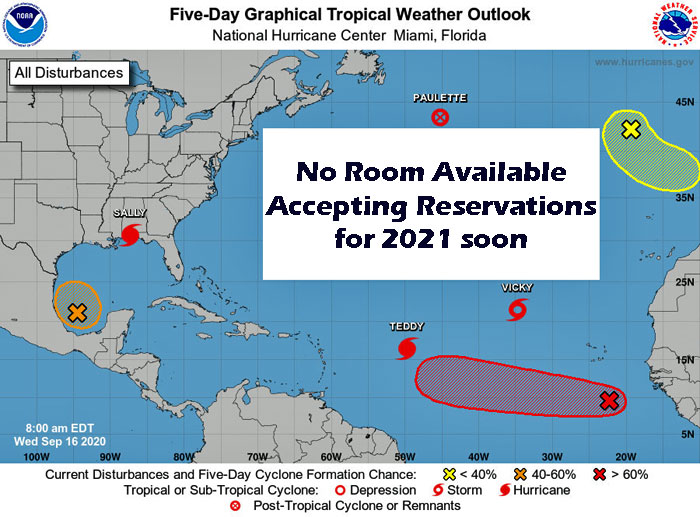
Tropical Weather Outlook
NWS National Hurricane Center Miami FL
200 PM EDT Wed Sep 16 2020

For the North Atlantic...Caribbean Sea and the Gulf of Mexico:

T
1. Showers and thunderstorms associated with a broad area of low
pressure over the southwestern Gulf of Mexico gradually continue to
become better organized. Upper-level winds are forecast to
gradually become more conducive for further development, and a
tropical depression is likely to form late this week or over the
weekend while the low meanders over the southern Gulf of Mexico for
the next several days.
* Formation chance through 48 hours...medium...50 percent.
* Formation chance through 5 days...high...70 percent.


380 posted on 09/16/2020 10:51:02 AM PDT by janetjanet998
[ Post Reply | Private Reply | To 379 | View Replies]


Navigation: use the links below to view more comments.
first previous 1-20 ... 341-360361-380381-400 ... 421-425 next last

Disclaimer: Opinions posted on Free Republic are those of the individual posters and do not necessarily represent the opinion of Free Republic or its management. All materials posted herein are protected by copyright law and the exemption for fair use of copyrighted works.

Free Republic
Browse · Search
News/Activism
Topics · Post Article

FreeRepublic, LLC, PO BOX 9771, FRESNO, CA 93794
FreeRepublic.com is powered by software copyright 2000-2008 John Robinson