
Posted on 09/12/2020 10:56:19 AM PDT by NautiNurse
The nineteenth named storm of the busy 2020 Atlantic Hurricane season developed off the southern Florida peninsula. The storm track forecast carries Sally across the southern FL peninsula into the Gulf of Mexico.
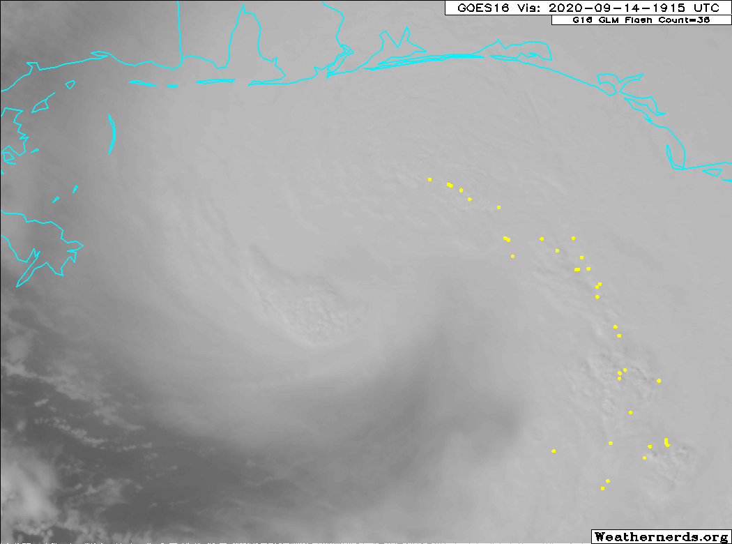
Mash the graphics below to enlarge. All links and images are self-updating.


Key West Radar Loop
Mobile AL Radar Loop
New Orleans Radar Loop
Buoy Obs Near Storm Track
Can someone explain the increased systems and the correlation to the Sahara Desert sand crossing the Atlantic?
https://www.myfoxhurricane.com/saharan_dust_car.html
Can someone explain the increased systems and the correlation to the Sahara Desert sand crossing the Atlantic?
Sarah Dust is surrounded by dry air, it helps to prevent systems from developing
what is shown there is a minor outbreak
The one is early June was huge
18Z model suite shifted east again
now landfall around Mobile
https://www.tropicaltidbits.com/storminfo/19L_tracks_latest.png
Thank you.
How does it correlate to the number of active storms with the dust suppressing the formation?
As far as Texas is concerned, Dr. Neal Frank says when you hit Sept 17th hurricane season for Texas is pretty much over. Those stats have been proven right.
Sally is now a Cat 2 according to 4pm advisory.
Hurricane Sally Discussion Number 14
NWS National Hurricane Center Miami FL AL192020
400 PM CDT Mon Sep 14 2020
After the rapid spin up of the inner core late this morning, the
most recent aircraft passes through the center have not found any
higher flight-level winds, however there have been a few SFMR winds
of 85-90 kt reported. Using a blend of the flight-level and SFMR
winds the initial intensity has been increased to 85 kt for this
advisory. The next Air Force and NOAA aircraft have begun to sample
the storm. Now that Sally has developed an inner core, the
favorable atmospheric and ocean conditions of low vertical wind
shear and warm water should allow for additional strengthening
tonight while the system moves over the north-central Gulf of
Mexico, and Sally could approach major hurricane strength. On
Tuesday, the global models are predicting an increasing in
southwesterly flow aloft, and this increase in shear, the potential
for land interaction, and some upwelling over the shallower shelf
waters over the northern Gulf should slow the intensification
process. The NHC intensity forecast is again near the upper-end of
the guidance envelope in best agreement with the HWRF and HFIP
corrected consensus models.
Sally did not move much earlier today as the center re-formation
took place, but it appears that a slow west-northwestward to
northwestward motion has resumed. Weak ridging over the
southeastern United States is expected to steer Sally generally
west-northwestward through early Tuesday. After that time, steering
currents weaken and a slow northward motion is forecast as a weak
mid-level trough develops over the the central United States. This
trough is forecast to slide eastward, allowing Sally to begin a
slow north-northeastward or northeastward motion. The specific
timing and location of the turn will be critical as to the eventual
location and timing of landfall along the north-central Gulf Coast.
The UKMET and ECMWF models show a more northeastward motion after
the turn and have trended eastward, with the ECMWF much slower than
the remainder of the guidance. The NHC track has been adjusted
eastward, and this requires and eastward extension of the hurricane
warning. The new track most closely follows the GFS and it ensemble
mean, but lies to the west of the various consensus aids, so some
additional eastward adjustments could be needed in subsequent
advisories.
Given the uncertainty in the timing and location of the northward
turn and the lack of well-defined steering currents, users are
reminded to not focus on the exact forecast track or the specific
timing and location of landfall. Hurricane-force winds, dangerous
storm surge, and flooding rainfall will affect a large portion of
the north-central Gulf Coast during the next few days.
KEY MESSAGES:
1. It is too early to determine where Sally’s center will move
onshore given the uncertainty in the timing and location of Sally’s
northward turn near the central Gulf Coast. Users should not focus
on the details of the official forecast track, since NHC’s average
forecast error at 36 to 48 hours is around 60 to 80 miles, and
dangerous storm surge, rainfall, and wind hazards will extend well
away from the center.
2. An extremely dangerous and life-threatening storm surge is
expected for areas outside the southeastern Louisiana Hurricane and
Storm Damage Risk Reduction System from Port Fourchon, Louisiana, to
the Okaloosa/Walton County Line in the Florida Panhandle, where a
Storm Surge Warning is in effect. Residents in these areas should
follow any advice given by local officials.
3. Hurricane conditions are expected late tonight or early Tuesday
within the Hurricane Warning area in southeastern Louisiana and are
expected by late Tuesday and Tuesday night within the Hurricane
Warning area along the Mississippi and Alabama coastlines and the
western Florida Panhandle. Tropical storm conditions are likely to
begin this evening in these areas and preparations should be rushed
to completion.
4. Life-threatening flash flooding is likely, as well as widespread
minor to isolated major flooding, on area rivers along and just
inland of the Central Gulf Coast. Significant flash and urban
flooding, as well as widespread minor to moderate river flooding is
likely across Mississippi and Alabama through the middle of the
week. Flooding impacts are expected to spread farther across the
Southeast through the week. Sally could continue to produce flash
flooding across the Florida peninsula and prolong existing minor
river flooding across west-central Florida through today.
FORECAST POSITIONS AND MAX WINDS
INIT 14/2100Z 28.8N 87.4W 85 KT 100 MPH
12H 15/0600Z 29.2N 88.2W 95 KT 110 MPH
24H 15/1800Z 29.7N 88.7W 95 KT 110 MPH
36H 16/0600Z 30.4N 88.6W 90 KT 105 MPH...INLAND
48H 16/1800Z 31.3N 88.0W 55 KT 65 MPH...INLAND
60H 17/0600Z 32.2N 86.8W 30 KT 35 MPH...INLAND
72H 17/1800Z 32.9N 85.5W 25 KT 30 MPH...INLAND
96H 18/1800Z 33.5N 83.0W 20 KT 25 MPH...POST-TROP/REMNT LOW
120H 19/1800Z...DISSIPATED
$$
Forecaster Brown
How does it correlate to the number of active storms with the dust suppressing the formation?
all other things equal, more dust means less storms
However, in this case a very active central African monsoon is ejecting waves west...also above average sea temps, and La Nina forming which usually means less wind shear in the Atlantic
The above 3 is causing a large number of storms this year
“The above 3 is causing a large number of storms this year”
—
Wonder what, if anything, that might mean for winter.
“now landfall around Mobile”
Rutroh.
Location...About 105 MI ESE of the Mouth of the Mississippi River
...About 145 MI SE of Biloxi MS
Max Sustained Winds...100 MPH
Moving...WNW at 6 MPH
Minimum Pressure...987 MB
Hurricane-force winds extend outward up to 25 miles and Tropical-storm-force winds extend outward up to 125 miles

On/Off Hurricane List Mash Here--> 


Our good FRiend Blam lives on Dauphin Island right outside Mobile Bay (Southwest of Mobile).
That’s the latest ground zero spot.
Blam, I hope you’re leaving!!!!
Nah. I live just north of DI, not on it.
I just put the shutters on the south side of the house and pulled the big propane generator out of the shed, janetjanet998 post #143 prompted me to do that. I was rigged for a smaller storm to land west of me. The last two hours, I've been 'upscaling.'
I'm set/ready again.
Damn. Even the Greeks knew it was/is Trump’s fault.
5.56mm
Very glad to know you are set/ready. Please keep up updated when you are able.
Disclaimer: Opinions posted on Free Republic are those of the individual posters and do not necessarily represent the opinion of Free Republic or its management. All materials posted herein are protected by copyright law and the exemption for fair use of copyrighted works.