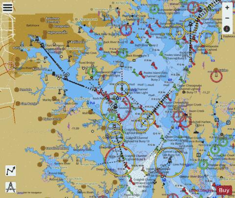
Ahoy! I've navigated with an AM radio for a direction finder, at night, in fog. (Reception is best when the back of the radio points toward the antenna, for you land lubbers.) Thank heavens the Chesapeake Bay is soft mud!
Posted on 02/13/2019 8:57:19 PM PST by Rebelbase
Full title: Mankind has lost the art of map reading, says the man who INVENTED GPS: Bradford Parkinson says world is 'too dependent' on smartphones that are vulnerable to failure
The inventor of GPS has lamented that people are unable to read maps because they are now 'too dependent' on using their smartphones or sat-nav devices.
Bradford Parkinson, the pioneer inventor of the navigation system relied upon by billions of people, said that he 'worries' about what impact its failure could have.
Professor Parkinson received the Queen Elizabeth Prize for Engineering in London last night for his key role in developing the Global Positioning System or GPS, along with the rest of his team: Professor James Spilker, Jr, Hugo Fruehauf, and Richard Schwartz.
They originally began working on the system in the 1970s as a military project but were unaware of the revolutionary impact it would have on wider society.
GPS signal is made by a network of around 30 spacecraft in orbit that transmit positional information and precise timing to receivers around the globe.
It helps cars, trucks, planes, ships and trains to navigate as well as providing a timing reference for the financial industry.
Professor Parkinson said that many of the tasks it performs were not anticipated when it was created but that it is vulnerable to failure, the Times reports.
(Excerpt) Read more at dailymail.co.uk ...
Ahoy! I've navigated with an AM radio for a direction finder, at night, in fog. (Reception is best when the back of the radio points toward the antenna, for you land lubbers.) Thank heavens the Chesapeake Bay is soft mud!
You’ve navigated not RDF but with a standard AM radio in the Bay? I would like to hear some stories about that! Were there particular directional towers and frequencies you remember?? What was the radio?
“The older generation can still read maps. The younger kids are hopelessly lost.”
Not my kids. And by the way, the Rand McNally Road Atlases and paper maps are still MUCH BETTER for large-scale navigation than smart phones, or even computer screens.
But yes, GPS and other advances are great for local driving, or even walking - particularly in other countries!
Ah, brings back memories of the good old days doing hydrology with the USGS maps…
We used to have fun with night orienteering.
No, it doesn’t have “speech recognition”, if it did I doubt it would recognize the words I was speaking to the POS!
The Leroy kit was a lot of fun to use but alas, it's a casualty of digital graphics.

Thank-you for letting us know. FR’s connection to history never ceases to amaze me.
OK, “Navigated” was overstated. The bay is the best marked body of water in the world and it’s hard not to hit the buoys.
I kept my puddle jumper south of Annapolis in Deale MD. Sailing to the Severn (or Baltimore) there was an AM station in Annapolis that, after rounding Thomas Point light, or coming across from the eastern shore, you could pick up with a little portable radio I kept on board for Redskins football and college ball games.
Loran was still in use back then but, a small AM radio was useful for general direction and early thunderstorm warnings; lots of static from lightning miles away.
I relied on a chart, compass, paddle wheel knot log and dead reckoning. The radio was not that specific but you had to turn it towards the station in Annapolis to hear it.
Annapolis also had those massive antenna arrays on the academy grounds which you could see for miles.
lol...OK!
Yup. Loved working with the Leroy pens. Loved the smell of the chemical we used to clean the stuff I acetone maybe?
Probably...Helicopter.
When I go somewhere I haven’t been to before, I study the route on Google Maps before, using Street View to identify the surrounding area.
That’s right! And I believe there are, or were, five towers. I kept my wooden cutter on Spa Creek for awhile and more recently had a boat at Herrington. Many moons ago I was at Shipwright, in the same area down in Deale. My memories of radio in Annapolis weren’t RDF but delighting in the very last days of WHFS which felt to me like free form FM rock and roll radio, with all the summer hits as we quaffed National Bohemian and sailed with beautiful women all over that part of the Bay. Life was never better. Cheers, Freeper!
Wasn’t WHFS in DC? I don’t remember WRNR.
This was AM radio not FM. Not a powerful signal.
I do remember Red Eye’s dock bar had wet T shirt contests over on Kent Island!
I was at Herrington Harbor North for a few years. Down in the York River now. You still sail?
One of my fondest memories from the Army was in helping a platoon become “unlost” by shooting a pair of back-azimuths to triangulate our exact position on a map.
Were you talking to him in NH?
Disclaimer: Opinions posted on Free Republic are those of the individual posters and do not necessarily represent the opinion of Free Republic or its management. All materials posted herein are protected by copyright law and the exemption for fair use of copyrighted works.