
Posted on 09/12/2018 1:53:29 PM PDT by NautiNurse
The National Hurricane Center has been issuing advisories for Hurricane Florence since August 30. The five day "Cone of Uncertainty" archive progression since Aug. 30 may be found here. As the super-size storm named Florence approached the U.S. Atlantic Coast, stories abound of people who are refusing to evacuate barrier islands.
The 82nd Airborne has relocated all of its assets, while FEMA is using Fort Bragg as a major staging area for post-storm supplies, including meals, water and cots. Fort Jackson (Columbia SC) has cancelled events including basic training graduation to prepare for military and civilian evacuees from coastal locations.
While hurricane preparations are rushed to completion, some stores are closing for lack of hurricane supplies inventory. Smart phone app Gas Buddy provides updates for gasoline availability along evacuation routes.
Wave heights to 83 ft. were recorded while Hurricane Florence churned 435 miles from Wilmington, NC. Storm surge is predicted to reach 6-13 ft along the coastline to the N of landfall. Steering currents are forecast to collapse at or near landfall, resulting in Florence meandering for days. This is expected to result in up to 40 inches of rainfall in isolated areas in the Carolinas, and up to a foot of rain in the Appalachian Mountains.
Tropical Storm Isaac: The government of France has issued Tropical Storm Warnings and Watches for the Lesser Antilles.
Invest 95L: The National Hurricane Center predicts 70% chance of development in the Gulf of Mexico. Limited forecast models, satellite graphics and GOM buoy info are available for Invest 95L below.
Mash the graphics below to enlarge. All links and images are self-updating.

Local Weather: |
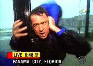
The weather channel is showing a weatherman on a board walk, close to piers -——— bending over in the wind. I hate it when I see this sort of thing. Dramatics? If people have to leave areas, why are these men still there??
FReepathon almost done, but AGAIN it is taking tooooooo long!! How about a small donation from a lot of people to get it done with???
Looks fairly mild so far. (GOOD!)
The weather channel is showing a weatherman on a board walk, close to piers -——— bending over in the wind.I hate it when I see this sort of thing.
+++++++++++++++++++++++++++++++++++++++++++++++++++
I hate it too because one of these days, a piece of metal or a hunk of wood, etc. is going to come flying through the air & someone is going to die. Being out in 50+ mph winds or even less is unnecessary, IMO .... I don’t need to see a reporter getting blown around/trying to stand up. There are plenty of other sights that better show storm impact on things other than reporters.

The narrow storm is worse for those in its path, but the wider one would probably cause more damage overall. I am not a meteorologist but experienced a very severe but very narrow typhoon many years ago.
Saw the first rain band just north of Wilmington. Looks like the eye will pass over my house.
The water surge beginning at Atlantic Beach about a little over couple hours ago today.....
Go to 3:34 and see the surge already just with the hurricane ‘feed bands’
https://www.youtube.com/watch?v=lPF36vHUqj4
During another storm, Steve Harrigan was almost decapitated by a flying piece of sheet metal. When he tried to re-enter the building, the folks inside refused to unlock the door for him. All on camera. Sometimes you just have to laugh at their antics for ratings.

Current max radar derived (precip areas only)wind velocity at 0.5 degree tilt altitudes is 48.7 knots. Probably faster, higher and or lower in the storm. Wild guess as to actual windspeed, I usually multiply by the standard 1.15 to get mph, then multiply by 1.5 for ground windspeed. 82.5 mph. Use that at your own risk.
:-)
Variance between last scan and the current, well, currently 116.2 mph groundspeed by above formula.
There’s another cam 70’ under the water at the same tower.
Nothing but murk. https://www.youtube.com/watch?v=a-gJoO9A6so
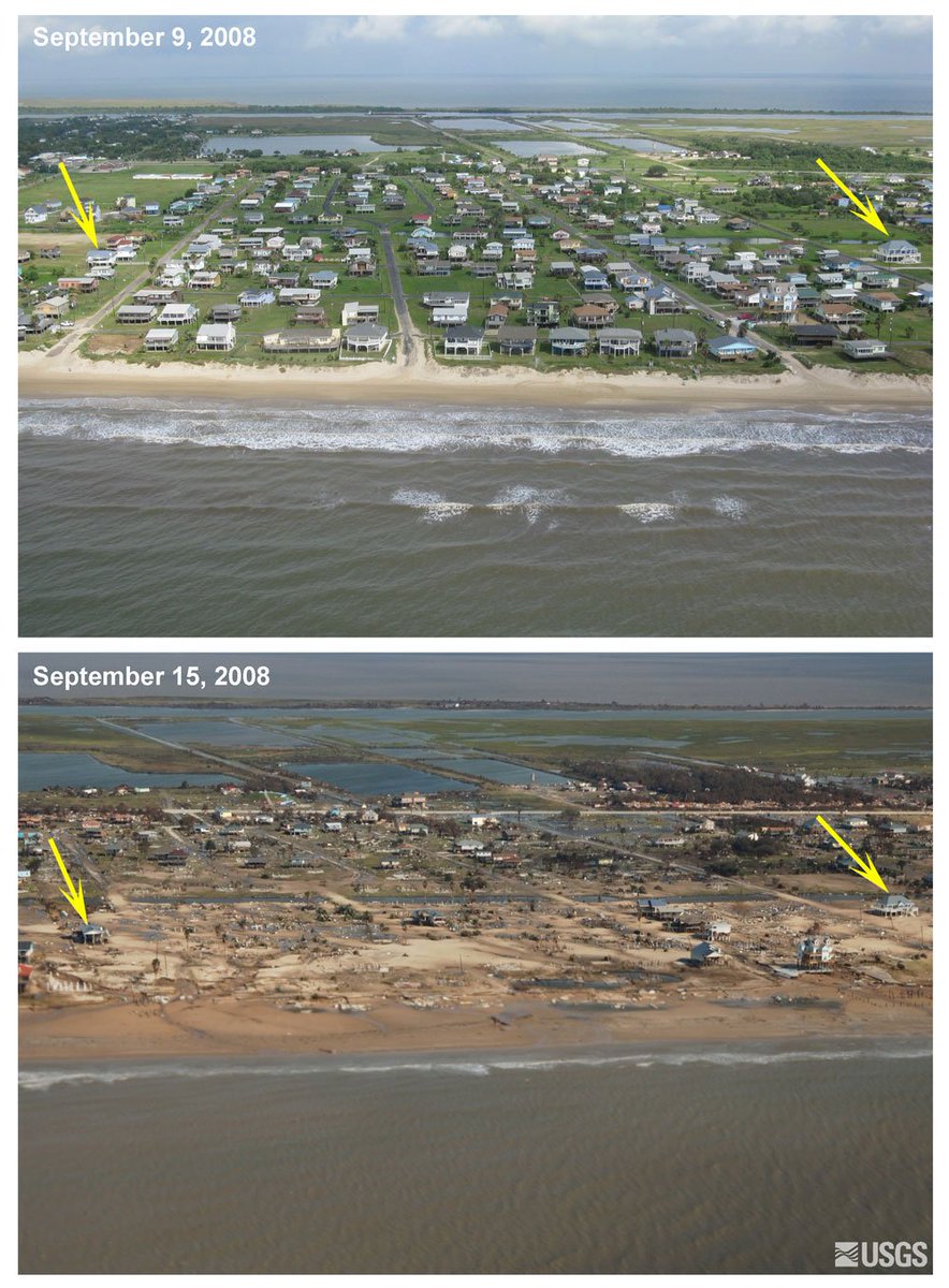
10 years ago a hit from category 2# Ike. Like Florence, it was a large hurricane with peak winds of 110 mph. These before/after photos show what the 15-20' storm surge did to our coast.
“here would they go? Transport en mass, or turn them loose?”
Same questions I would ask about the prison not being evacuated. That’s what I was replying to
bump to the top
10 years ago a hit from category 2# Ike. Like Florence, it was a large hurricane with peak winds of 110 mph. These before/after photos show what the 15-20' storm surge did to our coast.
The media will go gaga over the video of the hatteras overwash until they have something more impressive to show.
The funny thing is that kind of thing happens on the OBX several times a year and it’s only local news when it happens.
Stunning seeing those sharks in those murky waters....
Remarkable change in underwater visibility in just a few hours. Earlier, fish were easily visible.
Radar is showing outer bands of rain just now starting to skirt the NC -VA border, at Knotts Island, aprox. 130 miles or so from Morehead City as the crow flies. Local forecast for VIrginia Beach calls for rain starting about 4 PM
Bald Head Island web cam. This is the very tip of Cape Fear.
https://www.baldheadisland.com/island/ferry-cam
Some very exposed houses out there.
Disclaimer: Opinions posted on Free Republic are those of the individual posters and do not necessarily represent the opinion of Free Republic or its management. All materials posted herein are protected by copyright law and the exemption for fair use of copyrighted works.


